

An East Zion Classic.
Fat Man's Misery (West Fork of Misery Canyon) is a backcountry route on BLM land just outside the eastern boundary of Zion National Park. Getting to the canyon and escaping back to the car requires decent navigation skills – have a map and use it. This description includes two key waypoints, but reading and following a topographic map is the key to success.
Fat Man’s is the poster child for “hiking with ropes”. This is a long hike with a big handful of short rappels. The canyon hosts short sections of narrows with arches and pools, culminating with a delightful grotto that leads to the East Fork of the Virgin River. A brief walk down the river leads to the exit, which starts out steep and progresses to merely uphill. The climb out can be scorching in summer, so Fat Man's is best reserved for spring or fall. Water can be filtered from the Virgin River. Fat Man’s is delightful when full of water though much less fun in drier conditions.
For the sake of clarity, in this description the East Fork of the Virgin River will be referred to as the “Virgin River” and the East Fork of Misery Canyon will be called the “East Fork”.
Legend has it: one of the rappels could be avoided by worming down a narrow passage between boulders - thus the name "Fat Man's Misery." This feature has eroded away, but the hike out still provides a dose of misery for those not in top condition.
In recent years, parties have gotten lost on the approach and the exit. In both places, there are multiple trails that can lead one astray. Pay attention to the map and the description. Descending too early might put you in Family Camp Canyon, named for a family that spent two nights awaiting rescue. (Family Camp Canyon has challenging potholes and anchors.) On the exit, there are many routes that work and at least one well-defined trail that leads to a dead end.
In several places, single old bolts COULD be used for rappels. Those things are dangerous, brittle and unreliable – admire their antiquity, and rig your rappel off something better.
A permit is not required as the technical sections of Fat Man's are entirely outside the park. The approach is made from a parking spot in the park.
Exiting from Misery Canyon requires a short walk down the Virgin River. If the River is in flood this short walk could be difficult or impossible. When the North Fork is closed to hikers, the East Fork of the Virgin is also likely in flood. A gnarly bushwhacking exit can be made up steep terrain just east of Misery Canyon should the river prove too high.
WGS84 Key Waypoints
Top of The Whaleback: UTM 334281mE 4119175mN
Exit Hike Key Point: UTM 334429mE 4118456

Canyon Profile
Logistics

RATINGS
3BIII ★★★☆☆

TIME REQUIRED
10-14 Hours

PERMIT
Not Required

SEASON
Spring, summer or fall

LONGEST RAPPEL
40 feet (15 m)
Equipment

ESSENTIALS
Helmets, rappelling gear, webbing and rapid links.

COLD WATER PROTECTION
Wetsuits recommended in cool weather, especially if potholes are full.

DRINKING WATER
None until the Virgin River, bring plenty. River water can be filtered for the walk out.

ACCESS
Starts/ends on the east side of Zion, with parking along Hwy 9 near Checkerboard Mesa.
DIFFICULTIES

FLASH FLOOD RISK
Moderate. The collection zone is small, and all but the last narrows sections are short.

SKILLS REQUIRED
Difficult navigation, natural anchor skills, possible flooding in East Fork Virgin River, long approach and exit, surviving the HEAT!
Typical Timeline
0:00: Start
1:00: Checkerboard Pass
1:45: Top of Whaleback
2:30: First Rappel
3:30: Swing Around Room and Arch
5:30: Rappel at Confluence w East Fork
7:00: At Virgin River
7:30: At Powell Plaque / Exit climb
9:00: Back at The Whaleback
10:45: Back at Car

Getting there
Driving
Fat Man's starts by hiking up the canyon west of Checkerboard Mesa, between Checkerboard and Crazy Quilt Mesas. From the East Entrance, drive into the Park 0.9 miles and park in one of several pullouts across from the mouth of the canyon.
Approach
Your objective is the main fork of Misery Canyon, the north-south running canyon just outside the park boundary.
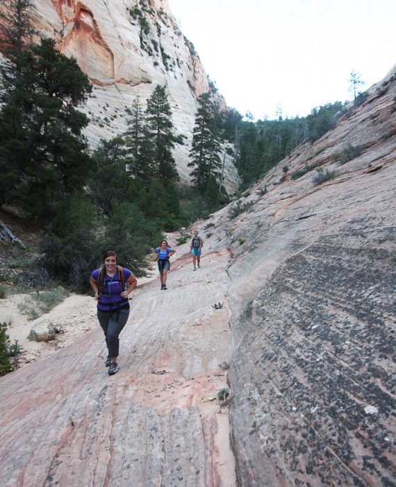
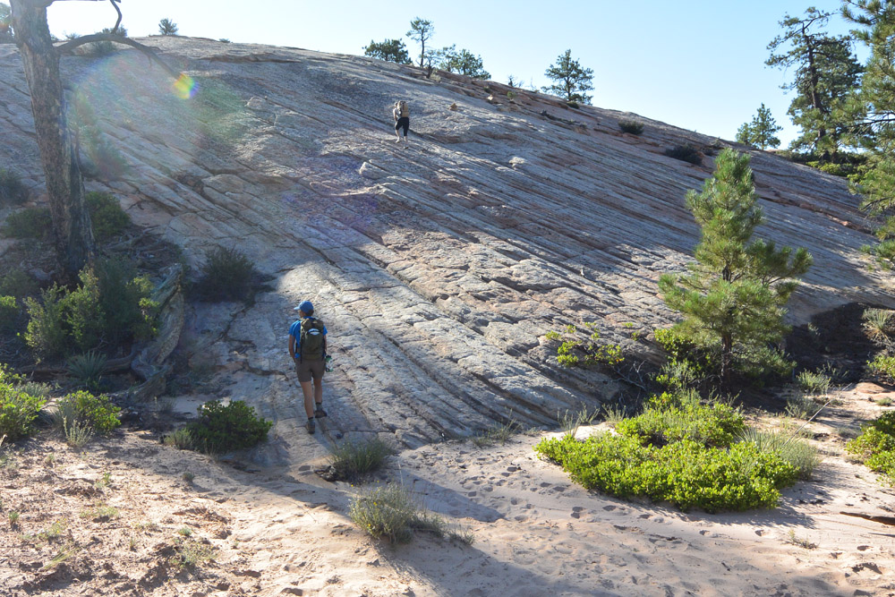
Hike up the canyon west of Checkerboard Mesa, ignoring side trails and staying in the canyon bottom as much as possible. Climb a steep sand hill on a deeply entrenched trail to the top, which I call Checkerboard Pass.
Follow the trail down the other side about ¼ mile then left out of the canyon. There may be several trails: Choose the best one. Follow the trail east past a big round buttress, then cross two drainages before climbing onto a long, white, slickrock ridge called The Whaleback. Cross this ridge and descend steeply east 400 feet into the canyon beyond, Fat Man’s Misery.
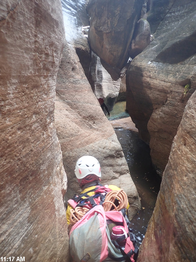
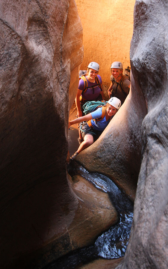
The Business
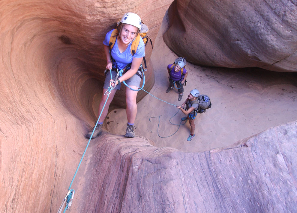
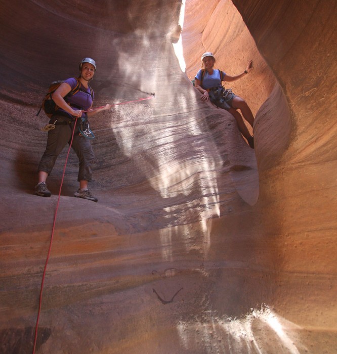
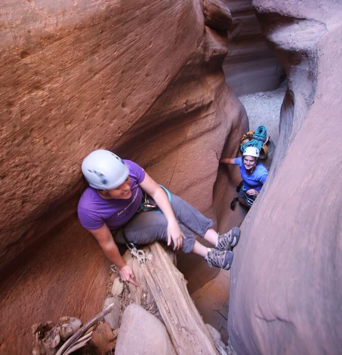
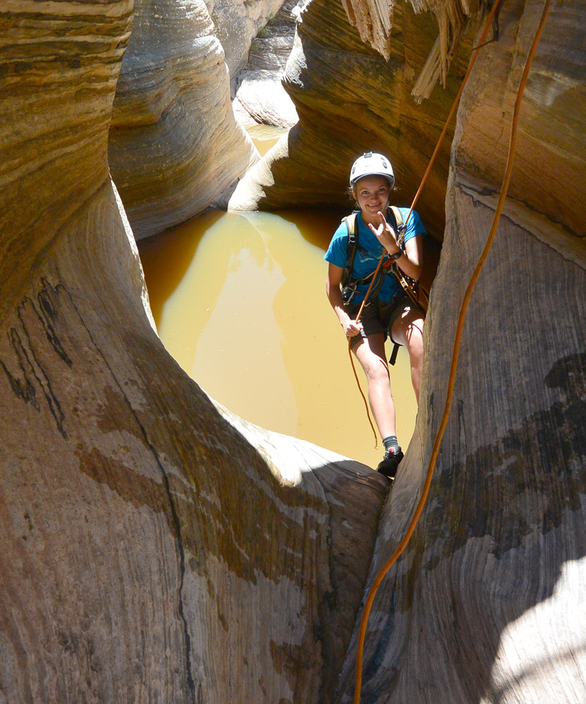
An open, sandy wash alternates with lovely, sculpted narrows. A few rappels are required. Don’t use the single, ancient bolts. Find safer natural anchors instead. One section of narrows is a good place to practice your partner-assisted downclimbing skills. There are four natural bridges and pools that often require swimming or deep wading. Do NOT rappel off the natural bridges; it creates rope-pull grooves.
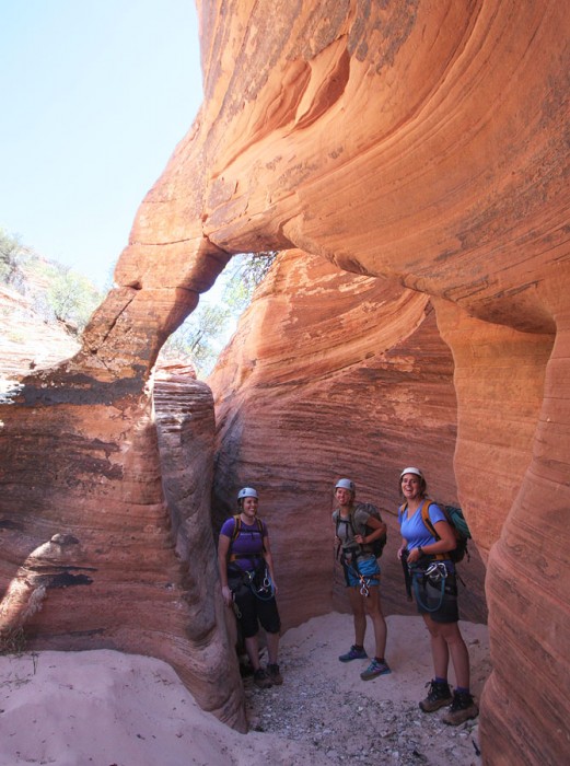
After four or five interesting narrows, the canyon intersects the East Fork of Misery Canyon. A short section of fun raps and anchor problems CAN be avoided by hiking the left rim, re-entering the canyon near the drop into the East Fork. Downclimb (tricky!) or rappel a short chimney to a large flat ledge overlooking the East Fork. Rappel 40 feet (12m) from a tree to the slabs below.
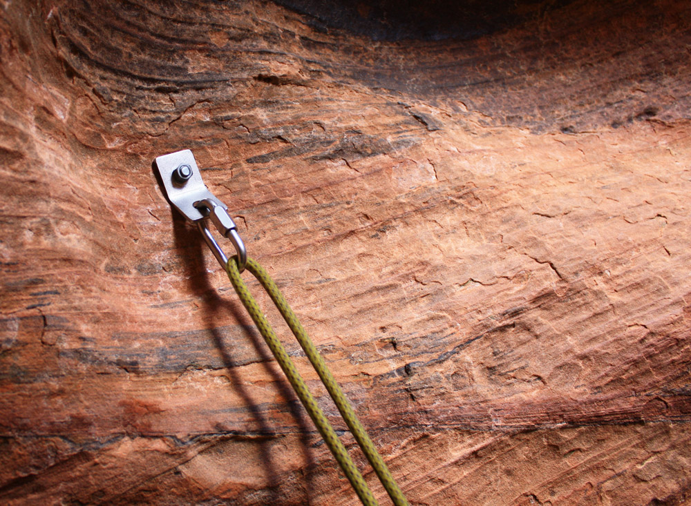
Below the confluence, the canyon soon narrows. A dirty section of canyon usually requires a rappel—this is where the "Fat Man's" down-crawl used to be. Choose your anchor carefully—the canyon is eroding rapidly and the rocks might be unstable. Rockfall here in 2017 pulverized where parties used to rappel—select a safe line of rappel over stable rock.
Shortly past this obstacle, the canyon enters an amazing grotto—its deepest and coolest section. The grotto leads to the East Fork of the Virgin River. A warm, sulfurous spring creates an interesting and fragile riparian area. Enjoy the croaking frogs, delicate flowers and soaring walls of the East Fork.

The Exit
From the Misery/Virgin River confluence, wade downcanyon about 1/3 of a mile (500m), or 10-15 minutes. On the inside of a sweeping bend to the right is a grassy/reedy/brushy area. This is the exit. Take a trail into the grass, and then climb a steep gully toward the rim. A plaque commemorating the Powell expedition of 1872 can be found on the downstream side of the grassy area, behind some brush. There is a lot of poison ivy here – beware!
The Virgin River is closed to public access below Labyrinth Falls, half a mile or so downstream.
The exit hike takes 3 to 4 hours and is mostly exposed to the sun. Be sure you have enough water for the exit. Consider waiting at the river for the heat of the day to pass before heading up and out.
Climb up a gully with a few steep walls, then follow the trail up to a campsite at an overlook. Past the campsite, climb ledges on a slab north then up a steep step to the top of the cliff. Proceed up and north, staying close to the top of the ridge… a long way. (There are multiple cairned routes in this section. I suggest staying close to the top of the ridge as the best route.) The ridge eventually leads to The Whaleback. Retrace your steps past the big round buttress and back to the road.
Author's Experience
I first did Fat Man's on July 29th, 2000 with Brian Cabe whence we learned that July is not the best time to do Fat Man's. I have done it a couple times since, learning it is quite a nice canyon in the fall and spring.
Trip Reports


Maps
Click for higher resolution


It is hot out, this year. WAY hotter than normal, so how can Fat Man’s be made reasonable?