Winter Explorations of Arches, Canyons, and Climbs in the San Rafael Reef, UT


Had to get out of town! Three weeks of cold weather and no going south makes the rat a grouchy boy. Weather reports called for cold and sunny, so it looked like staying in the sun by exploring the rugged terrain up on the San Rafael Reef would be the ticket...
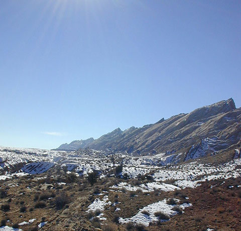
The well-traveled route from Price to Green River, then west to the Swell brought the reef into view - with rather more snow than I was counting on. I was expecting a few pockets hidden in crevices, but what I found was 6" of recrystalized powder on all north-facing aspects.

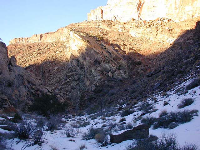
High on the hit list was an exploration of the Reef north of Little Spotted Wolf Canyon, seeking out a viewpoint of Eagle Arch, high on the south end of the massif. The face of the reef is particularly steep here, and climbing up the face was looking unlikely. Since the canyon itself was described as charming and short, I decided to take a quick look...

This area of the reef is protected as a BLM Wilderness Study Area.

It was a bit chilly inside the canyon. After 10 minutes of hiking, why was I back in the shade? Let’s find some sunshine!
A ramp invites me upwards into the sun. A quick check of the map revealed that this might take me up around the end of the Wingate to a view of the arch.

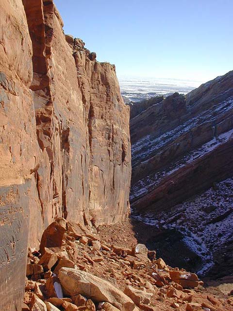
The sun was great as I climbed up the ramp, overshadowed by a 400 foot Wingate wall. A couple of crack lines looked promising for climbing from afar, but closer inspection, as usual, revealed good reasons why they would never be climbed.
From the top of the ramp, I descended the snow covered slabs on the north side. Six inches of recrystalized powder made for a fast slide into the canyon. No arch revealed itself on the crest of the block, so I continued down the cold, snowy canyon to where it narrowed. A short section of narrows, then the canyon began to drop off sharply. Guess a rope would be in order here.

No rope on this trip, so I returned up the canyon as far as possible, to avoid ascending the treacherous 20 degree snowy slabs. I flushed a herd of 15 Desert Bighorn Sheep onto the ridge, then followed them up to the top of the ramp. They had no problem with the snow covered slabs, escaping to the north. I followed the sunny ramp back down, leaving the descent of Eagle Arch Canyon on the list for another day.

Sunday dawned cold and sunny. Next on the list of southfacing reef-walks was "Green Dragon", the chunk of reef north of Black Dragon Canyon. It looks like it has some interesting canyons, and easy access onto it. Right at the mouth of the canyon, an obvious slickrock ramp headed upward...
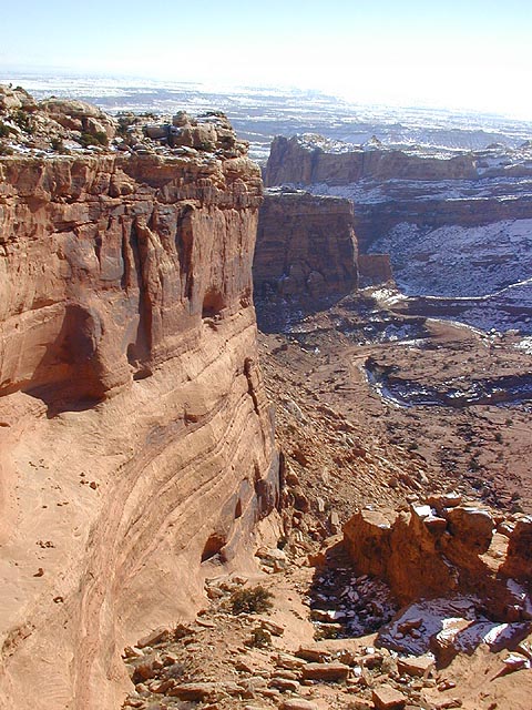
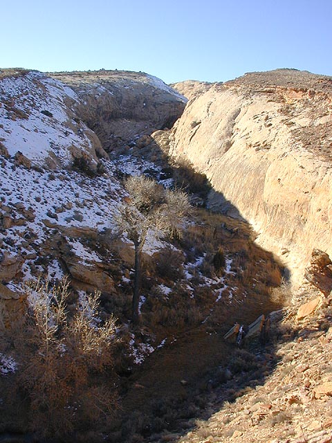
The huge ramp ascends, as do we. By staying right, it is possible to walk the edge and enjoy the view down into Black Dragon Canyon…

And equally great views across the canyon to the reef stretching south…

After an hour, the rim cliffs out in an area of rounded Navajo domes. By backtracking 15 minutes, I found a place to cut north down a steep, snowy slope into the adjacent canyon. Which leads west back onto the slickrock. Again cutting over to the edge, the view into Black Dragon Canyon just keeps getting bigger.

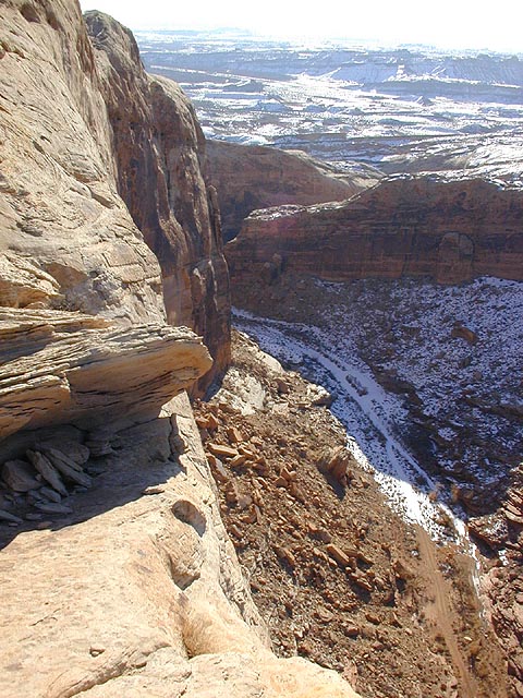
Finally at the tippy top, the views are expansive. The point overlooks the fabled Lower Black Box of the San Rafael River as it cuts deep through the Coconino sandstone. In the background is Mexican Mountain.

Northward from the point, a canyon drops away cutting toward the river. Beyond is the snowy plain between Price and Green River, with the Circle Cliffs in the background.
OK, time to head home. After traipsing down the first section of slickrock and into the in-between canyon, I chose to not ascend the snow slope back to the domes. Seeing where the little canyon would take me seemed more interesting. It was a good idea at the time.
Twenty minutes downcanyon, after a couple sections of thin traversing, the canyon steepened up and I was forced out to the north. You know, away from the car. Following the rim, I searched in vain for an opportunity to cross the canyon, until all the way down at the front of the reef. Taking cow trails south, the mouth of Black Dragon Canyon was soon attained.
Green Dragon Canyon has been scratched off the project list. It’s descent would require long rappels into swampy potholes, with very little canyoning of interest.