

SCENIC, SHORT CANYON.
Walker Gulch is a fun and scenic canyon that unfortunately is bit short on technical interest. The first rappel (of three) is down a wonderful chute. Two short raps lead to a fairly long narrows with nice striations on the walls.
Access from the Orderville trailhead is fairly easy for those with a high-clearance, 4WD vehicle. Those without SHOULD be reluctant to drive down the Jeep road, and might want to use the Dakota Ridge access, but much of the charm of the canyon could be lost with a longer approach and exit.

Canyon Profile
Logistics

RATINGS
3A III ★★★☆☆

TIME REQUIRED
5-8 Hours

PERMIT
No. Canyon is on BLM land adjacent to the Park. Group size limit 12.

SEASON
Summer or fall

LONGEST RAPPEL
150 feet (45 m)

SKILLS REQUIRED
Navigation, basic anchor rigging.
Equipment

ESSENTIALS
Helmet, rappelling gear, Webbing and rapid links. The first rappel requires 30 feet of webbing so bring at least that much.

COLD WATER PROTECTION
None required.

DRINKING WATER
None available.

FLASH FLOOD RISK
Low - the drainage is small and wooded.

ACCESS
Canyon begins and ends at Orderville trailhead (or Dakota Ridge TH).

GPS WAYPOINT
WGS84 UTM 12S: Top of Walker Canyon: 333428mE - 4134384mN
Typical Timeframe Orderville TH:
0:00 Leave Orderville TH (Cul de Sac)
1:30 Arrive at Head of Canyon (leave road)
2:15 Arrive at top of first rappel
3:30 Finish last rappel
4:30 Junction with Orderville Canyon
6:00 Back to Trailhead
Typical Timeframe Dakota Ridge TH:
0:00 Leave Dakota Ridge TH
1:00 Arrive at Head of Canyon (leave road)
1:45 Arrive at top of first rappel
3:00 Finish last rappel
4:00 Junction with Orderville Canyon
5:00 Junction with shortcut up to road
5:30 Reach road
6:30 Back to Head of Canyon
7:30 Back to Dakota Ridge TH

Getting there
Walker can be approached from the "Lower" or the "Upper" ends. The Lower being from the Orderville Canyon Trailhead (aka Cul de Sac) which requires a high-clearance 4WD vehicle to get back UP the two track road at the end of the day. The Upper route starts and ends at the Dakota Ridge Trailhead and requires high clearance but not 4WD – however, it is an hour longer on each end. The Lower works better and will be presented first.
Note: the North Fork road can be impassable when wet and muddy, even to 'fully capable' vehicles.
LOWER TRAILHEAD DIRECTIONS
From the Zion Park East Entrance, continue east on Route Nine 2.3 miles to a left turn on the North Fork Road. Follow this to the Ponderosa Ranch Resort – mark mileage from here. Continue on the North Fork road, which soon turns to gravel, 9.4 miles to the turnoff for the signed Orderville ORV area. Turn left and follow 1/4 mile to the Orderville Corral and a gate across the road. Conditions past this point are steep, soft and rocky all at the same time. HC 4WD is required.
Continue down the two track to the flats of Orderville Canyon then down the canyon 1.5 miles to the end of the road. Park here.
HIKING (LOWER)
From the carpark, descend the prominent trail to the wash level, and step right into the wash. The main trail will head left and stay out of the wash. Walk down the wash about 100 feet to where a side-wash comes in on the right. (Note: this is about 200 feet from your car, no more.) Step up this wash 10 feet then left up onto the bench, and follow a bit of a trail across and then up on the next bench. Follow the trail north; it turns into an overgrown two-track, an old wagon road. Follow the road as it turns left and contours the top of the strata west. At some point, it starts showing usage as an ATV trail. Follow west. After passing around a largish sidecanyon, the ATV trail becomes less clear but heads right and starts climbing over the hill. In a few places, the trail is unclear, so you might have to use the map. At the crest of the hill, it enters open ground and again is less clear - follow the most likely looking path north to where it cuts into the hillside to descend. Follow this north and down to cross a sidecanyon, the east fork of Walker. Follow the road up the hill on the other side and around a few squiggles then down into a larger wash, the main fork of Walker. Leave the road here and follow the wash.
UPPER TRAILHEAD DIRECTIONS
See directions above. From the Orderville ORV sign, continue on the North Fork road another 2.5 miles to a sharp turn to the right. The Dakota Ridge road goes left here, somewhat obscured by brush. Go left. Pass the wreck of a shack. There are a few places where small washes cross the road, requiring some careful driving. Continue on this road about 1.3 miles to an open area with a smaller road heading off to the left. You can park here. Most vehicles can drive another half-mile down the main road to either of two off-the-road parking spots before the road gets difficult.
HIKING (UPPER)
Hike down the road. It squiggles past a few drainages. In half a mile, the road turns left and heads more steeply downhill towards Walker Gulch. Go that way. (A trail continues along the ridge, leading to Dead Eye Dick, Eastern Sun and Checkerboard Canyons.) From the turn, it is one mile to the drop-in point. The road follows alongside and sometimes in the wash, and there are a couple of points that LOOK like they might be it - don't be hasty. Past the drop-in point, the road climbs the hill on the right, and then switchbacks up to climb more steeply.
The Business
Follow the wash, and arrive in five minutes at a cliff with wonderful large Ponderosa pines growing below. The edge of the cliff is unstable - do not approach. Cut left around the cliff and descend steep, somewhat brushy slopes to the canyon bottom.
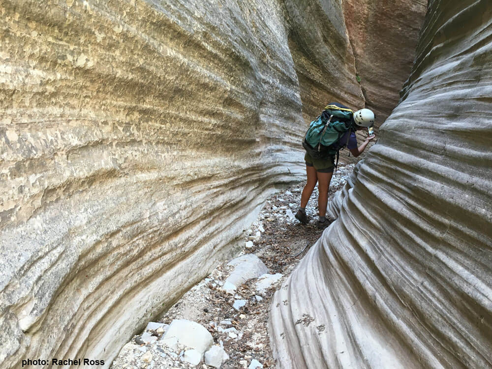
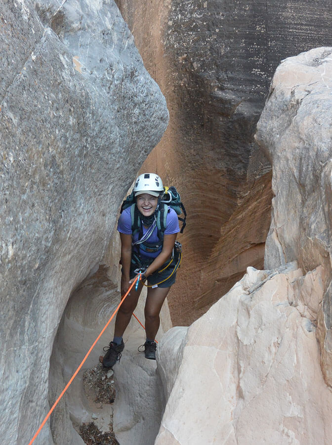
Follow the wash about half an hour through some charming small narrows to the conspicuous first rappel.
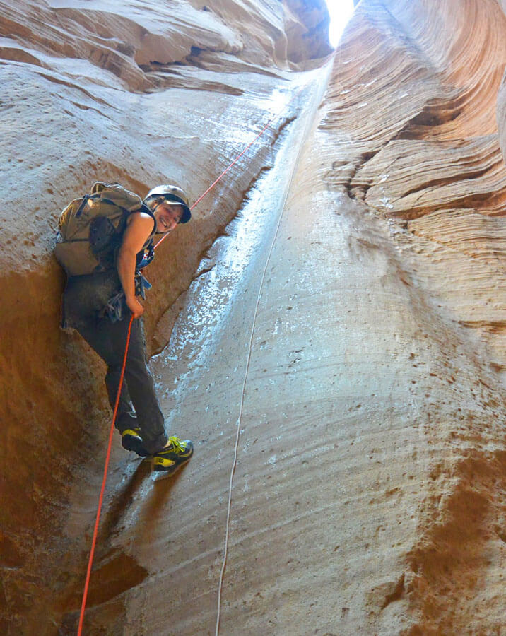
R1: 140 feet (43m) down a delightful flute. Anchor off a large rock back from the top of the flute that requires about 30 feet of webbing to rig.
Shortly downcanyon, a hodge-podge of logs and stones is stuck above a short drop. The logs might be unstable.
R2: 15 feet (5m) down under the log jam.
Shortly downcanyon, a chockstone creates a short drop.
R3: 20 feet (7m) off a deadman anchor.
That's it for rappels. Hike and downclimb through marvelously striated narrows to the intersection with Orderville Canyon.

The Exit
Turn Left and head up Orderville. It is about 0.6 miles (20 minutes) to Birch Hollow then another 15 minutes to the slot in the mud of Wild Wind Hollow. Just past WWH is a steep climb up on the right to the next level.
EXIT TO LOWER TRAILHEAD
Continue up Orderville another 0.8 miles (30 mins) to the Orderville Cul-de-sac parking area.
EXIT TO UPPER TRAILHEAD
After climbing to the next level, continue up Orderville. You are looking for a small canyon coming in on the left about a tenth of a mile past the upclimb. Hike up the side canyon with a few scramble moves 0.3 miles with 200 feet of gain. Near the top, the canyon splits; go to the right and a few feet further pop up onto an old wagon road, now an ATV track.
Follow it west. In about 1000 feet, the ATV trail becomes less clear but heads right and starts climbing over the hill. In a few places, the trail is unclear, so you might have to use the map. At the crest of the hill, it enters open ground and again is less clear - follow the most likely looking path north to where it becomes more trailish as it cuts into the hillside to descend. Follow this north and down to cross a sidecanyon, the east fork of Walker. Follow the road up the hill on the other side and around a few squiggles then down to a larger wash, the main fork of Walker. Cross the wash, and then step up onto the road. This is the TOP of Walker Gulch where you originally left the road. Hike back up the road to the Dakota Ridge trailhead and your vehicle.
Trip Reports
History
Probable first descent of this canyon was by Kip Marshall, Matt Smith and Dean Kurtz in June of 2001.
Author's Experience
I descended this canyon for the first time in July 2016. I tried to descend it earlier, discovering that the East Fork does not lead to the big rappel, so we rappelled in over the side.
Maps
Click for higher resolution


