

amazing flutes.
A fun and scenic technical canyon just outside Zion National Park, DED is far from the madding crowd and has a delightfully remote feel to it including two nice raps down amazing flutes. Canyoneers will need to be proficient in natural anchor techniques. No permit required. Since the canyon faces north and is a long way up the North Fork road, DED is unlikely to be accessible in spring until all snow is melted and the road dries out.
The technical part of the canyon is fairly short and straightforward. This canyon is more of a “tour” than a “challenge”.
DED can be done with one car by walking down The Narrows and climbing up a sidecanyon, but the thrash over to the canyon itself is kind of rough. With two cars, spot a car at Chamberlain Ranch for your exit, and then drive back to the Dakota Hill Road. An early start will help on those hot summer days.

Canyon Profile
Logistics

RATINGS
3B III ★★★☆☆

TIME REQUIRED
~8 Hours

PERMIT REQUIRED
NO.

SEASON
Summer or fall

LONGEST RAPPEL
100 feet (30.5m)

ACCESS
Begins off Dakota Ridge, ends at Chamberlain Ranch. Possible as a one-car adventure from Chamberlain Ranch.

EMERGENCY
Zion Wilderness Desk: (435) 772-0170
Zion EMERGENCY: (435) 772-3322
Equipment

ESSENTIALS
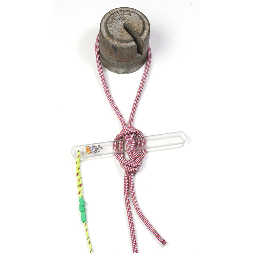
Helmets, rappelling gear, webbing and rapid links. FiddleStick is useful. This canyon is rarely descended, so you will likely need to build an anchor or two. Many people will like poles for walking up the Narrows.

COLD WATER PROTECTION
Wet suits not needed except in the coldest/wettest conditions. The canyon does not hold water.

DRINKING WATER
Bring plenty. Can pump water on the walk out.
DIFFICULTIES

FLASH FLOOD RISK
Moderate to Low, but the road could be impassable with rain even to 4WD vehicles.

SKILLS REQUIRED
This is a technical canyon in a wilderness setting. Natural anchors predominate.

ANCHORS
All raps are off natural anchors. Please do not add bolts to this canyon.
Approximate times:
Driving from Springdale: 1 hour
Car Spot: 40 minutes
Approach to the first rappel: 2.25 hours
Time in the canyon: 2 hours
Hike out: 1.75 hours
Total Time Car to Car: About 8 hours including car shuttle
WGS84 Zone 12S Waypoints (UTM)
Parking Spot, Dakota Hill Road: 335166mE 4135641mN
NE peak Dakota Hill: 333292mE 4135987mN
End of Ridge: 332793mE 4137039mN
First Rappel: 332267mE 4137299mN
One Car Approach, access canyon: 332587mE 4137656mN
Getting there
Spot an Exit Vehicle
The exit is out the top of The Narrows, so spot a car at Chamberlain Ranch.
Getting to the Start
The canyon starts on Dakota Ridge off the North Fork Road. The road can be impassable when wet, even to HC 4WD vehicles. From Springdale, take Utah State Route 9 through the Park. Continue 2.3 miles beyond the East Entrance and then turn left (N) onto North Fork Road. The road is paved at the beginning but turns to dirt after a few miles. At 11.4 miles, note a dirt road on the left, signed for Orderville Canyon ORV Area. Continue straight on North Fork Road another 2.5 miles. At the apex of a 90-degree rightward bend, there is a small road on the left; this is the Dakota Ridge Road. A shack is hidden in the trees on the right side of the road about 100 feet from the North Fork Road.
Spot a car at Chamberlain Ranch, 3.7 miles further down the road then return to the Dakota Ridge Road.
Drive out the rugged Dakota Ridge Road 1.23 miles to an open area and a road junction. The road has numerous washouts and rocky sections. While 4WD is not required, high clearance is required for all but the most reckless drivers. Park at the road junction, off the road. It is possible to continue down the right-hand road another .3 miles, but this section is rutted and slow, so walking might be faster.

Approach
The canyon is the last canyon going north into the Narrows before the park boundary, a little northwest of Dakota Hill’s highest peak.
From the carpark, follow the right fork of the road as it cuts down across the north end of the hill. It soon deteriorates as it crosses the top of three gullies. About ¾ mile (25 minutes) from the carpark, the road turns sharply left (south) just as the slightly-rocky summit of Dakota Hill comes into view. Do not follow the road south; continue west toward Dakota Hill, finding a thin path on the crest of the ridge. Where the main ridge turns left (south) follow a sub-ridge that crosses over to Dakota Hill. You will encounter a drop so look for the smallest drop possible. Follow the sub-ridge to the crest of the Dakota Hill ridge.
From the crest of the ridge, turn right and follow the ridge north ¾ mile (30 minutes) past all the white cliffs to an easy descent down and left to a flat mesa top. Head to the top of the gully forming the left edge of the mesa, then follow the edge of the mesa until overlooking the main fork of DED. Descend open scree slopes to the floor of DED just where the gully intersects to the left.
Follow the wash downcanyon. Walk around the first little drop on the left.
ALT One-Car Approach (Rugged)
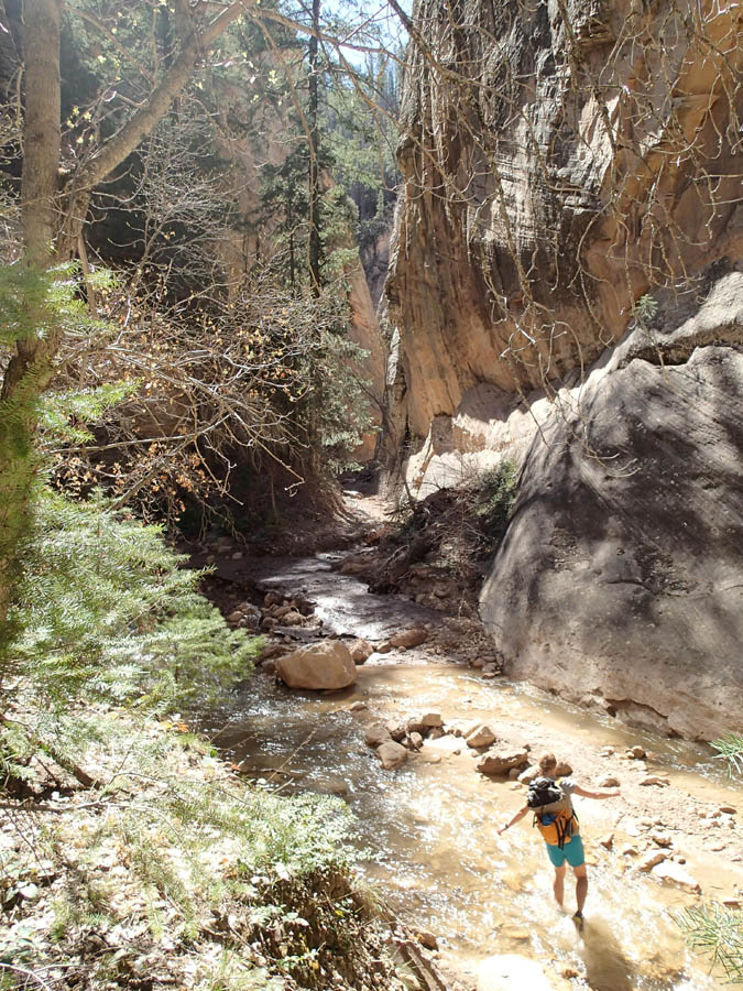
Park at Chamberlain Ranch, at the end of the road. Hike down the Narrows 4.1 miles to a wooded gully coming in on the left (south). Finding the correct gully can be challenging – bring a GPS and find 332587mE 4137656mN. Or use these directions: DED is a dramatic, straight slot canyon coming into The Narrows at a sharp angle with 300’ smooth walls on both sides. From the bottom of DED, hike back up the Narrows 1/3 mile to the first place one can climb a gully out of the Narrows on the right (south) side.
Climb the steep, rocky and brushy gully about six-hundred feet to the base of cliff band. Bushwhack the rugged ledge below the cliff band around to the right. Dead Eye Dick is a long way; when you reach the top of the canyon, hike along the edge,tiptoe across a side drainage and then scramble down a bit to the wash bottom. There is a tree and a rappel into the lower section, but don’t rappel. Cross DED and climb the steep hill on the far side through a weakness in the cliffband then up to the top of the ridge and south along the ridge. Descend diagonally the steep hillside into the wash of DED above any rappels.
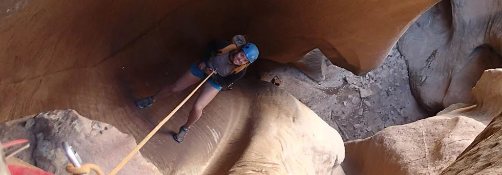
The Business
The next short drop forces a rappel.
A short drop forces a rappel.
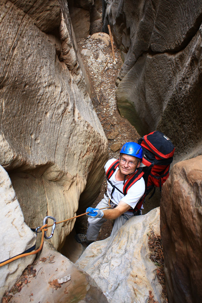
R1: 20 feet (6m) off any of several trees on the left. A FiddleStick works here; there may not be a tree with webbing on it.
A few minutes downcanyon is the first ‘real’ rappel.
R2: 72 feet (22 m) down an interesting flute off a deadman anchor.
Walk a log, then out to an open area.
R3: 75 feet (23m) off a large tree down a nice wall on the left edge of the open area.
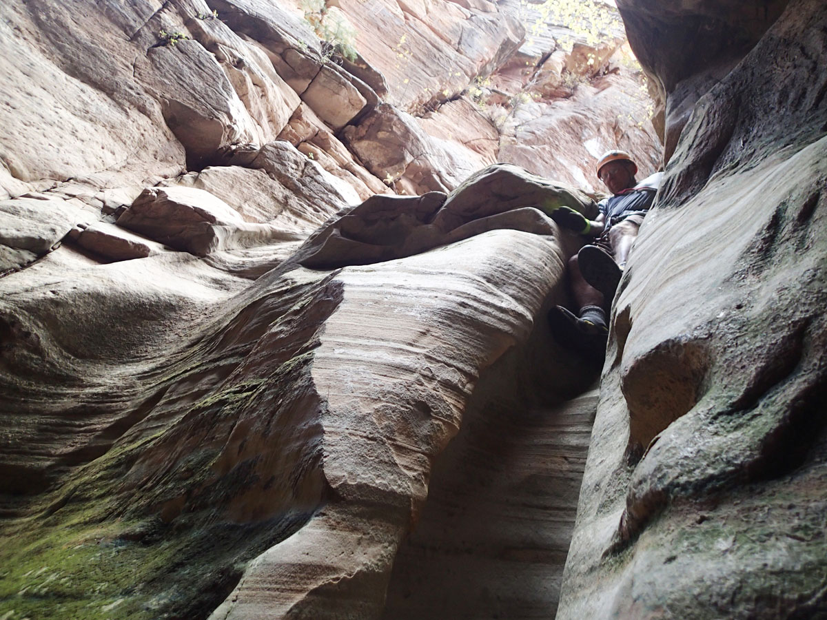
R4: 50 feet (15m) total off a sling around a rock on the right. Three stages, the second and maybe the third can be downclimbed.
R5: 60 feet (18m) from a deadman anchor through a nice slot.
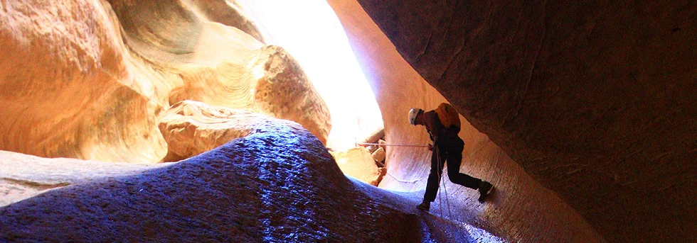
R6: 100 feet (30.5m) from a sling around a log down a fantastic flute.
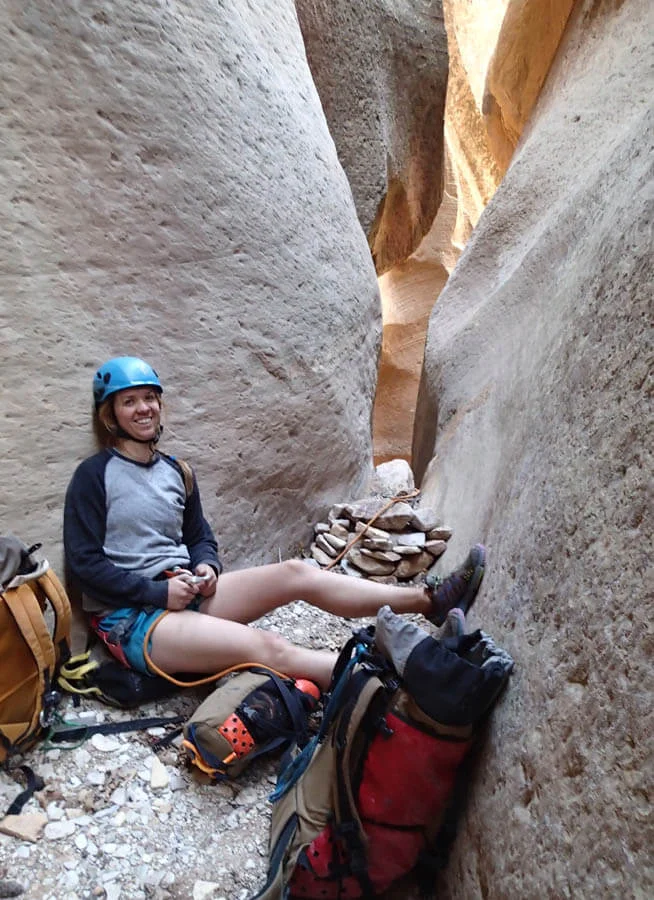
There are some pioneer inscriptions near the base of this rappel. Heading downcanyon, a downclimb or two spices up the short walk to The Narrows.
.

The Exit
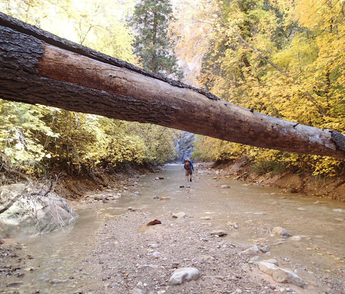
Turn RIGHT and walk up The Narrows 4.3 miles (1:45 hours) to Chamberlain Ranch.
Trip Reports
HISTORY
First Descent by Kip Marshall, Gaydon Leavitt and Bruce Wilson, July 7, 2012.
Tom first descended DED with friends in October 2013 via Dakota Ridge then returned in April 2014 with Amanda Jessop and sniffed out the one-car approach described here.
Exterior Links:
Maps
East side overview. Click for higher resolution
Specific canyon beta. Click for higher resolution


