A Hidden Gem.
Bluejohn is a great canyon and an excellent intro to the Roost. There are many forks of Bluejohn, and this is maybe the best combination put together by my friend Ram 15 years ago. This loop descends the cool narrows of the East Fork and ascends the Main Fork, through a spectacular tall narrows section, and then up a steeper section with chockstones and short drops. None of the climbing problems are particularly exposed, and all can be belayed once one person is up.
Rumors of bolting-up required in the East Fork are highly exagerated. After the second rappel in the East Fork, a short drop is passed by "sequencing" people down (rappeling off a braced canyoneer), then carefully spotting the last person down. Soloing this drop would be difficult.
From time to time, there is a long and incredibly cold pool just after the third rappel. Always bring a dry bag and be prepared to swim on this route.
The name Bluejohn Canyon is now infamous for a single, lonely, unlucky descent, told in the book Between a Rock and a Hard Place; and Hollywooded up in the movie 127 Hours. To me, the route Aron Ralston chose is a long, unspectacular slog with brief sections of mildly technical narrows - perfect for a long slow distance solo training run on a beautiful spring day. Many say Aron was reckless - I say he was spectacularly unlucky, and I am oh so glad, 123 hours later, he came up with a brilliant idea. The movie is good - go see it. Re-creating the events out in the wild, however, is not recommended.
Many non-canyoneers are excited to visit the spot of Aron's near-demise. Necro-tourism? It really does not look like much, and is far from the best spot in the canyon, let alone in the area. The jog out to the Blue Pool (160 miles each way) is a bit far for most day-hikers. Even Aron's mildly-technical route is not suitable for people without rappelling and downclimbing experience, and really is a poor route for beginners anyway.
Getting into the sport? There are plenty of professional guides available to show you a canyon or two. If you have some training, browse around our site. There are much better canyons for introducing yourself to the sport than Aron's route - including the East/Main Bluejohn loop detailed here.

Canyon Profile
Logistics

RATING
3B 5.6 ★★

TIME REQUIRED
About 8 hours

PERMIT
Not required

ACCESS
Long loop route that starts and ends at Granary Spring.

SEASON
Spring or fall

LONGEST RAPPEL
50 feet (15 m)
Equipment

ESSENTIALS
Helmets, rappelling gear, webbing, rapid links, drybags.

COLD WATER PROTECTION
Not usually necessary; after rain there are long wades/swims.

DRINKING WATER
Bring plenty.

ANCHORS
Natural and bolted
Difficulties

FLASH FLOOD RISK
Moderate
Skills Required

SKILLS REQUIRED
The exit up the Main Fork requires 5.6ish climbing with little exposure.

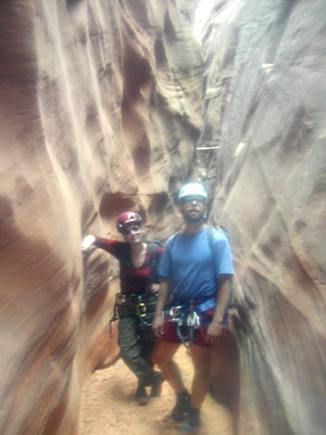
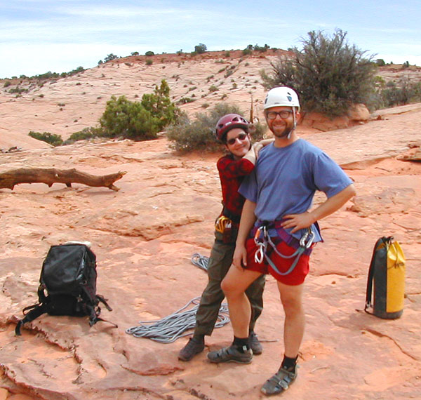
Bluejohn, blue skies
A beautiful day in the Roost with Hank and Alicia.
Getting There
From the junction of Utah Highway 24 and the Goblin Valley Road, drive south on Rte 24 about 1/4 mile to a signed dirt road on the left that heads south and east toward Hans Flat, The Maze, and Horseshoe Canyon. Follow this road 23.8 miles to a prominent junction with a sign. Turn right (south), saving Horseshoe Canyon for another day. Continue south 7.1 miles to a fork. Go Left toward Hans Flat Ranger Station, and continue another 2.7 miles to a small dirt road on the left (east). Follow this .2 miles to 2 scrappy buildings and a cowed up yard. Park here. All roads are suitable for 2WD cars, but can become impassable with rain or snow. (UTM: 561823mE, 4243944mN) All coordinates are WGS84 Zone 12S.
The Approach
From the carpark, head east into the canyon. On the right side of the canyon is a ridge with a flat top, and a notch in the ridge about 1/2 mile north of the carpark. Climb onto the ridge and follow it north. From the notch, descend the other side east into a flat grassy basin. The East Fork is on the far side of the basin. Cross the basin, sighting on the La Sal Mountains in the distance. Do not head north toward the exposed Navajo sandstone visible at the north end of the basin. When you get to the edge of the canyon, walk down in. If it is too precipitous to just walk in, stroll along the edge to the right until it is an easy walk-down. (approx: UTM: 563927mE, 4244610mN)

The Business
THE CANYON
Meander downcanyon. A nice slot is downclimbed with ease, and then a larger drop is encountered. Rappel 40' or so off a log or other natural anchor into the narrows. (This rappel can be avoided by walking around on the right).
The canyon is interesting and narrow for quite a ways - climb, clamber, stem and squeeze downcanyon. One bolted drop requires a 30' rappel. Soon after, the canyon runs into a big wall, and a small drop marks the junction. Sequence most of the party down, then spot the last person from below - no anchor required. (Sequencing is where folks rappel off the braced body weight of the canyoneers above - leaving the last person in the sequence to downclimb into the waiting arms of the grateful masses below).
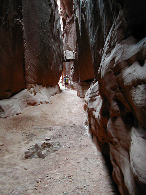
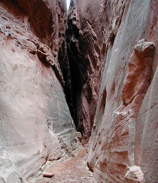
At this junction, there is often a pool. Walk, wade or swim downcanyon, and follow along through another spectacular set of deep narrows. After not too long, the narrows end and the slogging begins. An hour of slogging in loose sand leads to the Junction with the Main Fork. (UTM: 564508mE, 4249854mN)

The Exit
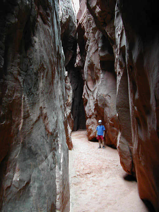
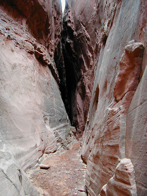
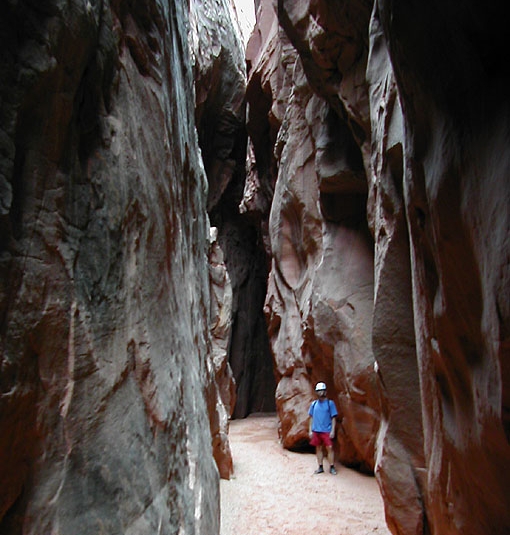
Turn left and slog upcanyon. After another hour or so, just as you are wondering if this is really worth it, the canyon narrows spectacularly. The sandstone walls sweep upward in virtual cathedrals. It's really nice. Somewhere in here, the canyon forks - stay left with the main canyon.
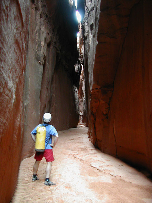
The narrows leads to a series of climbing obstacles, your penalty for doing the loop this way. Stem, chimney and offwidth up the various obstacles, passing packs as you go, and make your way to the top of the narrows. While reasonably difficult (5.6?, 5.8?), the climbing is never exposed, not too strenuous, and weaker members of the party can be belayed from above.
Out in the open again, follow the now shallow canyon south. A few short dryfalls are easily climbed around - but be careful - we found a rattlesnake blocking one of the up-climbs in a potentially disasterous spot. Keep your eyes and ears open. After a couple of dry falls, another hour of slogging up cowed-up soft sand finally leads back to Granary Springs and your car.
Trip Reports

Maps
Click for higher resolution
Photo Gallery
Bluejohn Canyon