

One Amazing Canyon.
Imlay is one of the best canyons in Zion, if not THE best. The first descent required three days and was a feat of amazing bravery and chutzpah. With knowledge of the route, plus modern techniques and equipment, it is now a wonderful journey inside the stone, with pothole challenges that add spice.
From Potato Hollow on the West Rim, the "Full Imlay" route is a little longer than the sneak route, and can be done in two days, camping near the Crossroads where the Sneak route comes in; or in one day with an early start from the West Rim Trailhead.
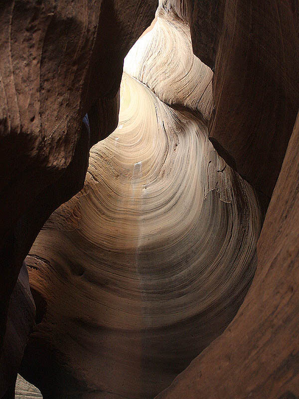
While the lower two sets of narrows of Imlay are AMAZING, the upper half of the canyon is much like many other canyons in Zion.
First descent: June 7–9, 1978 by Mike Bogart, Mary Dern, & Dennis Turville.

Canyon Profile
Logistics

RATINGS
4B IV R ★★★★☆

TIME REQUIRED
10 to 14 hours

PERMIT
YES – If seeking an early start, be sure to ask for a White Pass that allows parking at The Grotto.

SEASON
Summer or fall

LONGEST RAPPEL
165 feet (50 m)

SKILLS REQUIRED
Efficient travel, problem solving, pothole escapes, staying warm.
Equipment

ESSENTIALS
Helmets, rappelling gear, webbing, rapid links and hooking kit.

COLD WATER PROTECTION
Thick wetsuits or drysuits required at all times of the year.

DRINKING WATER
Once in the canyon, filterable pothole water is available, but not recommended.

FLASH FLOOD RISK
High - There are long sections of narrows and a large watershed above.

ACCESS
Start at the West Rim Trailhead by Lava Point; finish by hiking out the Narrows. A long car shuttle is required.
SEASONAL ADJUSTMENTS
Summer and Fall are the best times for Imlay. Snowpack in winter and spring could make both the approach and the canyon extremely difficult. The real variable for Imlay is the water levels in the potholes. High water = fast, cold and easy. Low water = slow, difficult and not so cold. Snowmelt and thunderstorms fill the potholes. Knowledge of recent weather or recent trip reports can clue you in, but you should ALWAYS be prepared to hook out of potholes.

Getting there
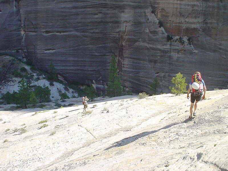
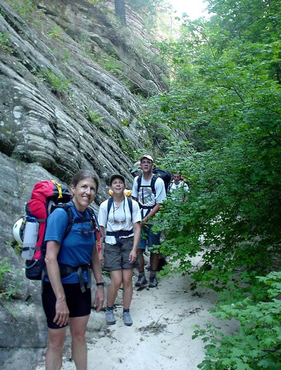
From Lava Point, hike the West Rim Trail 5.1 miles (8 km) to Potato Hollow. A side trail leads left to a small pond and a designated camping site. Follow the outlet of the pond to the head of the canyon. There is often a trickle of water in the stream. (Can also be hiked to from the Main Canyon floor but this will take 4-5 hours).
The Business
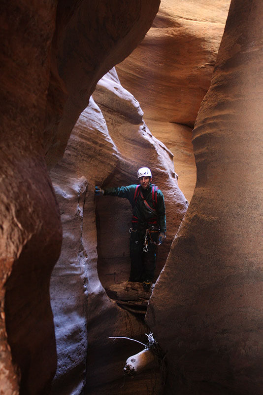
Traverse the left rim 1/8 mile (200m) to a small bowl with two pine trees. Downclimb through a break in the cliffband to the lowest pine.
R1: Rap 140 feet (40m) to a large pine tree.
R2: Rap 120 feet (35m) to the creek bottom.
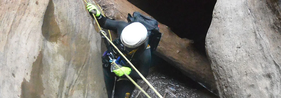
R3: Rap 120 feet (35m) off of logs in the streambed through multiple pools past an old piton. The pools are usually waist deep.
Climb down the canyon. One section may be easier to rappel or handline. At a steep pouroff, climb left up dirt and brush, then down to a small tree.
R4: Rap 60 feet (18m) to a large tree.
R5: Rap 65 feet (20m) to a ledge with a couple of bolts.
Combining R4 and R5 is not recommended as your rope can get stuck in the bushes and trees.
R6: Rap 165 feet (50m) down a steep wall to a big ledge atop a ridge.
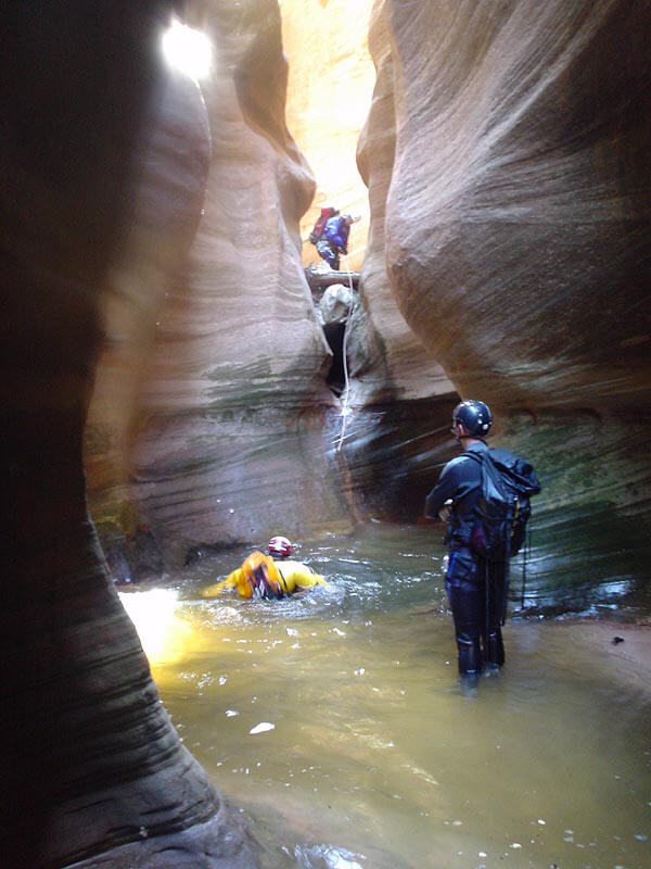
Downclimb to the end of the ridge, then off the right side down steep dirt into the wash. Several hours of interesting canyon with numerous short rappels (and a long rappel here and there) lead to The Crossroads. The pools get deeper as the canyon progresses – suit up after encountering the first waist-deep pool.
The Crossroads
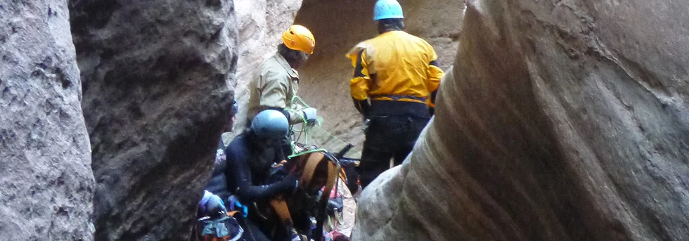
The Crossroads is a complex area where numerous canyons come in from both sides. The two Sneak Routes come in on the right, in two places quite close together. The end of the Crossroads is generally taken to be the "bivy alcove": a large overhang sheltering a sandy beach with easy access to higher ground. There is water in a pool, usually pretty nice.
After the Crossroads area is a section of corridors with numerous short downclimbs and short rappels, often a few swims, and at times some log soup to work through. This section will take 30 to 60 minutes to complete, ending with a rappel off a bolt into a keeper pothole - the start of the first extreme narrows.
Work your way through the narrows, enjoying the beauty of this deep, dark and heavily sculpted canyon. Strenuous climbing, pack tosses, ingenuity and, as a last resort, drilling and hooking may be required to pass the numerous obstacles. After an hour or two or three, the canyon relents and opens up briefly. A safe bivy can be found by climbing slabs out of the canyon to the left.
Note: it is possible to exit the canyon right at the start of the first section of extreme narrows, and proceed overland to bypass them – but it is reported to be ugly.
The second extreme narrows (the Terminal Narrows) is somewhat shorter, but still takes an hour or two to traverse. It culminates in a long rappel (60 feet, 20m) to a long pool. At the end of the pool, the canyon jogs left to a large ledge overlooking the North Fork Narrows. Rappel 110 feet (34m) to the river. Hike The Narrows to the Temple of Sinawava (about 2 hours).

The Exit
Hike The Narrows to the Temple of Sinawava (about 2 hours).
Trip Reports

Maps
Click for higher resolution


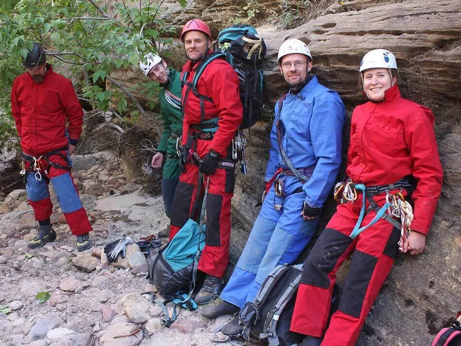


Went through Full Imlay with Steve Brezovec and Kelly Birdwell - to enjoy the canyon, of course, and to work on the anchors. (All photos this rave by Steve Brezovec.)