Short & Sweet.
Pipe Spring is an interesting little canyon in an unusual location—out near Lava Point next to the MIA Route. It is at a higher altitude than most canyons and well-shaded, thus is a good option when it is too hot elsewhere. Admittedly, the 2-mile, 900-foot of gain exit will discourage many people.
We had admired the slot from the bottom for many years, and finally decided to drop it from the top in October 2009. Not every day does one get to do a 'new' canyon in Zion, but that was one of those rare and precious days. The exit includes the top half of the MIA and the hike back to the West Rim Trailhead.
Because the canyon is rarely done, bring plenty of webbing and rings to re-rig many of the anchors. The approach and the canyon are on MIA Camp land (private land), though on the edge of the actively used area. You are a guest on the Camp's land; be a good guest. A permit from the landowner, the LDS Church, is required. Thankfully they have made this easy to get: email to requestRLA@ChurchofJesusChrist.org. You will be sent an auto-reply email with info and docs that need to be completed.
Alas, the spring feeding the pipe became contaminated with bacteria in 2018, so it is not suitable for drinking without filtering.
Most people will choose to do the upper section of the canyon, which has the best play to pay ratio, and makes for a fine moderate day, 5 to 6 hours for most parties. People who have not done the MIA exit might use this to familiarize themselves with the terrain for an upcoming Boundary or Kolob trip. The section below the midpoint has some good scenery, but adding the lower half of the MIA exit is an unfortunate penalty for completing the canyon.
WGS84 UTM 12S Waypoints:
Pipe Spring: 323580mE 4138758mN
Top of MIA: 323762mE 4138921mN

Canyon Profile
Logistics

RATINGS
3A III ★★★☆☆

TIME REQUIRED
5-8 Hours

PERMIT
A Park permit is not required, but an LDS Church permit is required
for accessing the MIA Camp land.

SEASON
Summer or fall

LONGEST RAPPEL
180 feet (55 m)
Equipment

ESSENTIALS
Helmet, rappelling gear, webbing, rapid links.

COLD WATER PROTECTION
None required.

DRINKING WATER
None available, bring plenty.

ACCESS
Canyon begins and ends at the West Rim Trailhead, Lava Point.
DIFFICULTIES

FLASH FLOOD RISK
Low - the drainage is small and wooded.

SKILLS REQUIRED
Navigation, basic anchor rigging
SPECIAL NOTE: The 180 foot Rappel 5 ends on a tiny ledge, large enough for 2 people maximum. If you have more than 2 people, you will need to set up Rappel 6 (95 feet) to get people out of there before pulling R5.
TYPICAL TIME SCHEDULE
0:00 Leave West Rim Trailhead
1:00 Arrive at Pipe Spring
1:30 Top of first rappel
2:30 Top of Big Rappel
3:30 Finish Upper Section
(from here 1-1/2 hrs back to the trailhead)
4:15 Finish R9
(from here 2-1/4 hrs back to the trailhead)
5:00 Finish R10 at Kolob Creek
(from here full MIA exit takes about 3 hours back to the trailhead)

Getting there
To get to the "Pipe Spring", follow the MIA Exit road-walk section, in reverse.
Park at the West Rim Trailhead and head down the MIA Road—the gated road on the north side of the parking area. If the gate is open, do NOT drive down the road. It might be locked by the time you get back. There is a maze of roads in this area, and some details on the USGS topographic map are out of date. Follow the approach map to reach the Pipe Spring 'picnic area'. Or simply: go left at the first Y, go right at the next and then follow this road straight down the ridge. The road ends on a road that follows the rim of Kolob Canyon. Follow the road to the right a short way to Pipe Spring.
There is a road next to the pipe spring watercourse; follow it to the developed rappelling area for the camp. Descend the established trail to the bottom of the canyon. Hike downstream. In a few minutes, the bottom drops out of the wash with twists and turns down below. Looks like we’re gonna need a rope!
The Business
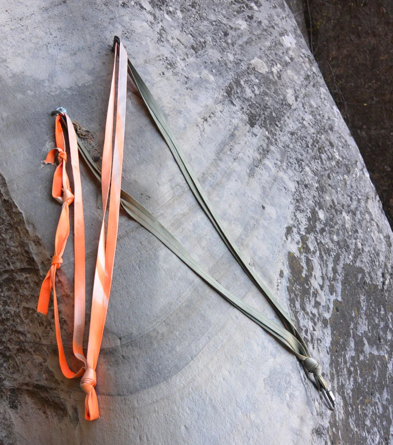
Most of the raps are bolted and might require being re-rigged.
R1: 70 feet (21m) Pick a stout tree on the left and rap in. This is a good one to rap with the ropebag clipped to your harness to avoid tangling the rope in the trees. Once over the edge, drop the bag clear to the ground.
R2: 100 feet (30m) down a flute, off a 2-bolt anchor.
Walk through a few twists and turns.
R3: 50 foot (15m) down another flute.
The canyon opens up for a bit, and a class 3 exit can be made up the edge to the left.
R4: 40 foot (13m) rappel off a tree.
Climb 20 feet down a chute.
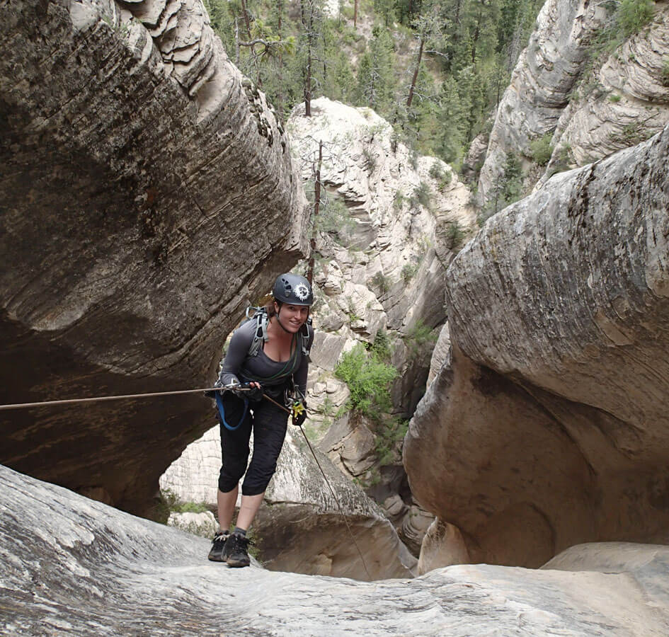
R5: 180 feet (55m) rappel off bolts down a steep wall to a tiny ledge with a two-bolt anchor.
R6: 95 feet (28m) to the ground off a two-bolt anchor.
R7: 25 feet (8m) rap off a single bolt.
R8: 25 feet (8m) down chute off single bolt.
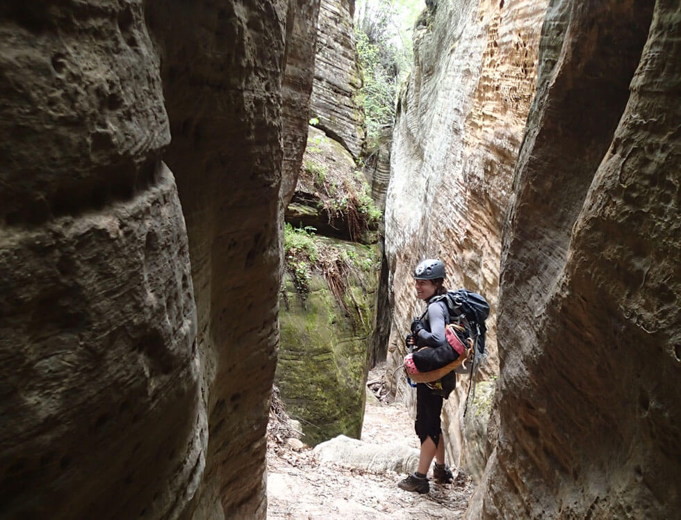
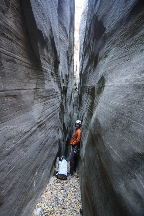
A wonderful, narrow slot and a couple short raps and fun downclimbs complete the technical part of the upper canyon. Walk out to the main MIA canyon. Most people will want to hike out from this point.
It is possible to continue with two more raps all the way to Kolob Creek.
Lower Canyon (variation):
Bushwhack down the watercourse to a very nice narrow slot that ends in a drop. Downclimb and rappel directly, or climb over the rib on the left (easier) and downclimb the chimney next to the wall. Saunter forward a few minutes further to a big drop.
R9: 80 feet (25m) down a very nice chimney/crack from a sling around a boulder (or FiddleStick a tree). You are about 2/3 of the way down the lower MIA exit. You may want to leave much of your gear here. (Even smarter, maybe forget the last rap and head on up the MIA.)
Downclimb a few obstacles. Look for trails of use where descent is not conspicuous. Close to the creek, the MIA trail goes left and up. The descent route follows the watercourse:
R10: 70 feet (22m) down a chimney, fix the rope off a big tree.
Bushwhack 30 feet to Kolob Creek. Head upstream 50 feet to the start of the MIA exit. The creek may or may not have water in it.

The Exit
(Bottom Half)
From two large rocks in the streambed sometimes marked with cairns, climb a well-defined trail steeply to the base of a rock then left and up. Traverse left and down to the top of the last rappel. Scramble up the canyon to the bottom of Rappel 9. Follow the canyon on the right up for a few minutes, until a trail on the left charges steeply up the hillside. Charge! The trail climbs directly up for several hundred feet, then traverses right to a pass.
From the pass, you can get a gander at the second half of the exit. Three standing dead trees (snags) mark the top of the route. Follow the trail down the other side of the pass to a streambed. Many people like to go across the streambed and up the rock on the other side, but I prefer following the streambed to the left for several hundred feet to where a brushy trail cuts right up the steep hillside to the top. Walk briefly across the top of the hill, then find the least obnoxious place to descend the steep sandy hillside to the canyon floor below. Depending on exactly where you end up, you might need to go left as much as 60 feet to get to the main streambed. Follow the main streambed to the bottom of the MIA slot.
(Top half)
From the bottom of Upper Pipe Spring Canyon, aka "MIA Slot", you "get" to "enjoy" the top half of the MIA Exit, a steep backcountry route that some have mistakenly labelled a "trail". The route is sometimes difficult to follow - but finding and following the easiest route is quite important, as, off-route, the terrain is even steeper and more hazardous. The best MIA route has changed location in the last couple of years; it’s become easier, though no less steep.
Follow the main watercourse upcanyon past automotive debris. Follow this canyon five minutes along the basin floor until it turns right and heads for the right-hand wall and slot. Climb steep dirt on the left directly up the fall line. The trail has developed cut-in steps. Follow the steep steps up several hundred feet to the base of the cliff above, then traverse right a long way.
The trail crosses a side-drainage and climbs straight up the steep hillside. The trail is well-defined. Near the top, the trail is less well-defined and climbs a few sections of steep, loose rock/dirt. Be careful of partner-generated rockfall. In the last few years, a few lengths of fixed rope sometimes make the final, steep sections faster and less-scary. Ascend to the road.
Back to the West Rim Trailhead
At the top of the MIA Route is a logging road. Turn left (south) and hike about 200 feet (60 m) to the top of the hill. The exit road goes up and right. You may want to visit the picnic area with water coming from a pipe (Pipe Spring) that is 200 feet (60m) ahead on the main road. The water is not drinkable.
From the top of the hill, hike up. Follow the roads, generally north and west, but always up, to the West Rim Trailhead. Allow a half-hour for the top half of the MIA Route and an hour for the roadwalk back to the trailhead. First time MIA'ers are likely to take longer.
Trip Reports
Author’s Experience
I have descended this canyon at least three times.
Maps
Click for higher resolution