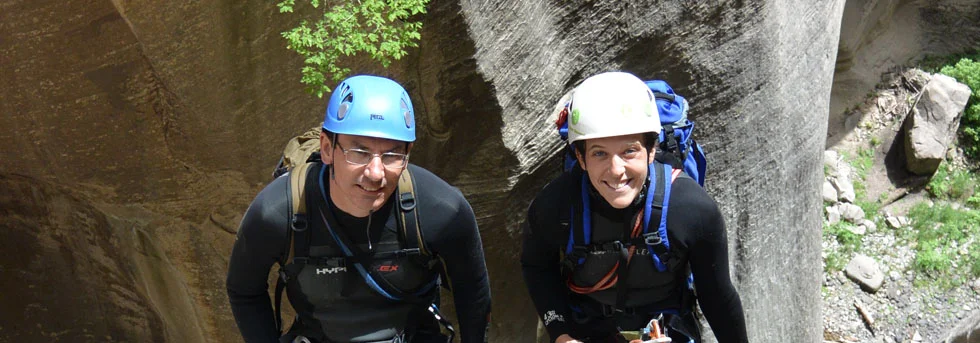
Wet & Fun, or Dangerous?
Kolob Canyon is one of the grand adventures in Zion, invested with an unfortunate history in part because of its special situation. On July 15, 1993, two youth-group leaders drowned while trying to descend Kolob Canyon in high water conditions. Three leaders and five teenagers were on a four-day descent of Kolob Canyon that coincided with a substantial release from the dam. After a four-day wait, the six survivors were located and rescued on July 19th. The subsequent lawsuit is largely responsible for the technical canyoneering permit system in Zion today.
So is Kolob wonderful and fun, or dangerous and extreme? It can be either. Kolob must be respected, but the 1993 leader made serious blunders leading directly to his death. The flow in Kolob Creek is controlled by a dam at Kolob Reservoir, several miles upstream from the technical narrows. The group entered the canyon when the flow was too high for their technical skills – maybe anyone's skills.
Dam controlled flow has interesting consequences. Except in deep drought, a small flow is maintained through the canyon, so the pools stay full and cold. Water is released to supply irrigators downstream, and when the water is flowing, the technical narrows are impassable, even to those with advanced technical skills. The volume of water released is a major flood for this small canyon. Potential Kolob-ers must first call the Washington County Water Conservancy District (435-673-3617) and determine the current release rate from the Kolob Reservoir Dam. Flows of 3-5 cfs will prove challenging to most canyoneers. Flows above 5 cfs are too high to safely descend the canyon. A Zion Park canyoneering permit is required.
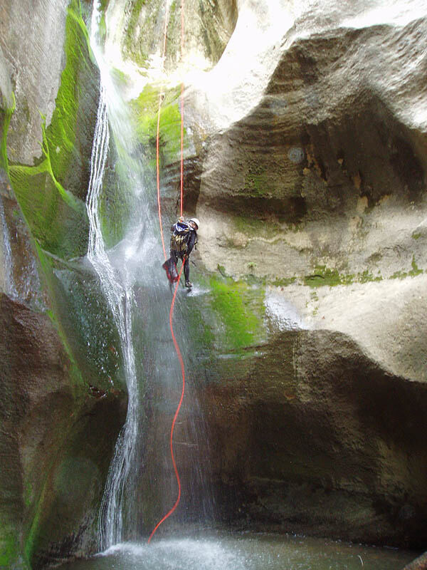
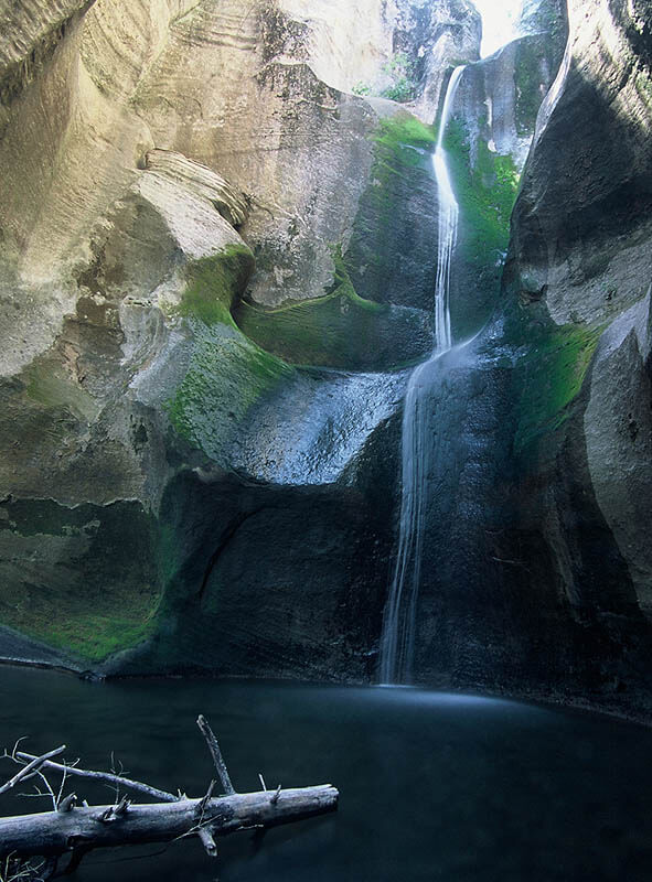
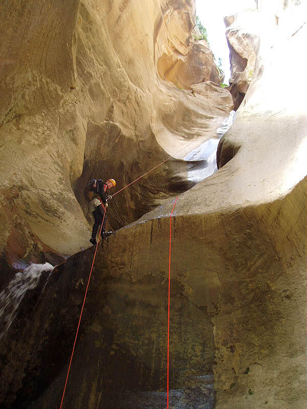
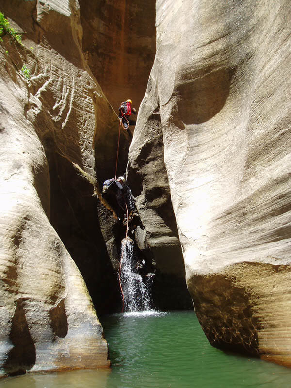
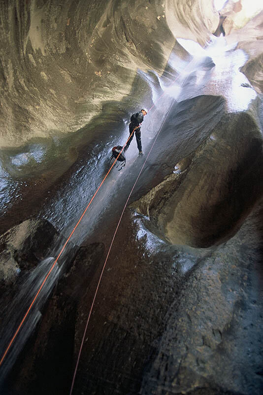
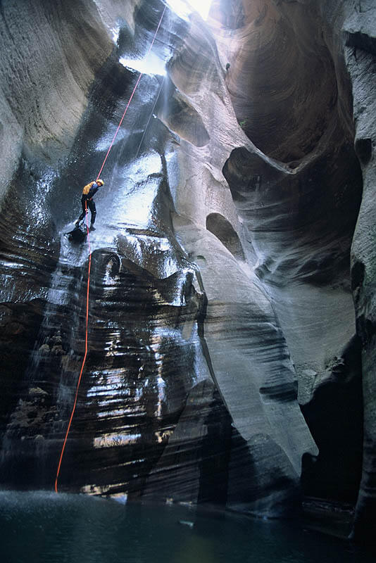
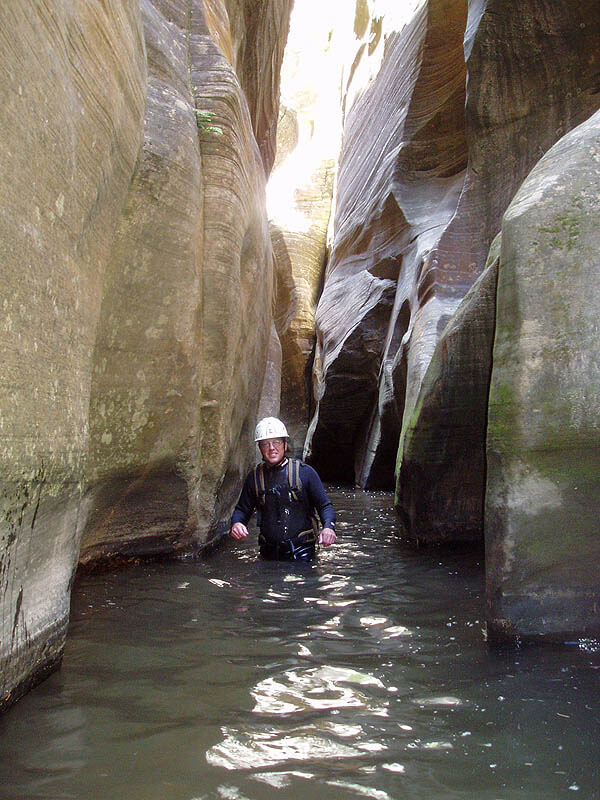
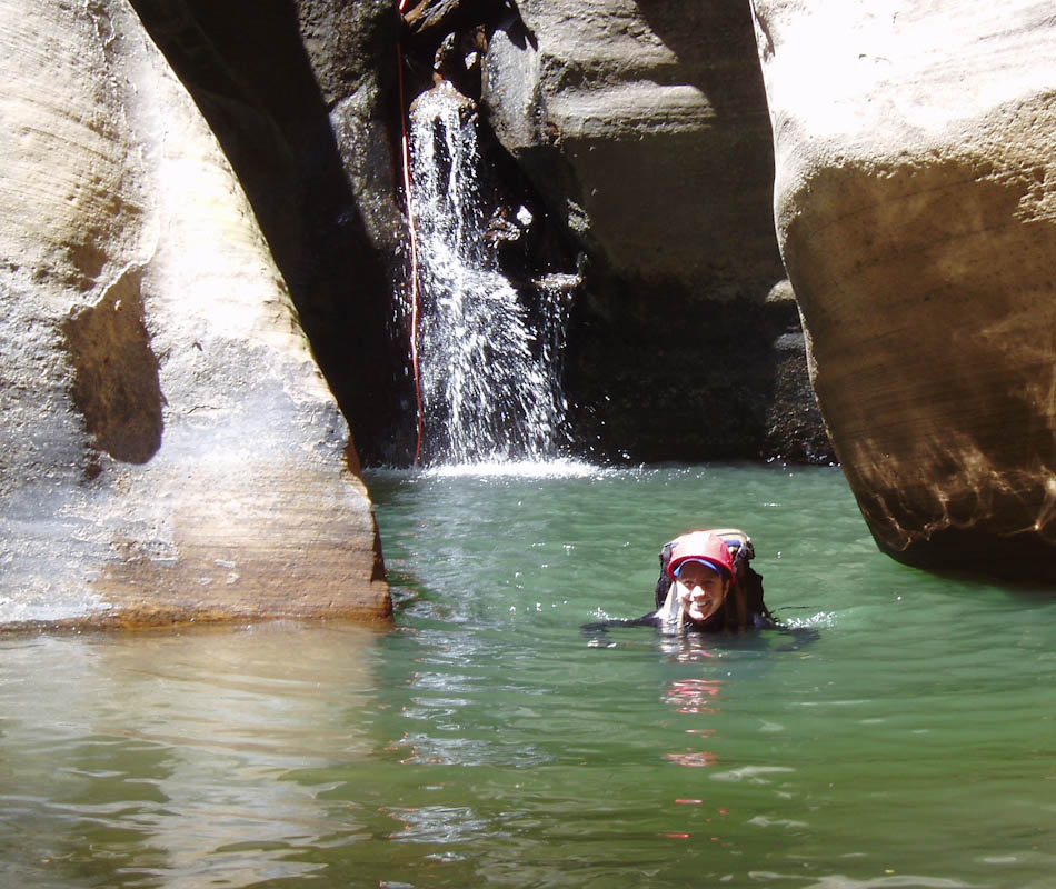
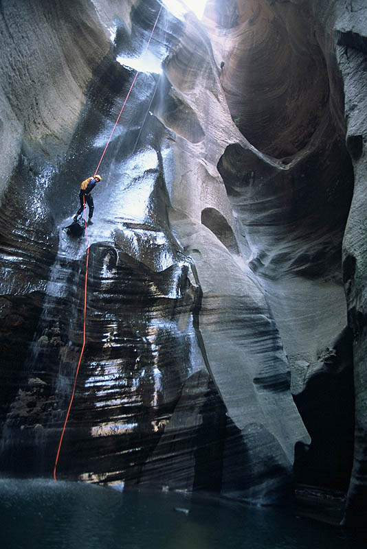
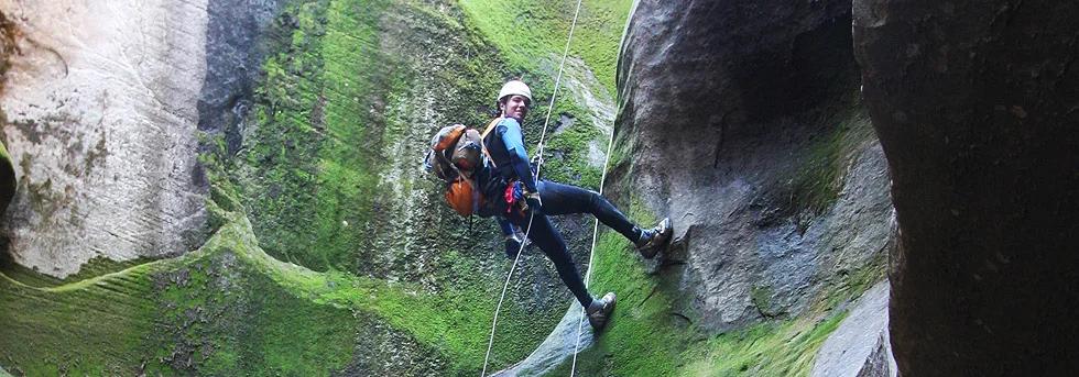
What is Kolob like? After a brief walk through the woods, the canyoneer rappels into a pocket garden. A hundred feet further on, the canyon starts a drop of 700 feet through numerous pools. A total of 12 rappels are made, many into crystal clear, deep green pools followed by short swims and climb-outs to the next anchor. The canyon is incised deeply, with delightful grottos and wonderful light reflecting off the walls. From the bottom of the technical section, the canyoneer can make the long hike out to the Narrows and the Temple of Sinawava, or can ascend the steep and strenuous MIA Trail.
Most parties will take 4 hours to complete the technical section, and will be in the water for most of this time. Drysuits or 7mm wetsuits are required for descending Kolob. Do NOT underestimate the power of cold water to kill you. While the technical difficulties in Kolob are few, the long exposure to cold water makes Kolob a step up in difficulty and danger compared to most of Zion's canyons. This makes it good preparation for the continuity of cold water found in Imlay and Heaps.
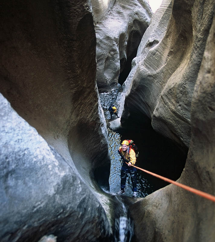
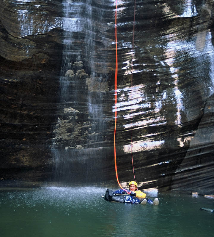
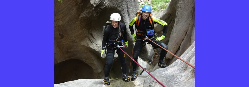
Anchors are bolted except a few raps off logs and trees near the start. In drought conditions, some of the pothole exits might be difficult; be prepared to do pack tosses, partner-assists and, as a last resort, drilling and hooking to exit the potholes. Most rappels require a floating disconnect; be sure everyone in your party is trained in this skill before entering the canyon, and bring a spare rap device or two. A few of the rappels chain together two or three pools, and it is important to understand this technique. Rappel into the first pothole and either disconnect or pull through a bunch of slack. Swim across and exit the pothole, then go back on rappel and rap into the next pothole. When all canyoneers are down, the rope is pulled from the lowest pothole. Care must be taken by the last canyoneer that the rope is untwisted and will pull easily. When descending Kolob, be sure to locate the next anchor before pulling the ropes.


Canyon Profile
Logistics

RATINGS
3CIV or V ★★★★★

TIME REQUIRED
8-12 Hours

PERMIT
YES - Also call the Washington County Water District (435-673-3617) for the release schedule. The District Office is only open during normal business hours, M-F, 9-5.

SEASON
Summer or fall when the canyon is open

LONGEST RAPPEL
165 feet (50 m)
Equipment

ESSENTIALS
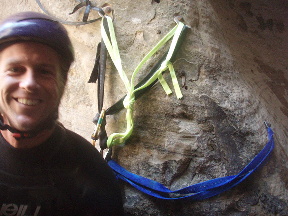
Helmets, rappelling gear, webbing and rapid links, drybags for your gear.

COLD WATER PROTECTION
Full Wetsuits or Drysuits

DRINKING WATER
Clear spring water available to filter once in Kolob Creek drainage.

ACCESS
Kolob is commonly done two ways. For a day trip out the MIA Trail, park at the West Rim Trailhead near Lava Point. The MIA Trail returns to this point. For a two-day trip enjoying the full glory of Kolob Canyon, start from the West Rim Trailhead and exit at the Temple of Sinawava.
DIFFICULTIES

FLASH FLOOD RISK
High - Long sections of narrows do not allow escape

SKILLS REQUIRED
Long exposure to cold water, navigation to the canyon entrance.
SEASONAL ADJUSTMENTS
The water release schedule from Kolob dictates when the canyon can be done. Release from the reservoir typically ends in September, making Fall the most likely time to do this canyon.
PREPARATION
Call the Washington County Water District at 435-673-3617 to determine the release schedule. They are only open Monday-Friday, 9am to 5pm. Obtain a permit at the Backcountry Desk. CONFIRM the waterflow in Kolob by looking where Kolob Creek crosses under the Kolob Terrace road.

Getting there
The approach to Kolob can be done entirely on old logging roads. Drive to the West Rim Trailhead near Lava Point. Walk back along the road a few minutes to the sharp turn. Continue straight north across the meadow to a gap in the trees, a post and the start of a road. Follow the road down a few feet, then follow it left and traverse steeply downhill 15 minutes to the bottom of a hill and a ‘meadow’. For Boundary, follow the clear path around to the right. For Kolob, follow a less-clear route straight ahead and join a smaller road climbing up to a pass.
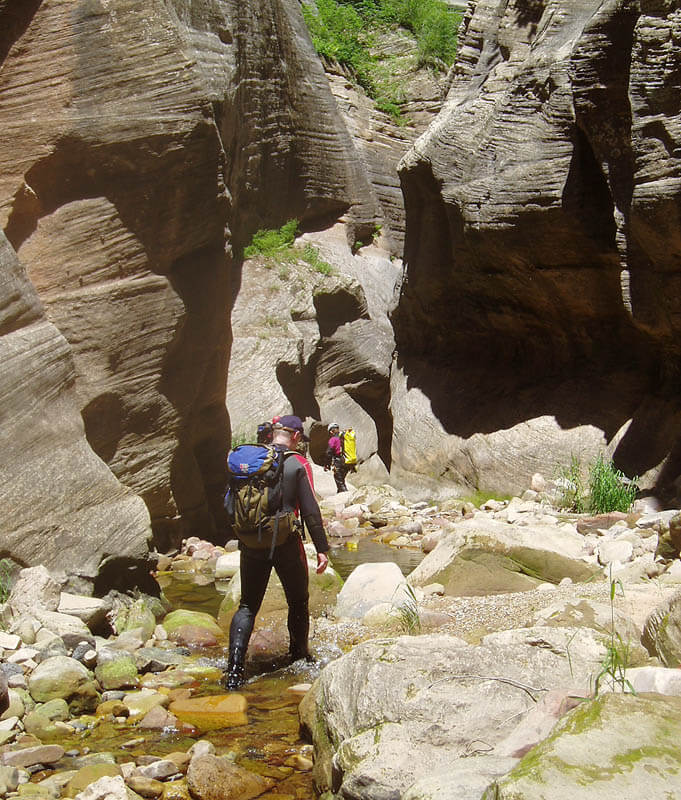
Descend the road on the other side of the pass, switchbacking down the drainage. Where the road forks, stay in the drainage. About 15 minutes below the pass, after crossing a small, rocky drainage, follow an obscured switchback to the right into a small drainage with bluffs on each side. Follow this road all the way to Kolob Creek. Follow a path on the right side downstream for a ways, then cross to the left side when forced. Follow a pretty good trail on the left side to the start of the drops. Allow 45 minutes for the approach.
The Business
Check the flow in the stream. The dam release schedule might have changed. Carefully consider the amount of flow you see: if it is more than five CFS you are out of luck—do not descend, and go find something else to do. The stream flow should be gentle and shallow—you will be rappelling, swimming and downclimbing in this flow, make sure it is low.
The first rappel in the canyon is 25 meters (80 feet) into a pocket garden. Suit up before this rappel. Choose a tree near the head to rappel from, and rap in. Head downcanyon and you immediately encounter your first swim. Yee haw!
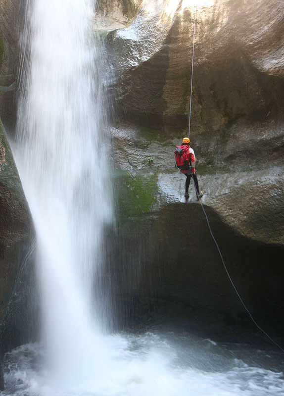
Proceed downcanyon. Rappels 2 and 3 are off log jams down short drops. Rappel 4 is a chained rappel through two or three pools. Most teams will do 10 to 12 rappels. Two long rappels of about 45 meters (150 feet) are near the end of the technical section. Otherwise rappels are no longer than 30 meters (100 feet).
The final long rappel into a big pool is fabulous. This marks the end of the main technical section, though not the end of the fun. Many parties remove their drysuits here. However, there are a couple short rappels and swims a half-hour to an hour downcanyon.

The Exit
To the MIA Trail
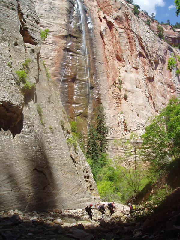
About thirty minutes downcanyon, a 400-foot waterfall comes in over the left canyon wall. The spring at its base is a good place to collect water. About one hour past the waterfall, and soon after two short rap-n-swims, Kolob joins the larger canyon of Oak Creek, and your direction changes from generally east to generally south. There is often a small flow in Oak Creek, and shortly downcanyon is a short drop into a pool. Rapping from bolts on the right might allow you to avoid another swim.
Finding the MIA Trail
While the MIA Trail is not hard to find, many a canyoneer has walked past it due to inattention. Noting the intersection of Boundary Canyon is the key to finding the MIA Trail. The MIA Trail should not be attempted in the dark. The first time, most parties will require at least 2 hours for the MIA Trail, plus another hour to hike back to the trailhead.
OR, Down Kolob Canyon to the Narrows (Overnight Option)
All canyon descents into Kolob Creek (Kolob Canyon, Boundary Canyon, the Oak Fork Canyons) may exit via a one- or two-day trip to the Temple of Sinawava, via Kolob Creek and the Virgin River (Zion Narrows). While this route requires more planning and gear than an MIA exit, it is arguably a more enjoyable, remote, and scenic way to complement your initial technical descent. Lower Kolob Creek itself offers a wonderful variety of narrows, and while the entire 12.1-mile route may not be the longest in the area, it may possibly be the most spectacular long narrows.
From the MIA Trail, hike downcanyon four miles to the intersection with the North Fork. There are two short rappels with swims in icy pools within the first two miles. Plan on 3 hours.
From the end of the technical narrows, there are numerous small places to bivy in the canyon. Please use zero-impact camping techniques. Kolob has a few pools, but tends to be mostly dry. Be prepared to pump drinking water from yucky pools, or pump early when the water is good. If you camp after the intersection with the North Fork, you will need a Narrows camping permit. Most parties camp between the MIA trail and the North Fork.
From the intersection with the North Fork, stroll 8 miles downcanyon to the Temple of Sinawava (approx 6 hours).
Trip Reports

Maps
Click for higher resolution
Photo Gallery
Kolob