

a splendid canyon.
Spry Canyon is the canyon between Twin Brothers and The East Temple, dropping into Pine Creek below Mount Spry. Mt. Spry is named for William Spry, third governor of Utah (1909-1917), and an early supporter of Zion National Park. He is most famous for signing the death warrant of labor organizer Joe Hill. The case generated international attention, with critics charging the trial, conviction and execution were based on flimsy evidence.
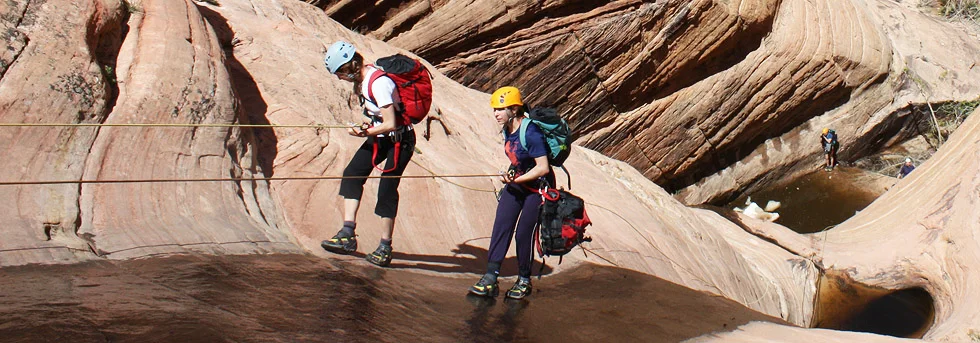
Spry has a delightful slickrock approach, though its charms can be lost when it is hot. After the slabby first rappel, it has ten mostly-vertical rappels, some interesting downclimbs and a few swims, all but one of which can be avoided. In summer after rainstorms, wear a wetsuit so the whole canyon can be enjoyed. The one mandatory swim is near the end and short - so wetsuits don't need to be carried when hot.
Spry is RELATIVELY safe from flashfloods, as there are escape spots after most of the rappels. The catch-basin is small, requiring a direct hit from a thunderstorm, but it seems to get those direct hits fairly often. In 2010, a flash caught three canyoneers and swept them over a rappel. Only one received serious injuries. Outstanding performance by ZNP Ranger Ray O’Neil resulted in a timely, successful rescue.
Spry is one of my favorites, and I enjoy sharing it with foreign visitors because it is so Zionesque. Wearing wetsuits allows visiting all the watery spots, the best places in the canyon. Even in high summer, there is enough water to be comfortable in a wetsuit. The canyon is very sandy and thus hard on ropes and rappel devices.
GPS: WGS84 12S
Parking Spot/Start: 328257mE 4120556mN
Top of Spry Pass: 327532mE 4121854mN


Canyon Profile
Logistics

RATINGS
3A/B III ★★★☆☆

TIME REQUIRED
4-7 Hours

PERMIT
YES. Group size limit 6.

SEASON
Spring, summer, or fall

LONGEST RAPPEL
165 feet (50 m)
Equipment

ESSENTIALS
Helmets, webbing and rings.

COLD WATER PROTECTION
None required in hot weather.

DRINKING WATER
None available, bring plenty.

ACCESS
Car spot or short hitchhike required.
DIFFICULTIES

FLASH FLOOD RISK
Moderate

ANCHORS
Most anchors are bolted.

SKILLS REQUIRED
A fair amount of downclimbing. Lots of rappels.

Getting there
Driving
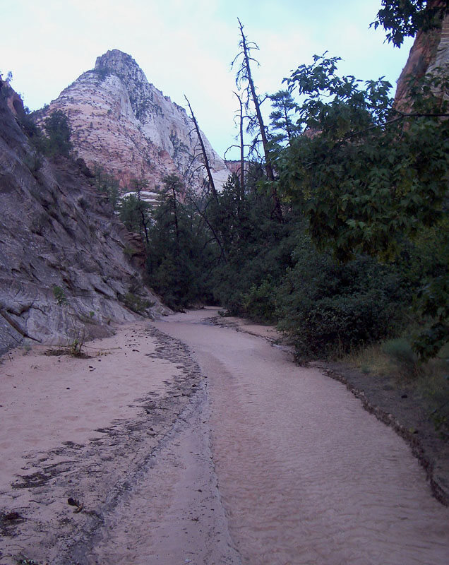
Car Spot: Spry ends at Pine Creek, just upstream from the bridge across Pine Creek east of Canyon Junction. Spot a car here. (One car: one person can hitchhike back to the start after the canyon).
Spry starts where upper Pine Creek crosses Highway 9 one third of a mile (500m) east of the main tunnel. There is parking for a few cars here. If needed, park closer to the tunnel and hike the road. The FIRST canyon coming from the south above the parking lot is Shelf Canyon and does not lead anywhere useful. Continue past this to the major canyon that runs north from the highway. This is upper Pine Creek while the creek beside the highway is Clear Creek.
Hiking Approach
The approach to the bowl of upper Spry also provides access to Lodge Canyon.
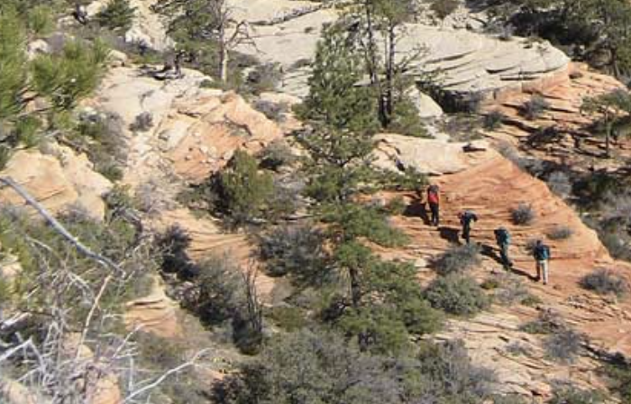
Walk the wide sandy wash about 15 minutes (1/2 mile, 800m) to where the canyon narrows. Exit the bed of the canyon left up a 4th class slickrock watercourse and climb up and a little right several hundred feet to a bench. Follow the bench north then west into a slickrock bowl below the impressive south buttress of Deertrap Mountain. Zig zag up the center of the bowl (4th class), then follow ramps up and right to the top of the pass. Keep your eyes peeled for faint petroglyphs on a vertical orange wall a couple hundred feet below the pass.
From the top of the pass, looking west, left to right you see: the big peak of the East Temple; then the upper bowl of Spry Canyon; the Twin Brothers; a notch pass next to Twin Brothers, leading to Lodge Canyon; then a ridge leading up to Deertrap Mountain. From the top of the pass, traverse right and slightly down toward the slot pass and to the head of a narrow slot that cuts across the slope below. Climb into the head of the slot and, pushing through some brush, follow the slot halfway down to the canyon floor. When convenient, exit to the right and descend steep broken slabs to easier terrain. You are now in the upper bowl.
The Business
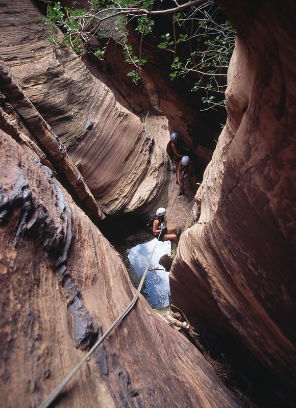
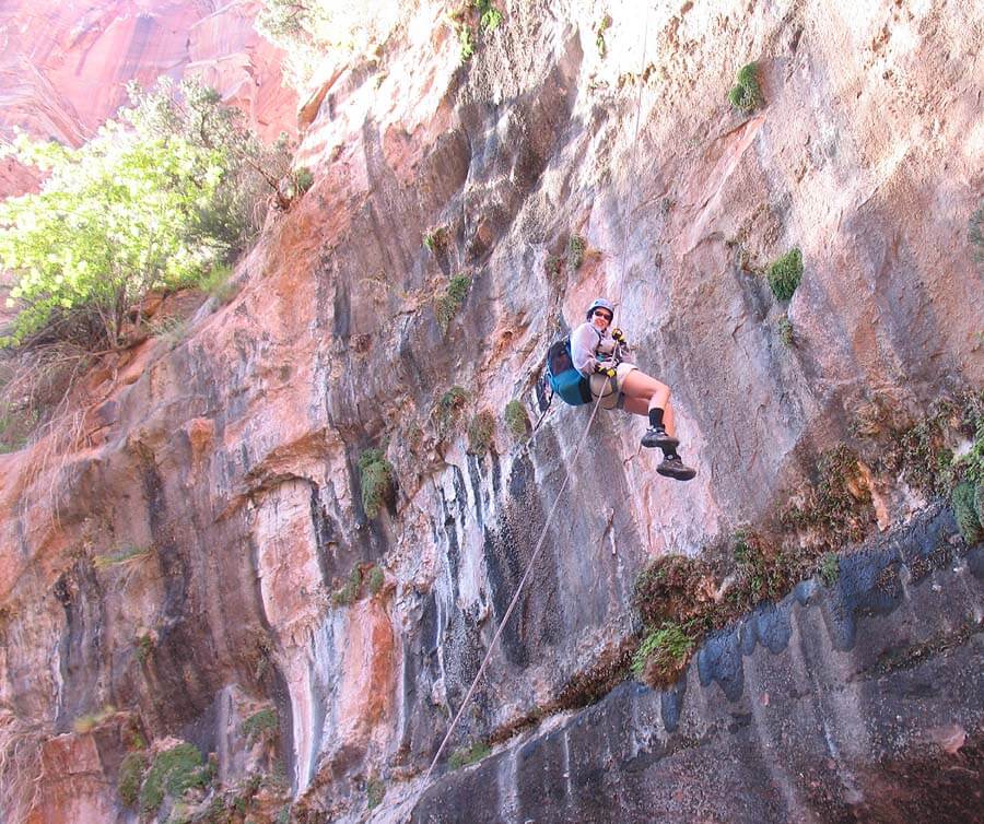
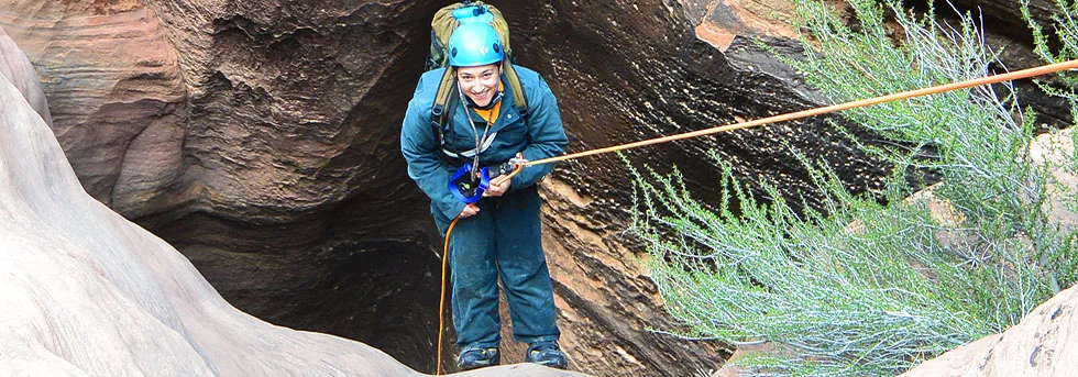
Descend the watercourse between huge, colorful walls. The canyon winds its way through trees and brush, soon arriving at a lovely slickrock bowl. Downclimb to a two-bolt anchor, then rappel (R1) 165 feet (50m) past a swampy pothole to the ground. The pool at the bottom can be avoided.
The canyon again winds its way through a delightful forest. A couple of small potholes lead to a mossy area of short drops in the canyon bottom, usually downclimbed. Stay in the watercourse. The second drop is tall but yields easily to the "elevator" technique – staying back in the corner and using outward pressure to control one's slide. The last drop into a dark tunnel slot requires a short rappel off the most solid of the abundant debris. The dark slot usually requires wading. Some people go around this section, but where is the fun in that!?
After another mellow section, the canyon gets going. Moderate downclimbing is interspersed with about 10 rappels. In one spot, a narrow slot is downclimbed elevator-style, then a pool delicately stemmed over. After an interesting rappel, the canyon opens out. A slabby slope downclimbed by staying slightly right leads to a two-bolt anchor for a 90-foot (27 m) rappel into a black slot.
Soon after, a slung block anchors a short rappel into a hidden pool in a slot- not to be missed. Swim the pool, then rig a second short rappel off a two-bolt anchor to “The Beach”. (Var: those wishing to avoid the swim can rappel 100 feet (30m) off a large tree directly to the beach).
Toward the end, a diagonal rappel gains the top of a flute, thus avoiding the drop into a skanky pool. Finally, the canyoneer downclimbs (4th class) a scary-looking, narrow slot (easier with pack off) into a pool (ankle to nose deep) to a 100-foot (30m) rappel to a large ledge. The final rap is made in the watercourse off an exposed two-bolt anchor

The Exit
Work your way directly down the watercourse (large blocks) to a big ledge.
(R11) Rappel the 90-foot (27 m) drop, the Lambs Point Tongue layer of Navajo Sandstone. Avoid the copious poison ivy at the landing area. Descend through more large blocks to Pine Creek. Turn right and walk out Pine Creek to the bridge.
Author's Experience
I first descended Spry in August 2001 after finding a ranger report in the Black Book at the Wilderness Desk. I descend it about once a year.
Trip Reports
Maps
Click for higher resolution


