In the Heart of Zion.
Lower Fridge is a short little outing with a lot of air. Not a good place for beginners, but delightful for those who have long-rappel and downclimbing skills.
While Lower Refrigerator's main feature is two nice rappels, there is also a bit of sporty downclimbing at the start. Less-confident chimney climbers might want a belay for this part. Some discretion is a good idea when leaving the Angels Landing trail to avoid being followed by curious hikers.
The canyon faces east and south. If you are looking for warmth, head there in the morning. If seeking shade, try the late afternoon. The raps are in the center of the watercourse, so if you can see water flowing from the road or trail, it is probably not a good day to do this canyon. Webbing will need to be replaced regularly, so be sure to bring some.


Canyon Profile
Logistics

RATINGS
3A II ★★☆☆☆

TIME REQUIRED
About 4 Hours

PERMIT
YES

SEASON
Spring, summer or fall

LONGEST RAPPEL
190 feet (58 m)

EMERGENCY
Zion Wilderness Desk: 435-772-0170
Zion EMERGENCY: 435-772-3322
Equipment

ESSENTIALS
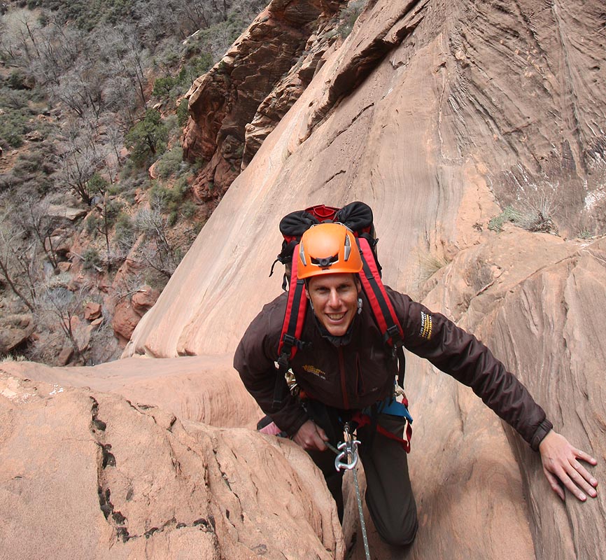
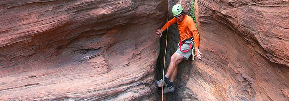
Helmets, rappelling gear, webbing, rapid links and safety leash for everyone. The ledge at the top of rap #3 is only big enough for 2 or 3 people. If your party is larger than that, you will want to bring enough ropes to have both rappels set up at the same time. Bring trash bags to pick up litter.

COLD WATER PROTECTION
None required.

DRINKING WATER
None, bring Plenty.

ACCESS
Starts and ends at The Grotto Trailhead
difficulties

FLASH FLOOD RISK
Moderate: The drainage above is small, but there is no escape from the canyon after starting.

SKILLS REQUIRED
Navigation, downclimbing, and rappel set-up on a small ledge.

ANCHORS
All anchors are bolted.
SEASONAL ADJUSTMENTS
Winter and Spring - Snowmelt from the canyon above might produce flow. The canyon can be seen from the Scenic Drive in Zion Canyon, so the level of flow can be assessed before even leaving the car. The canyon faces east and south, so it is good in spring if dry when higher-altitude snow and melting limit other options.
Summer - The canyon faces east and south, so it will heat up right away. An early start or an early evening descent is recommended.
Fall - Pleasant temperatures make this a fall classic.

Getting there
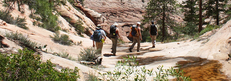
From the Grotto shuttle stop, head up the West Rim/Angels Landing Trail to the bridge crossing Refrigerator Canyon. Backtrack a few feet and drop into the watercourse where it can be done with zero impact. Move downcanyon a bit and gear up. Allow 30 minutes for the approach.
The Business
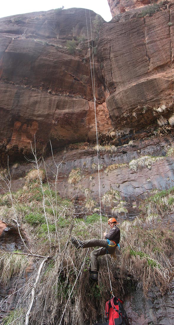
The canyon starts with several short, downclimbable drops. Short people and less confident climbers might want a belay. The downclimbs are intimidating, but not very difficult. Packs can be handed down on long leashes or short ropes. After several interesting steps, a two-bolt anchor is found on the left above a short drop to a pool.
R1: 50 feet (15m) to a pool, which can be avoided with some dexterous climbing to reach the large, flat top of a pillar. It looks difficult as a downclimb, but it is fairly easy (and can be belayed). Packs can be zipped across the pool.
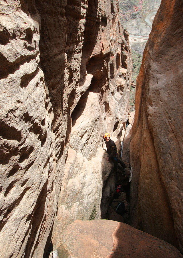
R2: 110 feet (33m) from a two-bolt anchor to a small ledge. Room for 3 maximum.
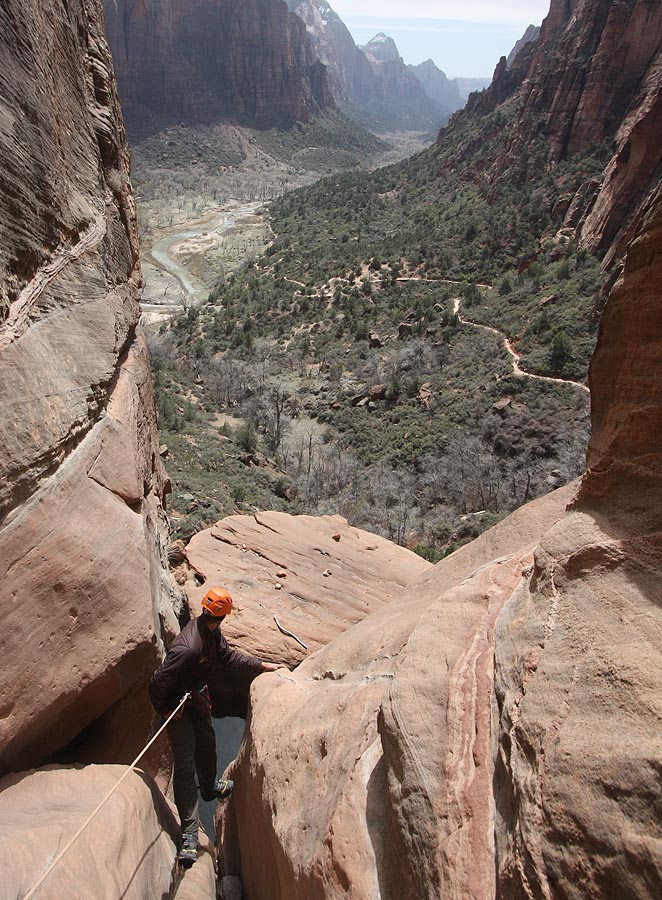
R3: 190 feet (58m) from a two-bolt anchor. The last 60 feet are free.
There is poison ivy in the landing zone and further downcanyon. The slime at the bottom of the rap is particularly slippery - beware!

The Exit
Minimize your impact on the exit hike. There are usually plenty of empty water bottles to pick up.
Boulder-hop down the watercourse about 10 minutes until it is possible to escape right to a flat, somewhat grassy patch.
From the flat, grassy area, follow human trails south toward the West Rim trail, crossing a gully or two, then pushing through the Fremont Mahonia (ouch!) to reach the pavement. Follow the paved trail back to the Grotto.
Trip Reports
Author's Experience
After downclimbing to the first of Royce Trappier's bolt anchors on a previous occasion, I descended Lower Fridge with Jonathon Zambella on May 9th, 2010. Jonathan had done it a few years ago with Royce. We installed a bolt at the lower rappel station. I returned not too much later with Scott Williams and we installed two bolts at the middle rappel station and one more bolt at the bottom rappel station.
Lower Refrigerator, 5/09/10 -Tom, Jonathan and Scott descend Lower Refrigerator.
I have done the canyon a few times since then.
Maps
Click for higher resolution