Fluted & Fun.
Birch is a technical sidecanyon of Orderville Canyon and makes a nice day out with family or friends. It is generally beginner-friendly. Birch WAS a showcase of natural anchor technique, at least before some ass bolted it up. Contemplate how YOU would build anchors at each of the many drops if the bolts were not there. Birch has become popular as a straightforward, reasonably-short technical day for beginners, and it is not uncommon to see guided groups and large self-guided groups in the canyon. The traffic can be aggravating, especially on Fridays and Saturdays.
While outside the stringent National Park permit system, the BLM has concerns about disturbance of the endangered Mexican Spotted Owls that reside in the canyon; a voluntary group size limit of 12 is in place with a 20 minute gap between groups. Please respect these guidelines.
Birch Hollow terminates in Orderville Canyon, near the top of the Orderville route. There are four normal exits from Birch:
1. The Wild Wind Hollow exit has developed a pretty good trail of late due to increasing popularity. Hike up Orderville to Wild Wind Hollow, then up WWH a few feet, then steeply up to the ridge between WWH and Birch, and then steeply up a pretty good trail back to the starting point. This exit is a LOT less driving, but it does involve hiking steeply up hill.
2. With two capable vehicles, spot a car at the Orderville Trailhead and hike up Orderville from the Junction. The carspot from the starting trailhead takes at least 45 minutes. The Jeep Trail down to the trailhead from the Orderville Corral varies widely in its condition and CAN require HC 4WD to get back up. This exit is the least walking and the most driving.
3. With two less-capable vehicles, spot a car at the Orderville Corral. This exit is less driving but more hiking.
4. Most parties will be sated with Birch Hollow, but a fast group can exit down Orderville Canyon to The Narrows and the Temple of Sinawava. It makes for a long day. A couple swims in Orderville suggest bringing a wetsuit in all but hot weather. This exit is the most hiking and the most driving.

Canyon Profile
Logistics

RATING
3AIII ★★★☆☆

TIME REQUIRED
4 to 8 hours if exiting upstream to Orderville Trailhead or up Wild Wind Hollow; 8-12 hours if descending downstream through Orderville. Crowding in the canyon and/or large groups will likely slow your descent.

PERMIT
Only if descending out Orderville Canyon. Group size limit of 12.

SEASON
Spring, summer, or fall

LONGEST RAPPEL
120 feet (40 m)

ACCESS
One and two-car options available.

EMERGENCY
Kane County Sheriff: (877) 644-2349 Ext. 1
Equipment

ESSENTIALS
Helmets, rappelling gear, webbing, and rapid links.

COLD WATER PROTECTION
None required for Birch, but wetsuits recommended if descending Orderville.

DRINKING WATER
None available until lower Orderville Canyon. Bring Plenty.
DIFFICULTIES

FLASH FLOOD RISK
Moderate. There are only a few sections of sustained narrows.

SKILLS REQUIRED
General rappelling and downclimbing skills. The clay mud is famously slippery, so be ready if descending after a rain or in the spring. The first two rappels have awkward starts: the hardest raps of the day.

ANCHORS
Trees and bolts. Bring webbing.
Seasonal Adjustments
Fall: The preferred season, with nice temperatures and great fall photography.
Winter: Roads and canyon trailheads are at high elevation and are often inaccessible due to snow or mud. Driving down past the Orderville Corral requires dry conditions.
Spring: Can be quite wet in the spring. Makes for a muddy day, but there are no swims. The Virgin River must be running lower than 150 CFS to descend out Orderville Canyon. Snow or mud limits access to the start.
Summer: Often hot! Get an early start. Once in the canyon, the temperatures tend to be very pleasant, except for the exit.... Bring plenty of water for the full-sun hike in upper Orderville.
Getting there
Car Spot
If exiting UP Wild Wind Hollow, spot a car where Birch Hollow crosses the North Fork Road; or spot 0.2 miles further up the road, at a sharp turn with a small dirt road off to the left with a few camp spots.
If exiting UP Orderville Canyon, spot a car at the well-signed Orderville Corral, 11.4 miles up the North Fork Road. A jeep trail descends a further 2.1 miles to a cul de sac, if your vehicles can handle it.
If exiting DOWN Orderville to Zion Canyon, spot a car at Canyon Junction.
Approach
There are two approaches to Birch Hollow:
A. The Logging Road Approach, along logging roads 2.6 miles and down a steep slope to the top of the 2nd rappel. (I prefer this approach). And;
B. The Down-the-Watercourse Approach. Follow the watercourse from where it crosses the road to the top of the first rappel. The watercourse is unpleasant - brushy and thorny due to wild rose. The first rap has some loose rock on it and is nothing special.
Follow the old road down through the scrub. After 15 minutes, an ATV trail branches right toward Birch Hollow. This branch can be obscured by brush and hard to see. Turn right. Follow this around the head of a wash, through a meadow and up a hill. At a fork in the road, go right and follow the road out to the edge of a canyon. Follow the best of several social trails steeply down the hillside into the canyon, and walk downcanyon one minute to find the top of a rappel, the second rappel in the canyon. Allow one hour to get to the second rappel.
Logging Road Approach
Birch Hollow can be approached using an old logging road off the North Fork Road. Drive north on the North Fork Road 5.4 miles to the entrance of the Zion Ponderosa Resort. Continue 2.8 miles on the North Fork Road to a small dirt road on the left (west) between two fenced ranches, the Gifford and EZ Acres. Park opposite the entrance to this road. Access to the canyon is a courtesy provided by the families—please respect their private property rights and move through the area expeditiously.
Approach
Follow the old road down through the scrub. After 15 minutes, an ATV trail branches right toward Birch Hollow. This branch can be obscured by brush and hard to see. Turn right. Follow this around the head of a wash, through a meadow and up a hill. At a fork in the road, go right and follow the road out to where it ends at the edge of a canyon. Follow the best of several social trails steeply down the hillside into the canyon and walk downcanyon one minute to find the top of a rappel, the second rappel in the canyon. Allow one hour to get to the second rappel.
Watercourse Approach
Drive north on the North Fork Road 5.4 miles to the entrance of the Zion Ponderosa Resort. Continue on the North Fork Road 3.2 miles to where Birch Hollow crosses the road; there is a bit of a parking area on the left. This is also often where the first big mud puddle on the North Fork Road occurs, and a BLM signboard is here. Park.
Follow a rough trail on the left side of the drainage until it is possible to cut down into the drainage. Follow the drainage for 0.9 miles to the top of the first rappel.
Driving Times
From SPRINGDALE to TURN ONTO N FORK ROAD: 30 minutes (plus tunnel time)
From N FORK TURN to where ROAD CROSSES BIRCH: 15 minutes
From point where ROAD CROSSES BIRCH to ORDERVILLE CORRAL: 10 minutes
Note: The drive down into Orderville is highly variable; allow 20-30 minutes each way

The Business
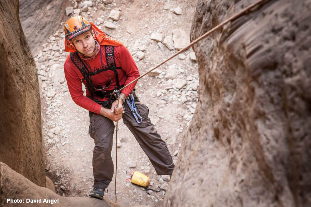
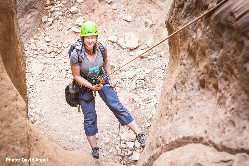
The first two rappels are past blocky limestone layers, with awkward starts and loose rock at the bottom. Thankfully, they are also overhanging for much of their length.
R1: Rappel 110 feet (34m) off a block or tree. Be careful of loose rock and of the sharp, unstable talus at the bottom of the rappel.
R1(variation): a shorter and cleaner rappel off a tree can be found by traversing the rim right to a small watercourse. Rappel 70 feet or so to the talus below.
Hike downcanyon. In a few minutes, the second drop becomes apparent. (Logging road approach joins here).
R2: Rappel 90 feet (30m) off a block or tree. Be careful of loose rock, and of the sharp, unstable talus at the bottom of the rappel.
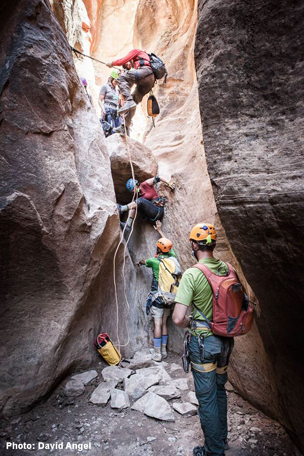
Continue hiking downcanyon. In a few minutes, the canyon narrows up and a few small drops are encountered. These can be rappelled and/or some can be carefully downclimbed. Most parties will rappel at least twice. Soon, the first of a series of "real" rappels is encountered.
R3: Rappel 90 feet (28m) from one of the trees to the side into the slot.
R4: Walk down-slot 30 feet (10m) and rappel 80 feet (25m) off bolts to the canyon floor
R5: Slide down to a pothole ledge and set a short rappel off a bolt anchor.
R6: After a short downclimb, a drop starts by climbing under a boulder. The bolt anchor is well-placed for belaying this drop as a fun downclimb, or it can simply be rappelled.
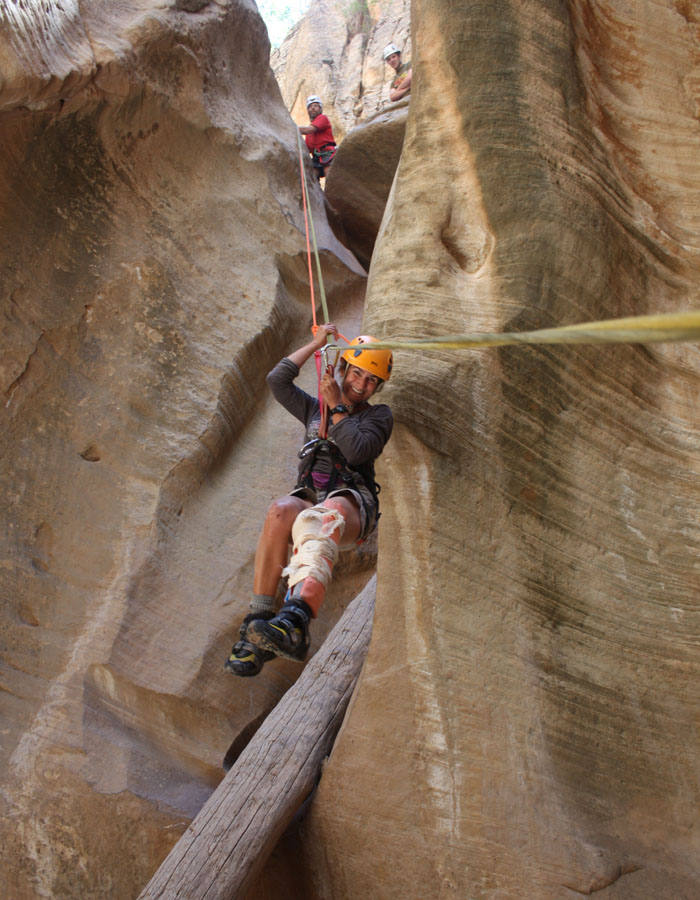
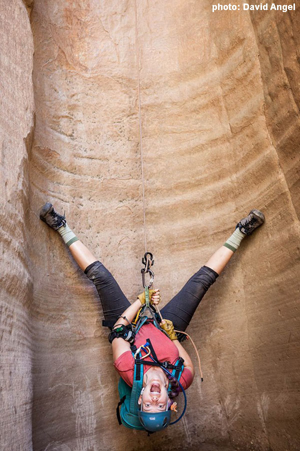
R7: A lovely rappel drops into an awesome chamber. Click click click go the cameras.
R8: A wonderful rappel down a double flute ends at the ground. Fifty feet downcanyon is Orderville Canyon.
If you sit down and have a break after the canyon, hike out 2 minutes to Orderville before you do so. A friend’s group took their break at the bottom of the last rappel, and got caught by a flash flood. No injuries, but it was a close thing!
The Exit
Turn right to exit up Orderville Gulch and back to the North Fork Road; or turn left to descend Orderville Canyon to The Zion Narrows.
Wild Wind Hollow Exit
This used to be a horrendous bushwhack, but a pretty decent trail is now established. Hike UP Orderville Canyon 0.4 miles (15 minutes) to where a canyon comes in from the east (on your right) as a steep V in a pile of dirt or mud. Scramble up the dirt V for a minute or so until a reasonable escape can be made up the right side to the bench above. Follow a trail on the bench at first paralleling the dirt V, but eventually climbing steeply away from it up onto a ridge. Follow the trail up as it winds through the trees. As the brush thickens, the trail may become obscure. Continue up, then to the right over to the edge of Birch Hollow. Follow the now clearly defined trail east along the crest of the ridge to the North Fork road. Turn right and follow the road 0.2 miles to where Birch Hollow crosses, or a further 0.3 miles to the Gifford – EZ Acres parking spot.
Orderville Trailhead and Corral Exit
Hike UP Orderville 0.4 miles (15 minutes) to Wild Wind Hollow. Continue up the main drainage, and look for a trail cutting up the slope on the right. Scramble up this to a bench, then up another steep slope to the top of another bench. Another 0.8 miles of hiking on a good trail beside the wash (exposed to the sun) will bring you to the end of the road at the Orderville Trailhead. Hop in your vehicle, if parked here.
If not, follow the road as it meanders up the flat Orderville Gulch. After a bit, the road turns right and climbs steeply up the hillside to the Orderville Corral in 2.1 miles with 600 feet of elevation gain.
Times: about 45 minutes to the end of the jeep road; an additional 45 minutes up to the Corral.
Out Orderville and The Narrows
Hike DOWN Orderville, to the Narrows. There is usually one short rappel or handline and several swims. It is quite a long way.
More Notes on Logistics and Trailheads
Birch has 4 Trailheads.
T0: (Logging Road Approach) The first is my favorite — the logging road between 2 ranches, 1/3 mile short of where the North Fork Road crosses Birch Hollow. I like the easy stroll this provides into Birch Hollow between R1 and R2, though the steep bit down to the canyon itself interupts the charm. A bit.
T1: (Watercourse Approach) Top of Birch, where the road crosses Birch, with BLM signs. Most cars other than sports cars can make it to this point unless the road is wet. You can take the Wild Wind Hollow exit which comes out on the N Fork road 1/4 mile further out. The approach to the canyon itself follows the stream course, with numerous obstacles and quite a bit of Wild Rose bushes to push through. Wear long pants.
T2: The Orderville Corral: 3 miles further along on the N Fork Road is the Corral, just off the N Fork Road. Most cars can make it to here in dry conditions. It is entirely possible to park a shuttle vehicle here, and hike to here after doing Birch.
T3: The Orderville Cul de Sac: a 'jeep trail' of 2 miles slides down into Orderville Canyon and then along the flat canyon bottom to the cul de sac. The road is driven a lot by the Zion Ponderosa in their shuttle vehicles, but those are big vehicles. The road varies widely in condition. The crux is about 1/2 mile past the Corral. Going UP it requires 4WD and reasonable clearance even when 'nice'. It is steeply up-hill with cobbles and small boulders and dirt, and leans towards a ditch you definitely do not want to fall into. I have driven it when the road was in bad shape, and in my Tacoma (big tires, no lift) I was afeared of sliding into the ditch. But I think the Ponderosa keeps the road in better shape these days.
The North Fork Road and these side roads are located in the Carmel Formation, which includes some mudstones/shales that turn into lubricating foam when wet on the road surface. Even fully-capable 4WD HC vehicles have trouble staying ON the road when it is wet, though it usually takes more than a brief thundershower to produce the full-foam condition. Generally, the road is a good to go even when a bit wet as far as the Birch Hollow T1 Trailhead; and then the road deteriorates rapidly from there.
Note that to hike from T3 to T2 at the end of the day generally takes an hour. Driving from T2 to T3 takes almost half an hour - but if you spot a vehicle at T3, you do that drive 4 times, taking almost 2 hours. Jus' sayin'... T2 is my go-to trailhead for Birch Hollow, although it really seems like me and mine "adult-up" and take the Wild Wind Hollow exit most of the time.
Trip Reports

Maps
Click for higher resolution.