

THE EAST FORK.
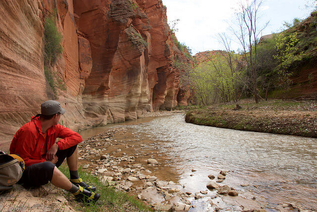
The mighty Virgin River has two main forks: the North and the East. The North Fork is more famous and accessible, as it carves "The Narrows" and runs through Zion's main canyon. The East Fork carves another deep, narrow canyon: a close cousin to The Narrows, but on a more human scale, beginning near Mount Carmel on Hwy 89 and traveling through rugged backcountry to meet the North Fork near Rockville. Though the logistics of the hike following the East Fork are more difficult, the beauty and solitude are worth the trouble.
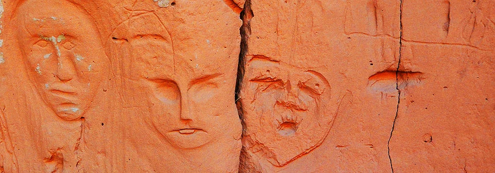
The nomenclature of the area is somewhat confused – some people call it “Parunuweap” and others “The Barracks.” “The Barracks” specifically refers to the dramatic narrow section of the canyon where the walls are tall and tight. There are several nice side canyons to explore but also a bit of bushwhacking plus cows and cowed-up areas to deal with. On the map, the canyon is called The Barracks from where it cliffs up a few miles west of Mt. Carmel to Labyrinth Falls, just west of the Zion Park boundary. From Labyrinth Falls down it is labeled Parunuweap Canyon, but is closed to the public as a Natural Research Area.
This description is of the traditional one-night overnight route starting near Mt. Carmel and following the river, finding a campsite and continuing the next day to the Powell Plaque, exiting north into Zion Park and coming out in East Zion near Checkerboard Mesa. (This is the exit used for Fat Man’s Misery.) This is not the best way to see The Barracks; the first part is tedious hiking in an unexciting, shallow canyon shared with cows. The Powell Plaque exit is a long uphill grunt back to civilization. While this version has a nice story arc, the best parts of the hike are more-easily covered using the Rock/French loop, also easily done as a one-night overnight. Rock/French requires a fully capable vehicle to drive the deep-sand roads to the south-rim of The Barracks, where that loop starts and ends.

hike Profile
Logistics

RATINGS
Off-trail, strenuous hike with sections of knee- to chest-deep water. Backcountry travel and camping required.

DISTANCE/TIME REQUIRED
About 20 miles (32 km) one way, usually done over 2 or 3 days.

SEASON
Late spring, summer, or fall.

ELEVATION GAIN
Minimal altitude loss until the exit, where you'll gain ~2,500 ft.

SHADE
A mix of full sun and deep shade.

PERMIT
No, but if leaving a car overnight at Checkerboard Mesa put a courtesy note for Park Law Enforcement on the dash. Include your name, phone number, destination and the date your hike ends.
Equipment

ESSENTIALS
Sturdy water hiking shoes, ample water, purifying tablets or pump, backpacking gear, and drybags.

DRINKING WATER
Water is available to purify until you begin the exit climb.

FLASH FLOOD RISK
Moderate - the narrow sections of the canyon are tight and sustained. Not a good choice in inclement weather.

ACCESS
Requires a car spot or shuttle. Begins off Hwy 89 near Mt. Carmel and finishes on Hwy 9 inside the Park at a pullout across from Checkboard Mesa.
Difficulties

CONSIDERATIONS
A long, strenuous backcountry adventure in remote terrain, often in full sun. Requires good backcountry navigation skills.
Seasonal Adjustments
Spring: Only practical after the spring snowmelt has completed.
Summer: The open sections can be hot, so plan accordingly. You are close to water for most of the hike, and there are often shady canyon walls you can hide beneath. Plan your entry hike and exit climb for early or late in the day.
Fall: Cool weather makes this the best season.
Winter: Impractical for all but the heartiest arctic explorers, even in ideal conditions.

Getting there
Spot a car near Checkerboard Mesa, where you'll finish the hike. Use the small pullout across from the drainage between Checkerboard and Crazy Quilt Mesas.
The trailhead for Parunuweap is a dirt road about a half mile south of the Junction of Hwy 9 and Hwy 89. Directions/Mileage below are from the Chevron in Mount Carmel Junction.
0.0 miles Chevron – head south on Highway 89
0.4 miles Turn Right onto a wide dirt road (no sign)
0.9 miles Corral and camp spots. There are many camping spots in the next half mile.
1.3 miles Cattleguard. Sign.
1.4 miles River crossing. If the river level is higher than ankle-deep, doing this hike will be very difficult. (Might be dry – don’t worry, springs feed the river)
2.4 miles Park Here – start of The Barracks Ranch Private Property
3.2 miles Barracks Ranch house, first river “crossing”.
5.6 miles End of Road. Fully capable vehicles can make it this far in good conditions / low river flow. (This is BLM land, parking here is legal).
The Hike
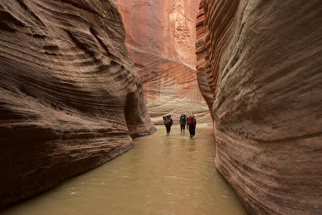
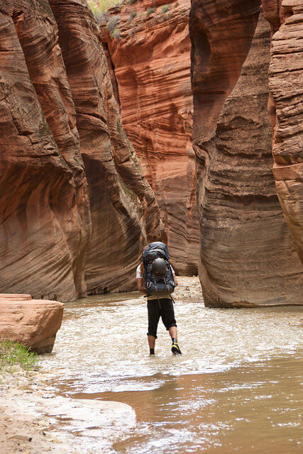
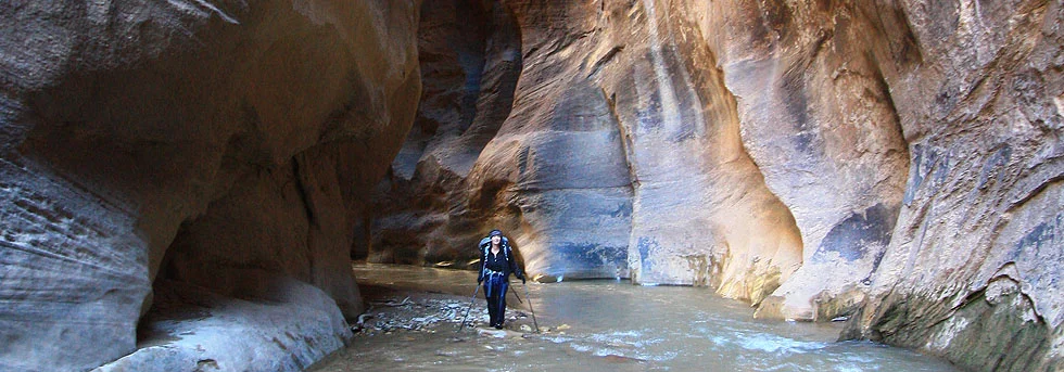
From the carpark at 2.4 miles, follow the road to reach the first river “crossing” below the Barracks Ranch farmhouse. (Some vehicles can make it three miles further down the road than the carpark, but yours maybe isn’t one of them.) Skirt the edge of the river on the right and pick up the road again. Continue for approximately two hours - encountering a handful of river crossings along the way - until the road leaves the canyon bottom. From here, follow trails along the river’s edge or just walk in the river. The canyon is pleasant, but nothing spectacular quite yet.
About 4-1/2 hours downcanyon, Mineral Gulch comes in from the north – a detour well worth an hour’s time. After another hour or so, Rock Canyon intersects from the south. Near the mouth of the canyon is perhaps the best place to camp, and from here, one can explore the wonderful Rock Canyon riparian zone, minimally impacted by cows. Water from the Rock Canyon stream will be somewhat cleaner than the water from the river, but still requires filtering. From this point downriver, agreeable campsites are available about every half hour.
Below Rock Canyon, the sandstone walls grow taller and more continuous, though escaping the watercourse to the north is easy in many places. As the canyon closes in, you will be hiking in the river more and more. The next canyon of note is French Canyon, about 2 hours below Rock Canyon. It comes in from the south as a 15-foot wide slot, lush with vegetation – some of which is poison ivy, so tread carefully. A half-hour past French Canyon, Poverty Gulch intersects from the north. Here, the river turns sharply south, and this is perhaps the last good campsite. Take an hour to investigate Poverty Gulch if the mood strikes.
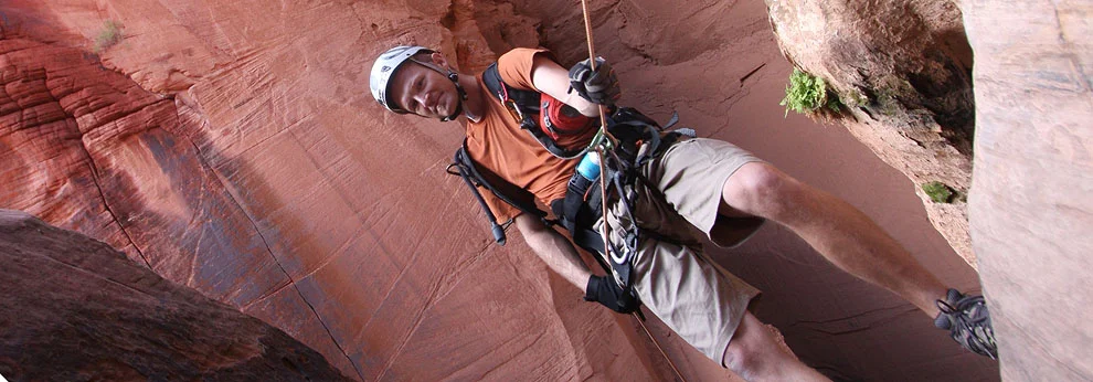
Forty-five minutes below Poverty Gulch is “The Waterfall”. At low water levels, one can sometimes climb down along the right edge, followed by a short swim. A dry route is available across the river on the left: climb 30 feet up a steep gully, then cut right behind some sizeable rocks to find the ‘rabbit hole’ downclimb that emerges below the waterfall.
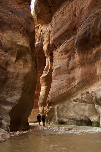
The next half hour of walking features the most dramatic portion of the canyon, all soaring walls and flowing water. Fat Man’s Misery Canyon comes in from the north a half hour below the waterfall. A slightly sulfurous warm spring marks the intersection. This canyon is well worth a half-hour detour up into its dark grotto. A smattering of partner-assisted scrambling is required to get to the best part.
The towering walls persist, but passing Fat Man’s Misery indicates that the end is near. About 20 minutes further downcanyon on the inside of a sweeping bend to the right you will find a reedy, brushy area with a trail that goes into the grass. This is the exit. Consider waiting until the heat ebbs before beginning your climb out; full sun awaits. A plaque commemorating the Powell expedition of 1872 can be found on the downstream side of the grassy area behind some brush (lots of poison ivy here – beware!) and another ~30 minutes down the canyon the river drops 40 feet at Labyrinth Falls. The tantalizing Parunuweap Canyon is closed to the public from here, so get a good eyeful, enjoy the scenery, and head back towards the exit.
Camping
Most backpackers camp somewhere between Yellowjacket Canyon and Rock Canyon. The East Fork has many shaded alcoves that make great campsites, so rest assured you'll have plenty of good options. Past Poverty Wash, closer to The Barracks, the canyon narrows and fewer camping options exist. If you only have two days, try to make it close to Rock Canyon the first day, to evenly split your hiking over two days.
Barracks/Parunuweap Time and Mileage Guideline
Hours Miles KM Landmark
0:00 0.0 0.0 Park at Barracks Ranch property line
2:00 3.0 5.0 End of sandy road
4:30 6.6 10.6 Mineral Gulch
5:30 6.6 10.6 1 hour side trip Mineral Gulch
7:00 8.6 13.8 Rock Canyon (possible camp spot)
0:00 0.0 0.0 Rock Canyon
2:00 2.7 4.4 French Canyon
2:30 2.7 4.4 ½ hour side trip French Canyon
2:40 2.9 4.7 Poverty Gulch
3:40 2.9 4.7 1 hour side trip Poverty Gulch
4:30 4.1 6.6 Waterfall obstacle / bypass
5:00 4.7 7.6 Fat Man’s Misery Canyon
5:30 4.7 7.6 ½ hour side trip up Fat Man’s Misery Canyon
6:00 5.0 8.0 Powell Plaque exit route
8:30 7.8 12.6 Checkerboard pass
9:00 8.8 14.2 Route 9 parking spot
The Exit
The exit is a strenuous scramble and hike back to Highway 9 that takes most parties about 3 hours. Rest up and filter plenty of water for the hike out.
Climb up a gully with a few steep steps, following the trail up to a campsite at an overlook. Pass the campsite and traverse to the north, climbing ledges on a slab then up a steep step to the top of the cliff. Continue upward and northerly, staying close to the top of the ridge… for a long, long way. There are multiple cairned routes in this section, but the keeping close to the top of the ridge functions as a trusty handrail. The ridge eventually leads to a large, white, roundish slickrock ridge not unlike the back of a whale; find the trails leading left and down and cross two shallow watercourses. From here the trail should be very well-defined. Hike west past a clean, teepee-shaped buttress and around into the notch beyond, then climb to a pass and drop down the other side on steep sand. Follow the canyon bottom out to the road, where your vehicle (hopefully) awaits.
Trip Reports
Maps
Click for higher resolution


