

downloadable maps by region
printer-friendly Maps
Print versions are sized for 11” x 17” paper.
Most computers will auto-fit the map to 8.5” x 11” paper, if that’s all you have.
phone-friendly Maps
You may save mobile maps to your phone or device by saving to photos (or similar). Helpful when in the field, out of service range.
First, when doing a canyon, look over the map carefully when reviewing the written description. Find landmarks you will be able to navigate by. Make a good guess at what the terrain will look like, and look for places that could be difficult or confusing.
The first challenge is starting in the right place. Many times, I have started off into the outback only to realize I was not where I wanted to be. Pay careful attention to the map when driving in, and be absolutely certain you know where you are when leaving the car.
Use the map all the time. It is often difficult to figure out where you are, so keep track from the beginning. Follow the twists and turns. This will not only constantly improve your map reading skills, but may keep you from getting lost in the first place.
And of course, maps do you no good when left at home. There are many hikes in this guide that can be done without a map, but there are even more that cannot. Always plan on bringing the map.

CAPIToL REEF
- PANDORA -
Map includes Pandora’s Box Canyon aka Meeks Canyon, & Wiggum’s Gulch.
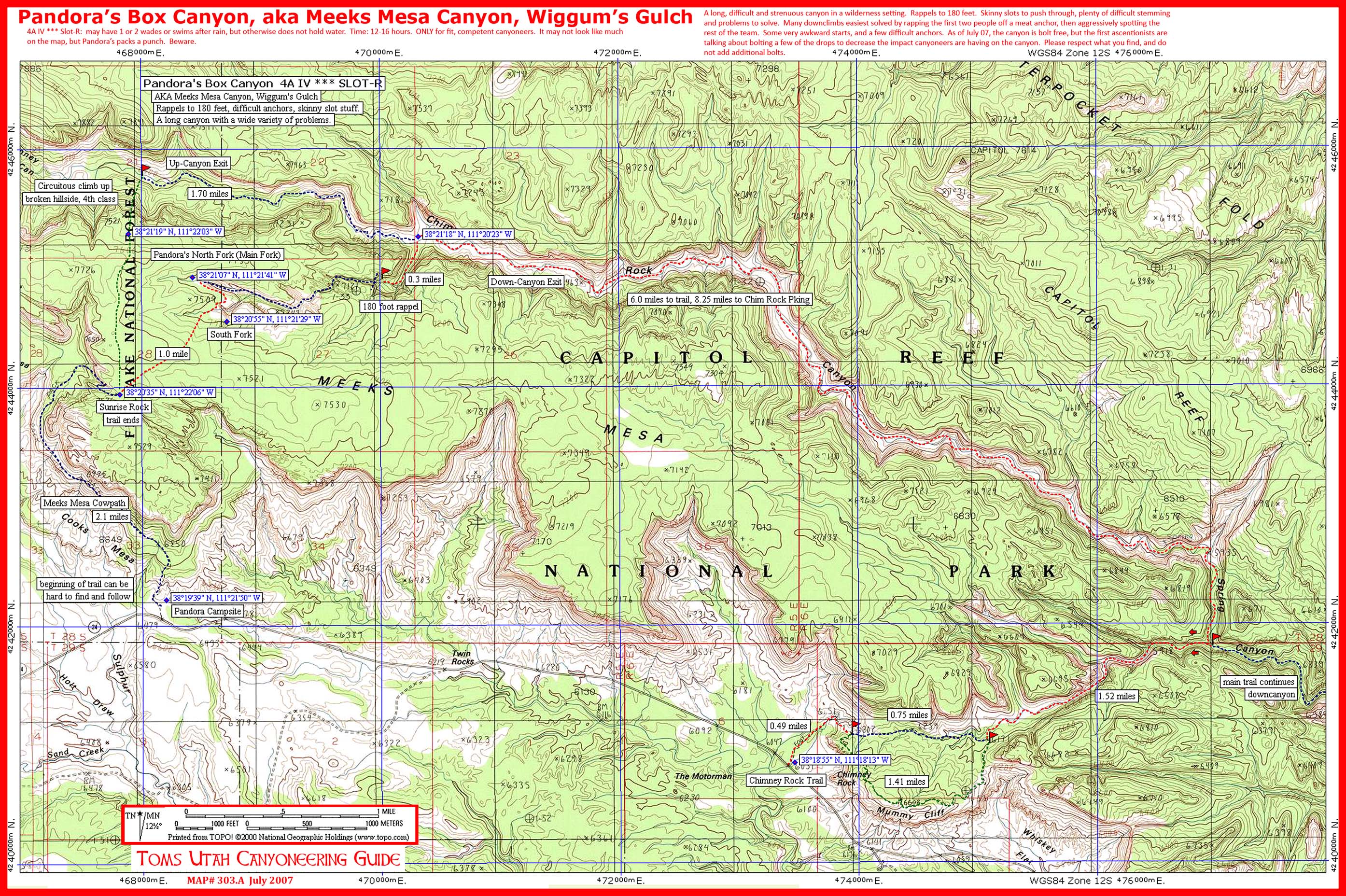
print version
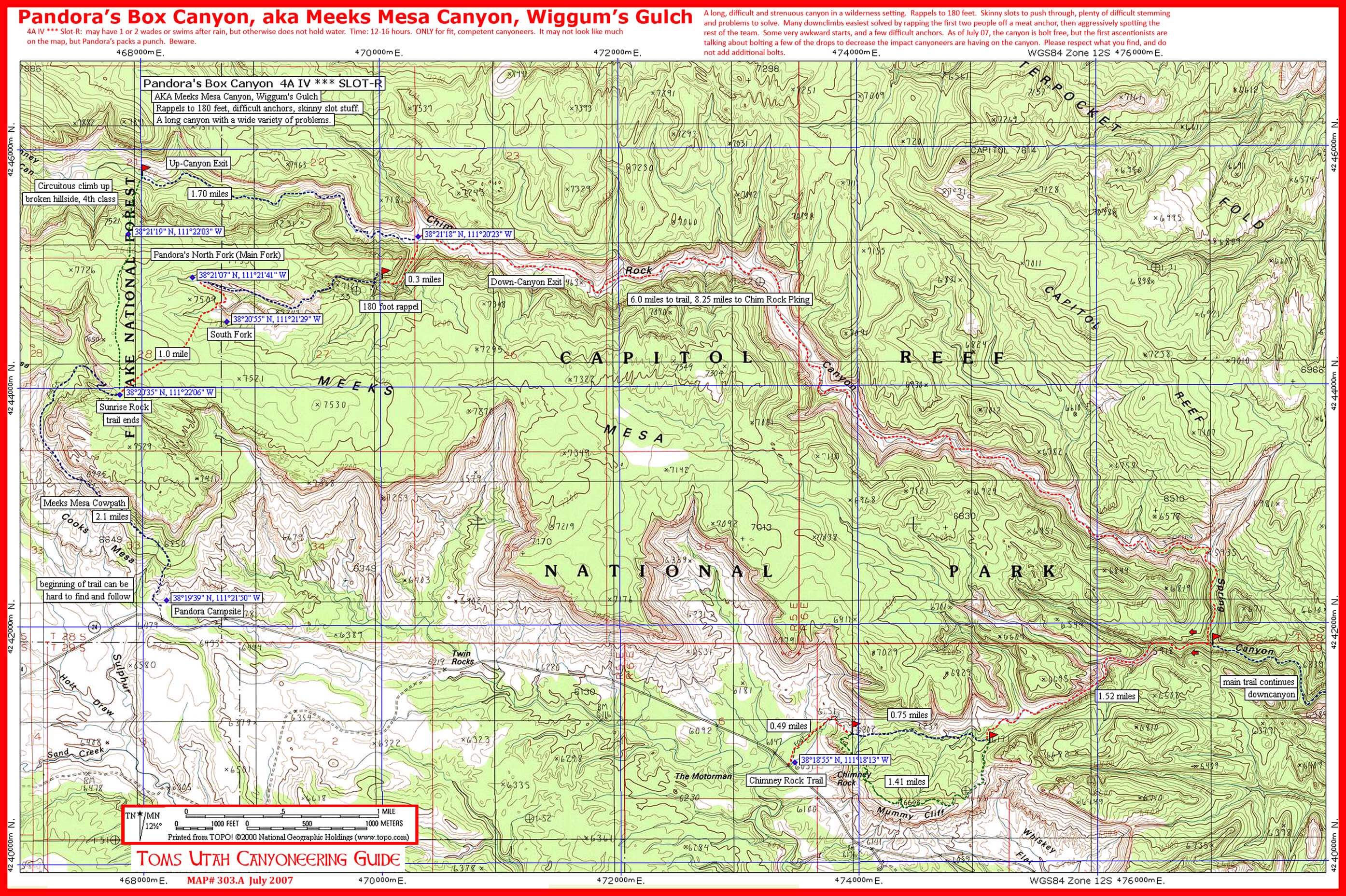
MOBILE version

ESCALANTE
- Neon -
Map includes Neon, Ringtail, and Egypts 2 & 3 Canyons.
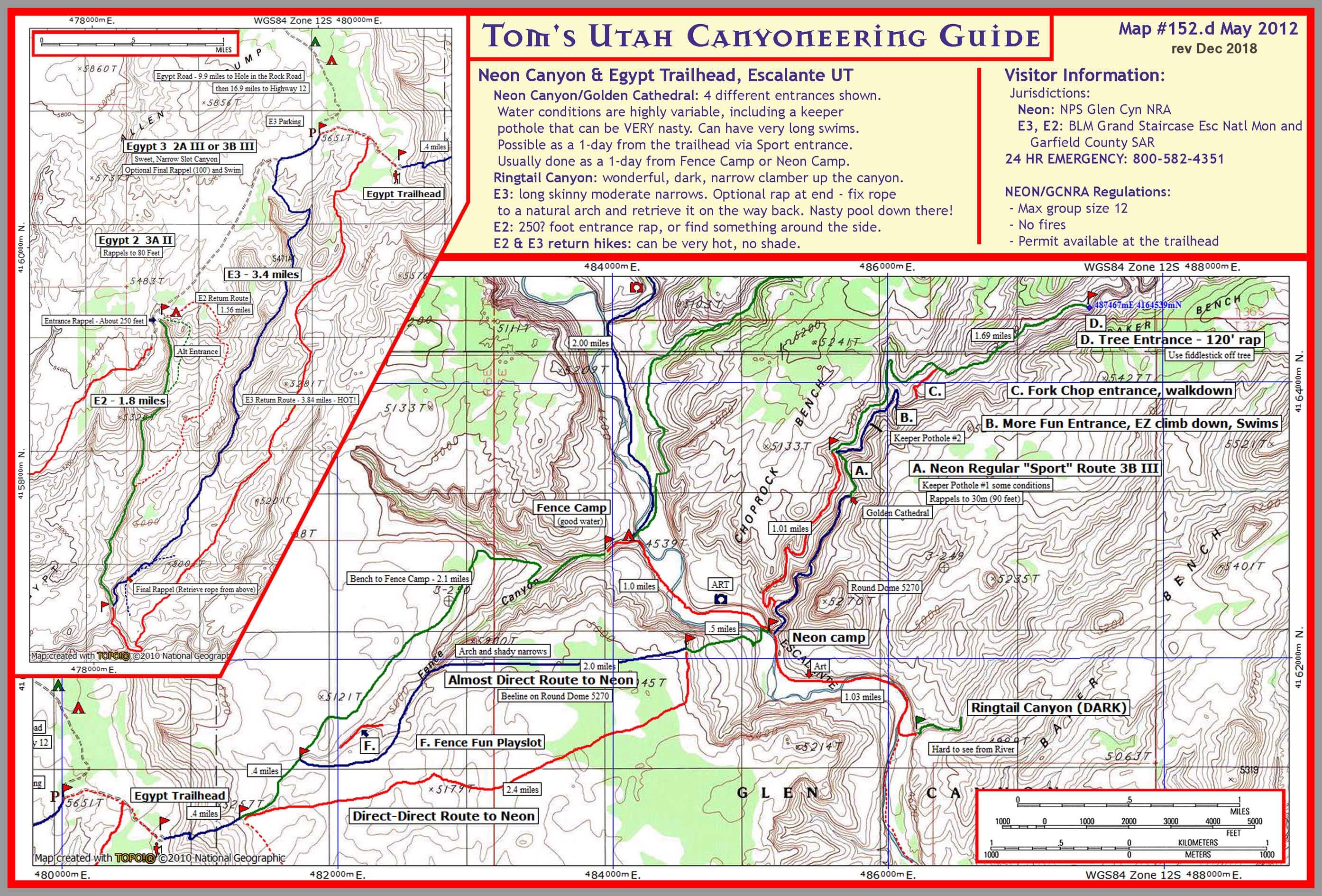
PRINt VERSION
Mobile VERSION
- Coyote Gulch -
Map includes Coyote Gulch Backpacking Trail.
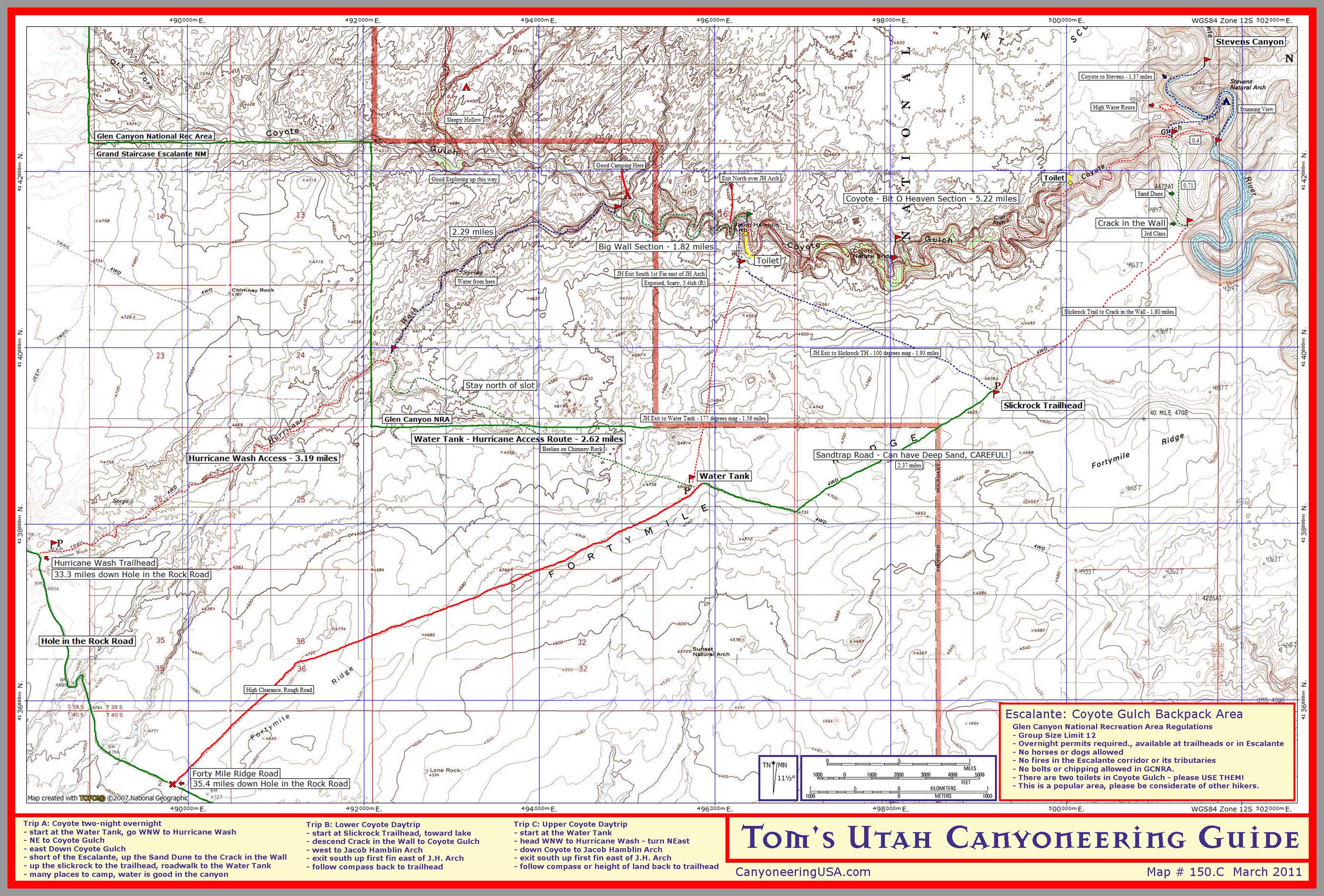
Print version
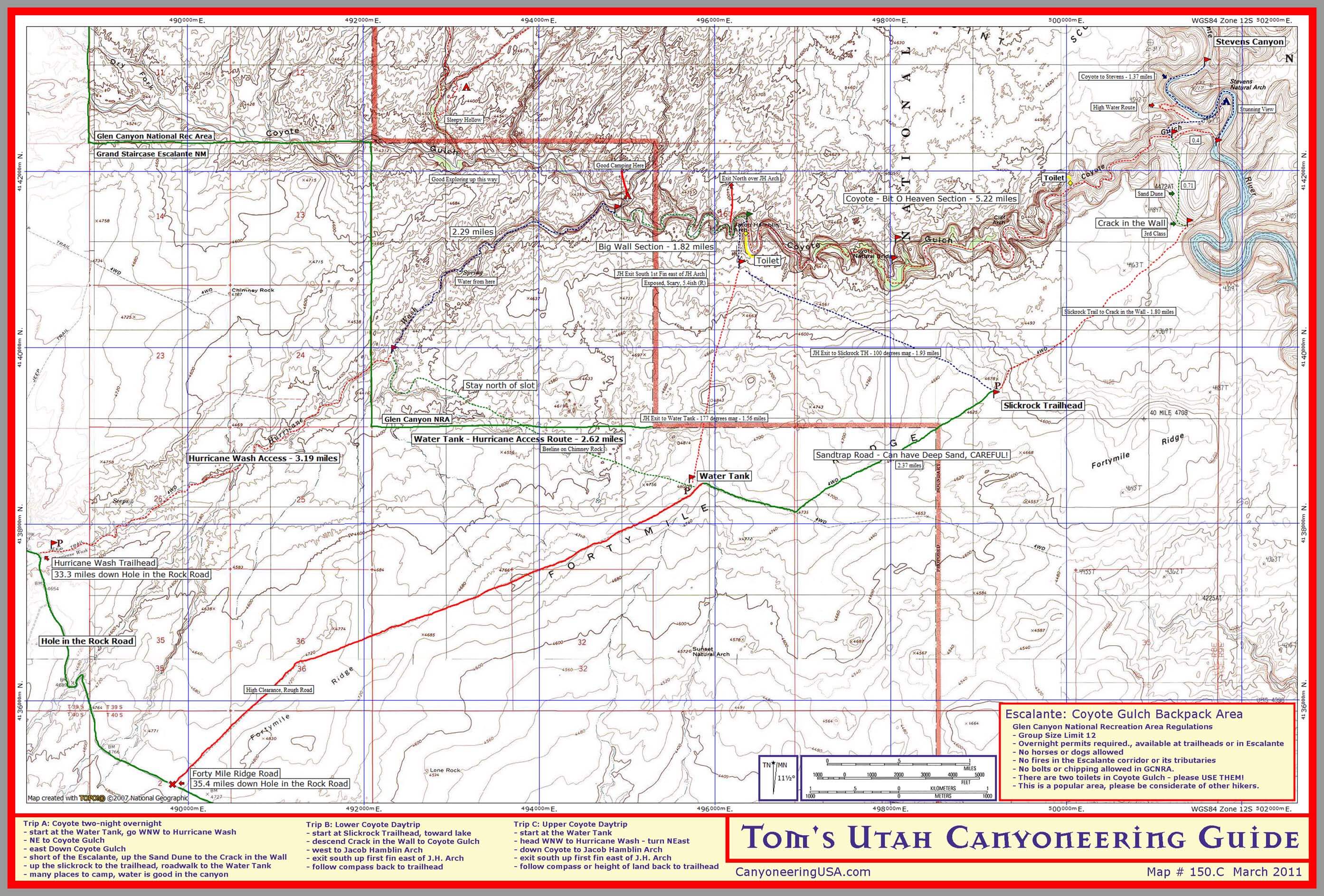
Mobile version
- Coyote Dry Forks -
Map includes Spooky, Peekaboo, Brimstone, & Dry Fork Canyons.
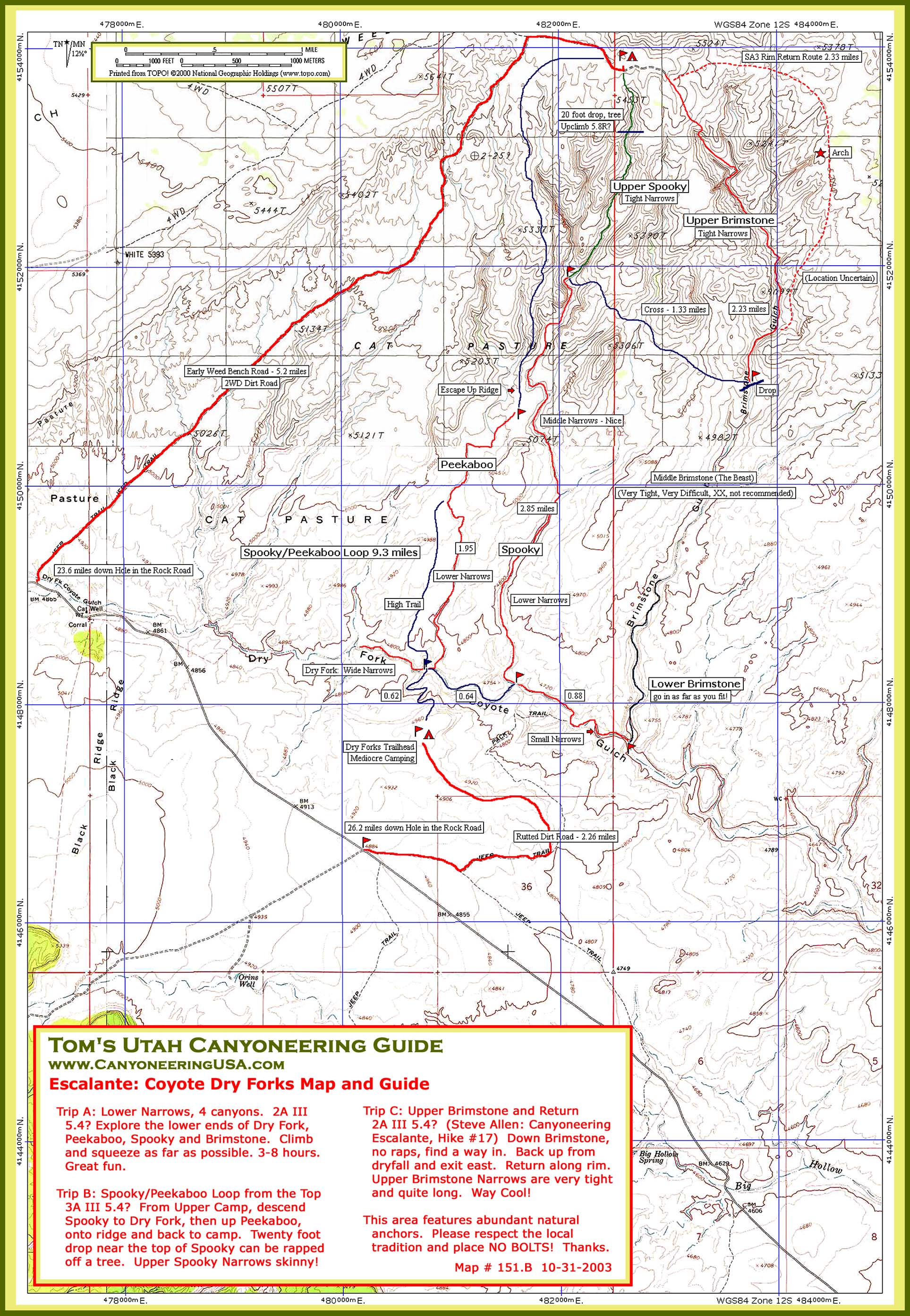
Print version
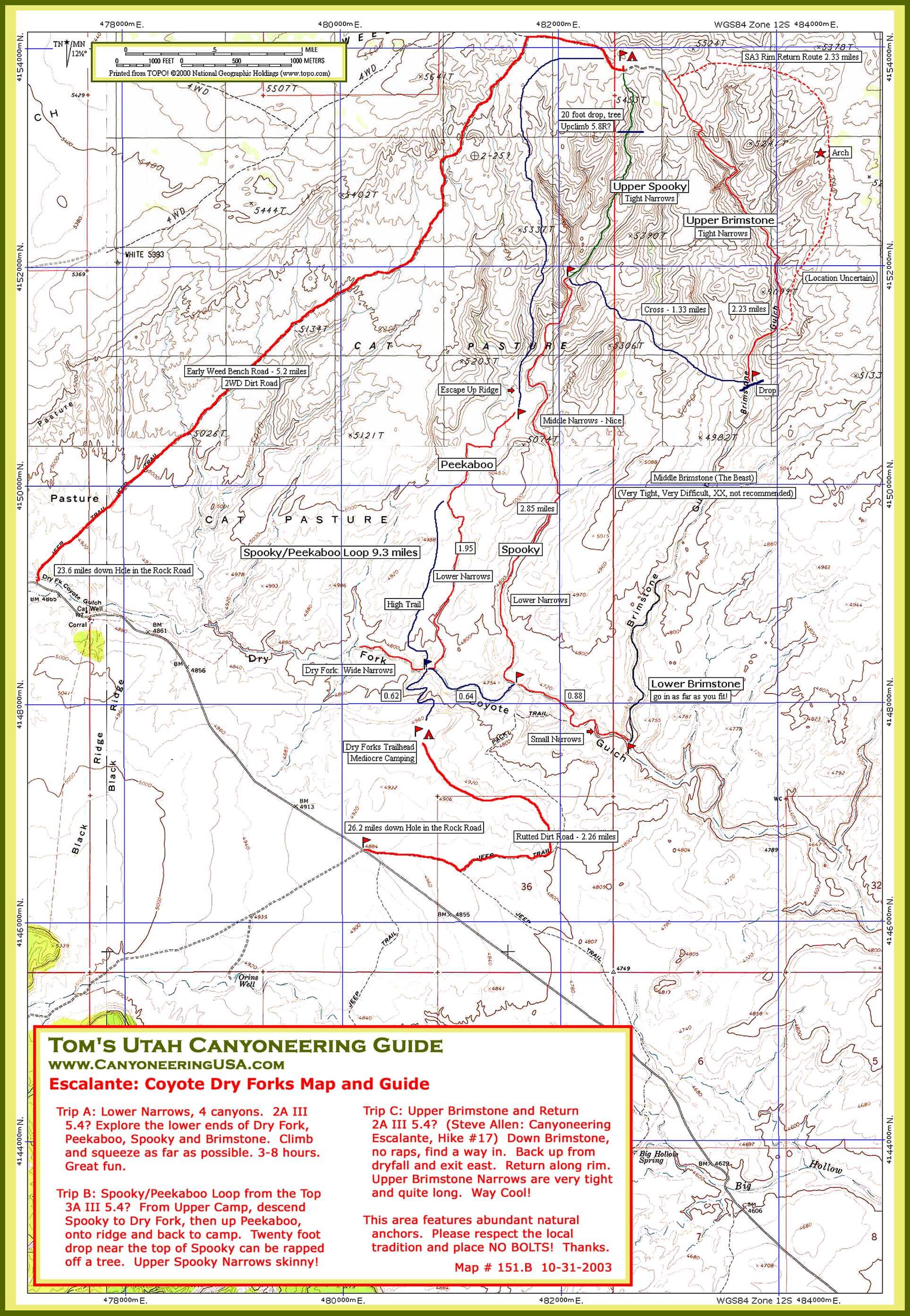
Mobile version

MOAB
- Canyonlands -
Map includes Needles District Trails.
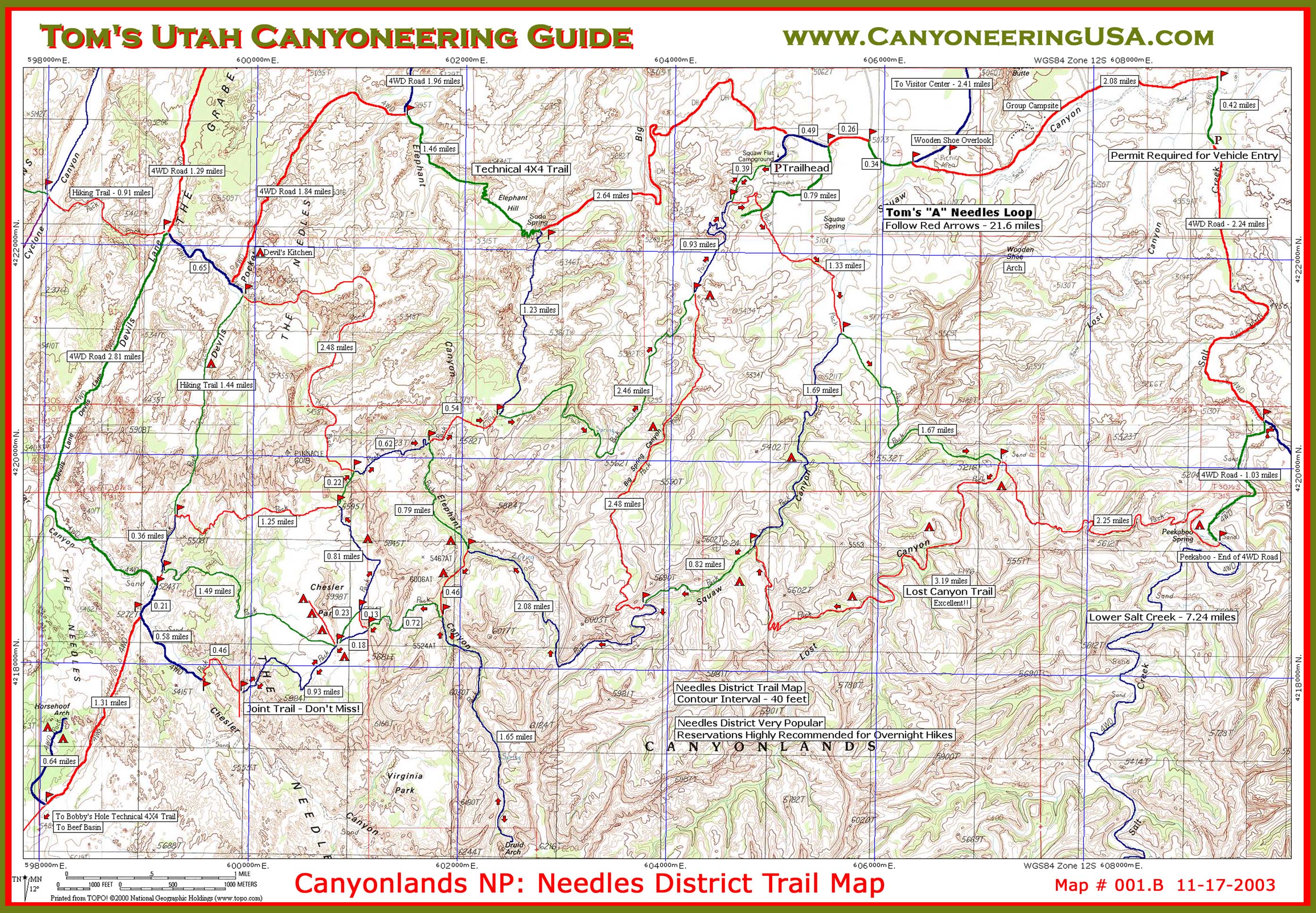
Print Version
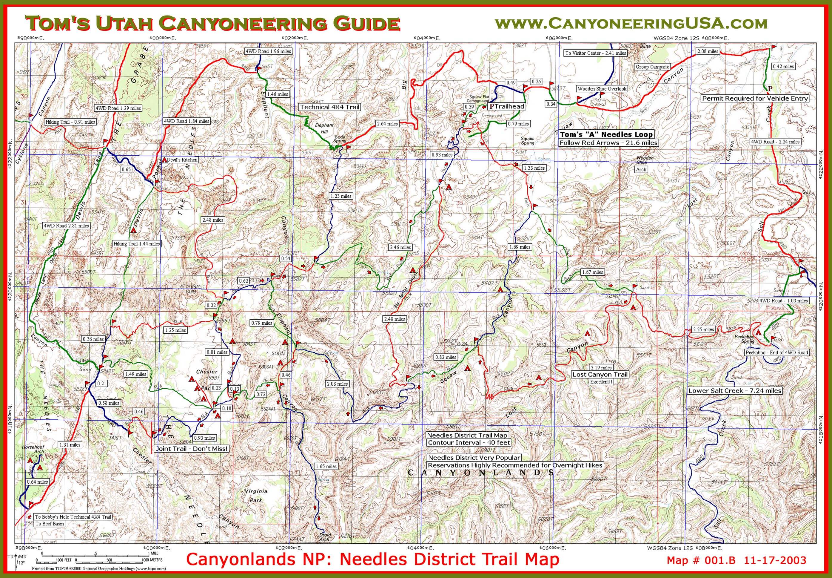
mobile version
Map includes Horseshoe Canyon hike to the famous Great Gallery.
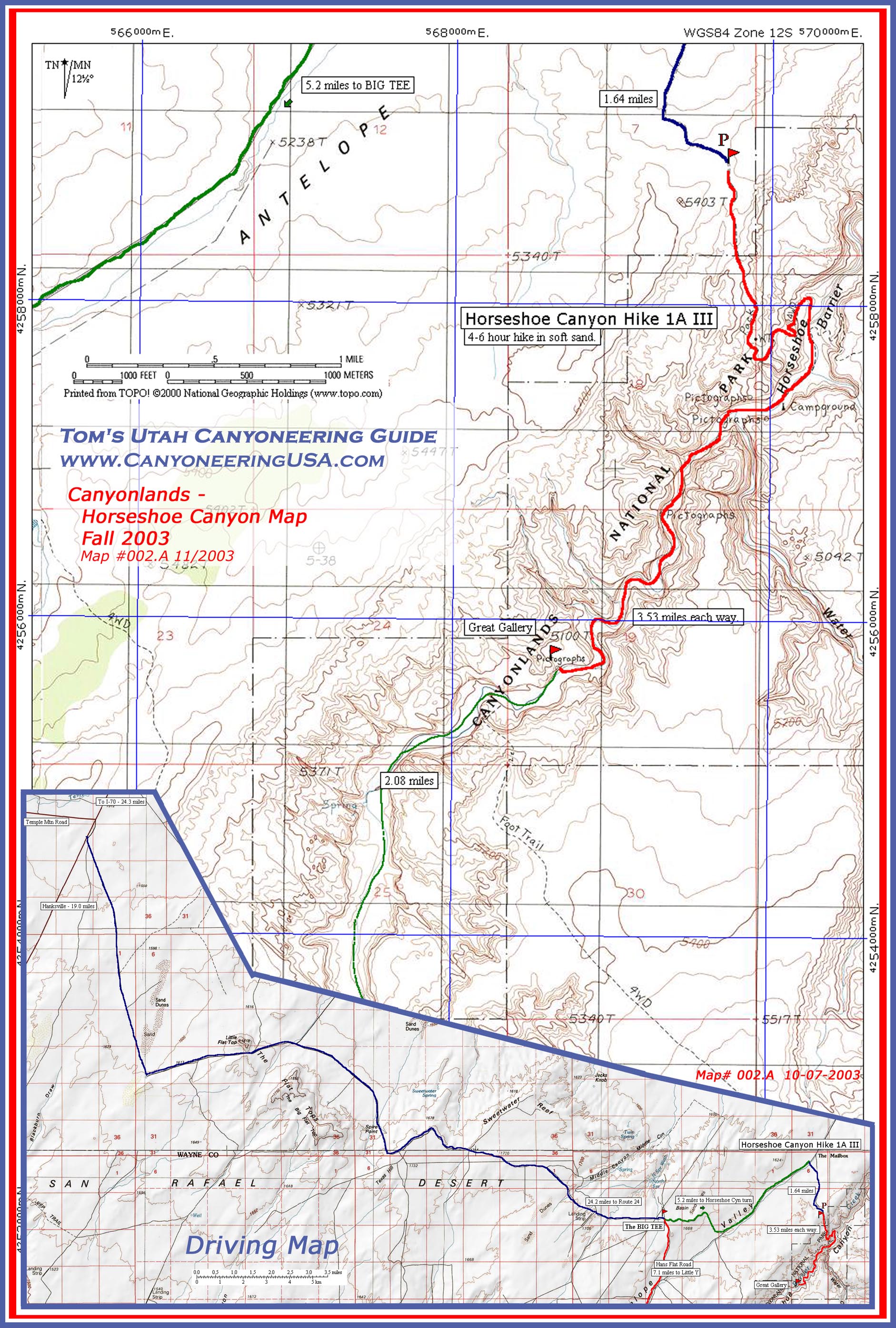
print version
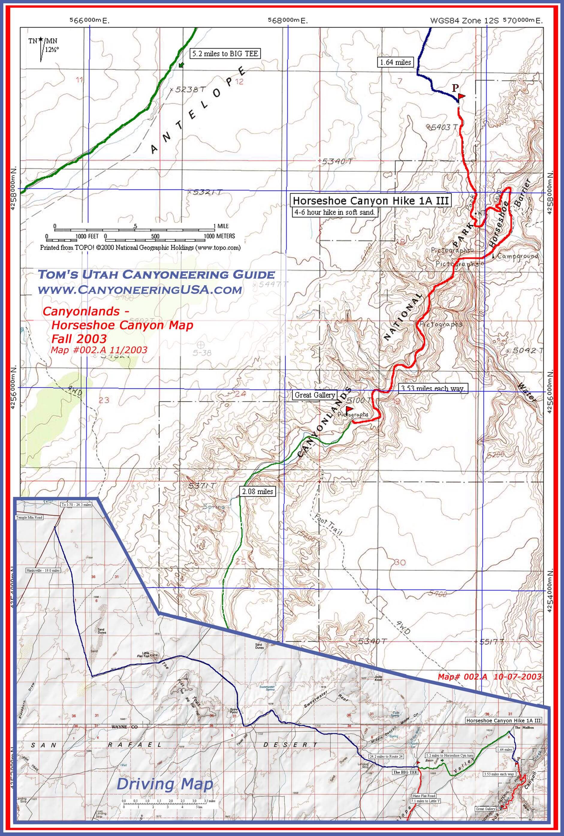
Mobile version

north wash & cedar mesa
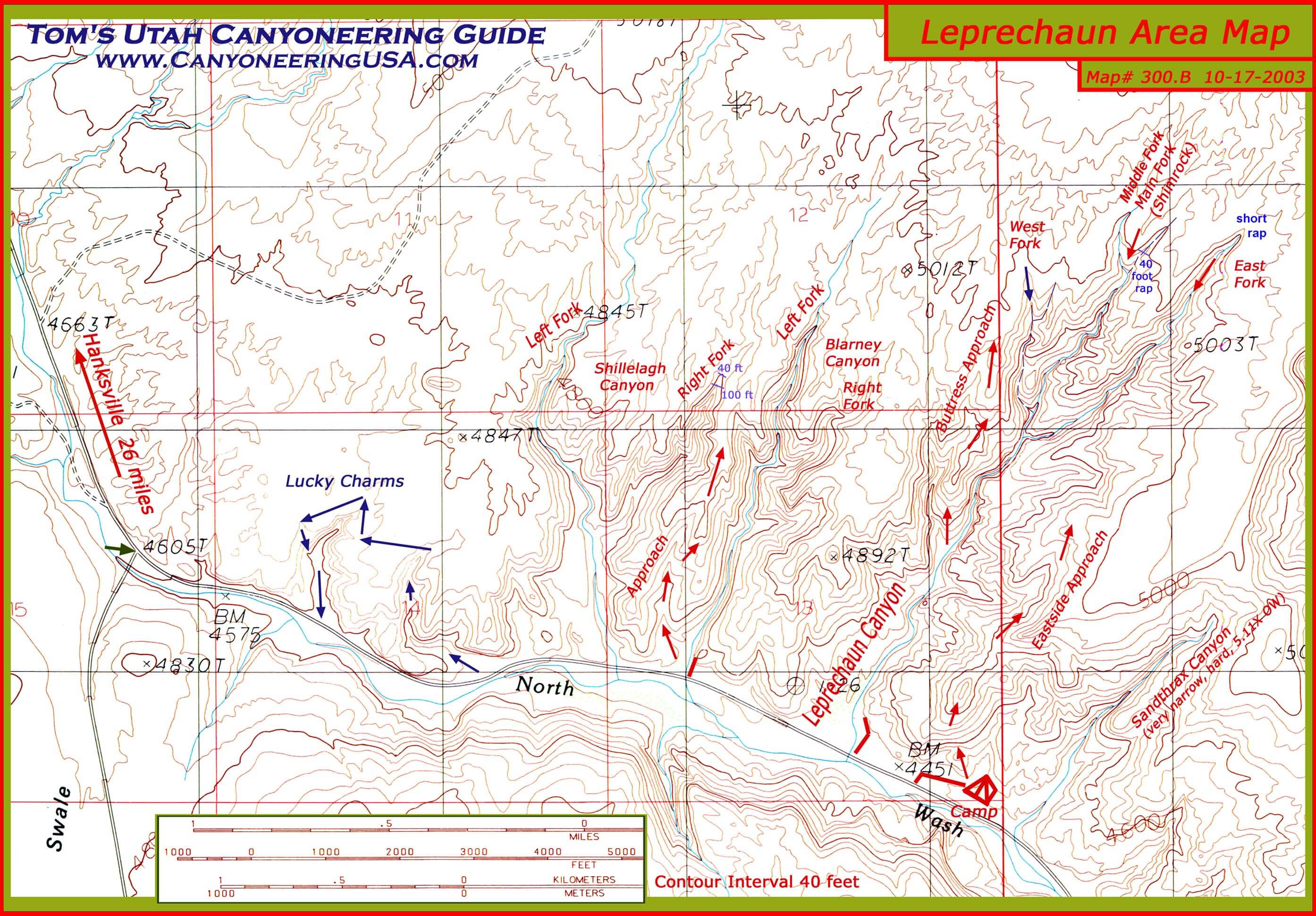
- Leprechaun area -
Map includes Shillelagh, Blarney, Leprechaun forks, and Sandthrax Canyons.
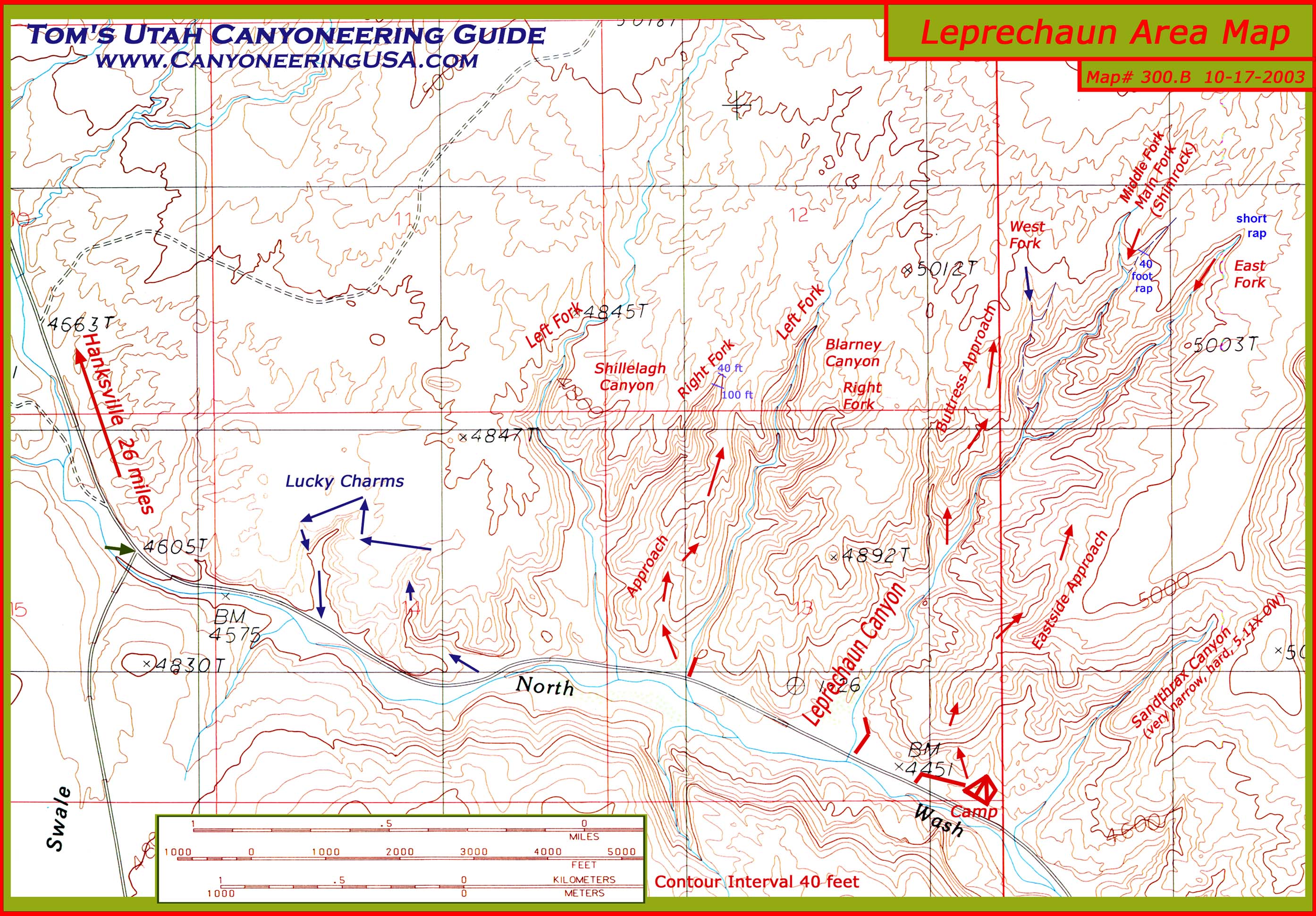
print version
mobile version
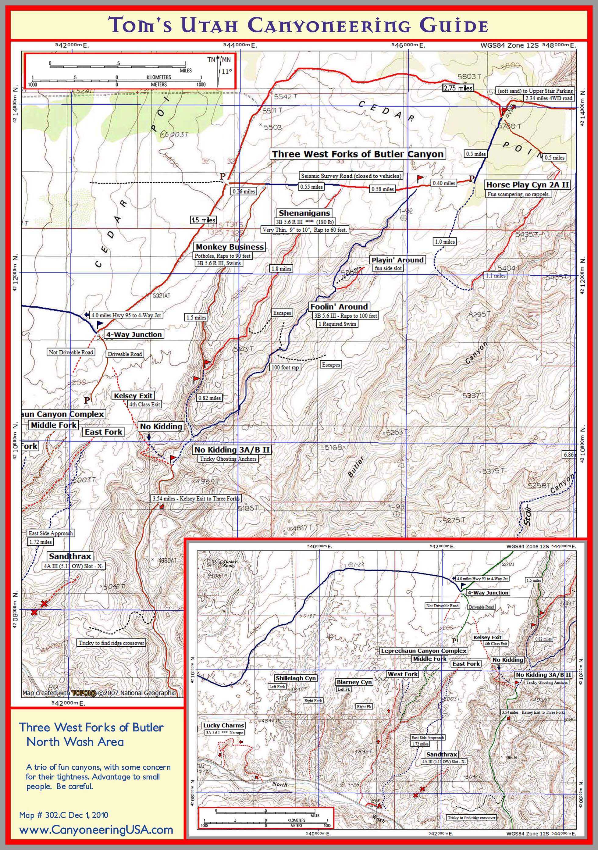
- Butler Area -
Map includes Monkey Business, Shenanigans, Fooling’ Around, No Kidding, Horse Play, and Sandthrax Canyons.

print version
mobile version
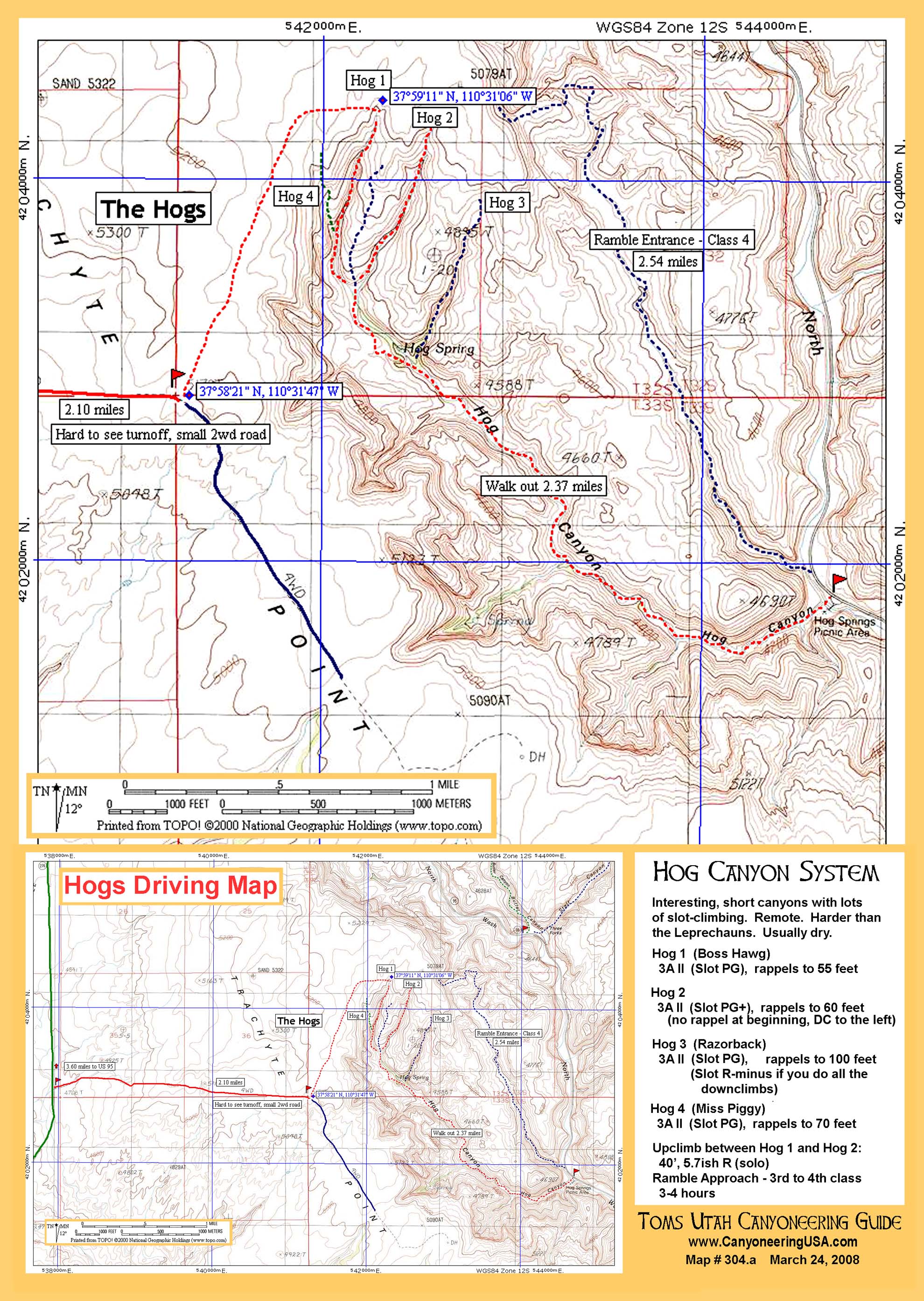
- Hog area -
Map includes Hogs 1, 2, 3, & 4.
print version

mobile version
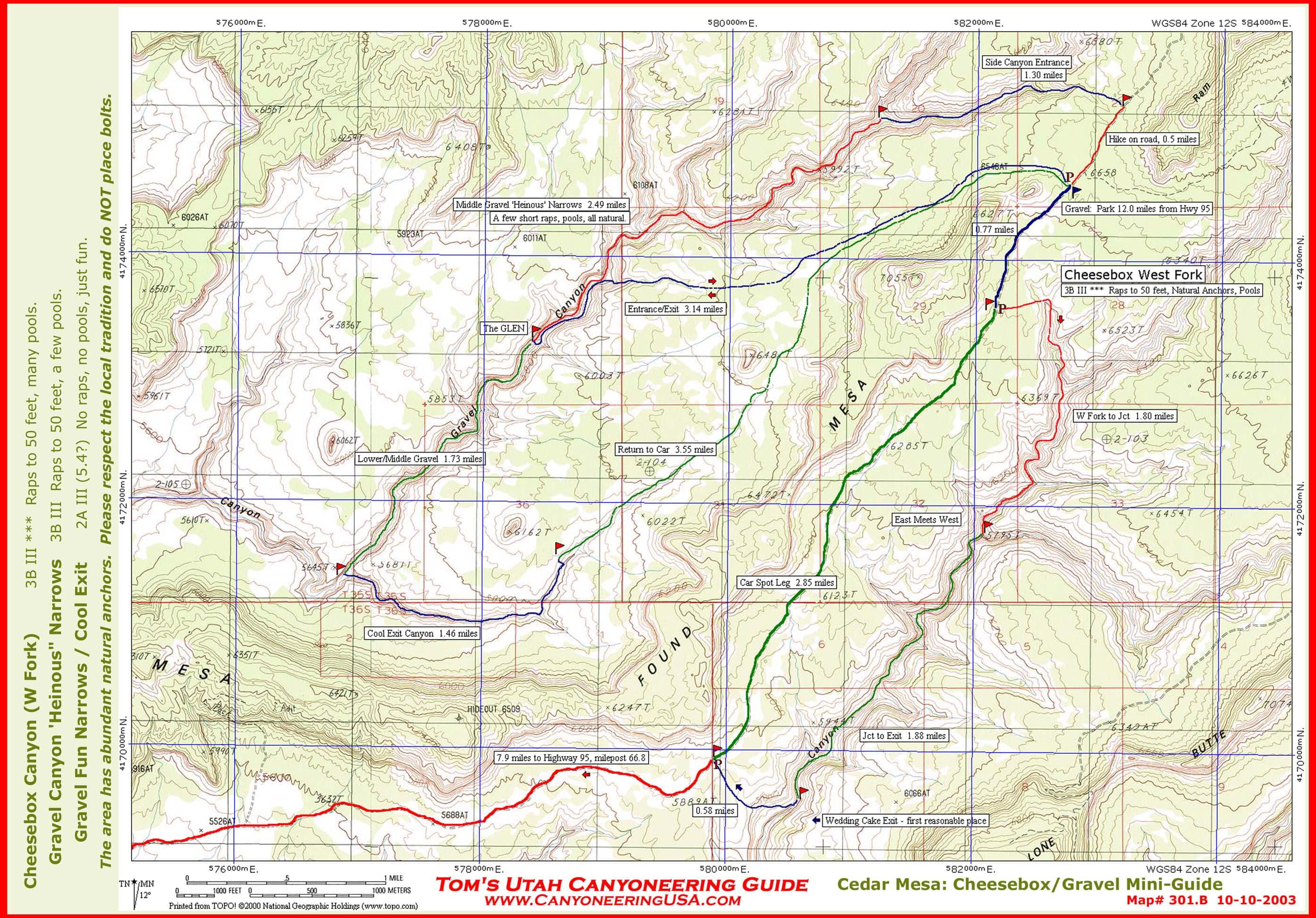
- Cedar Mesa -
Map includes Cheesebox and Gravel canyons along with Gravel Narrows.

print version
mobile version

Death Valley
- Black Mountains North -
Map includes Lower Natural Bridge, UnNatural Bridge, Abysmal, Purgatory, Erebrus, Typhon Cy forks, Bad, Hades, Helios, and Cerberus Canyons.
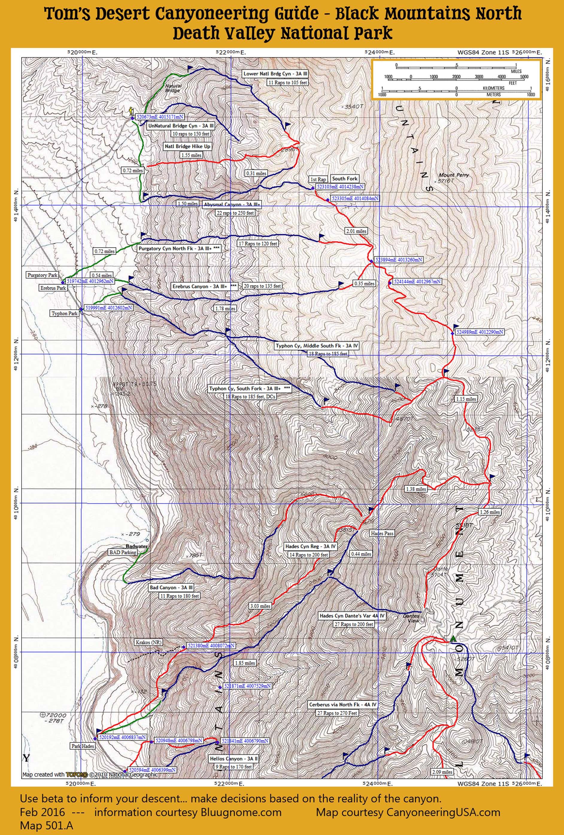
print version
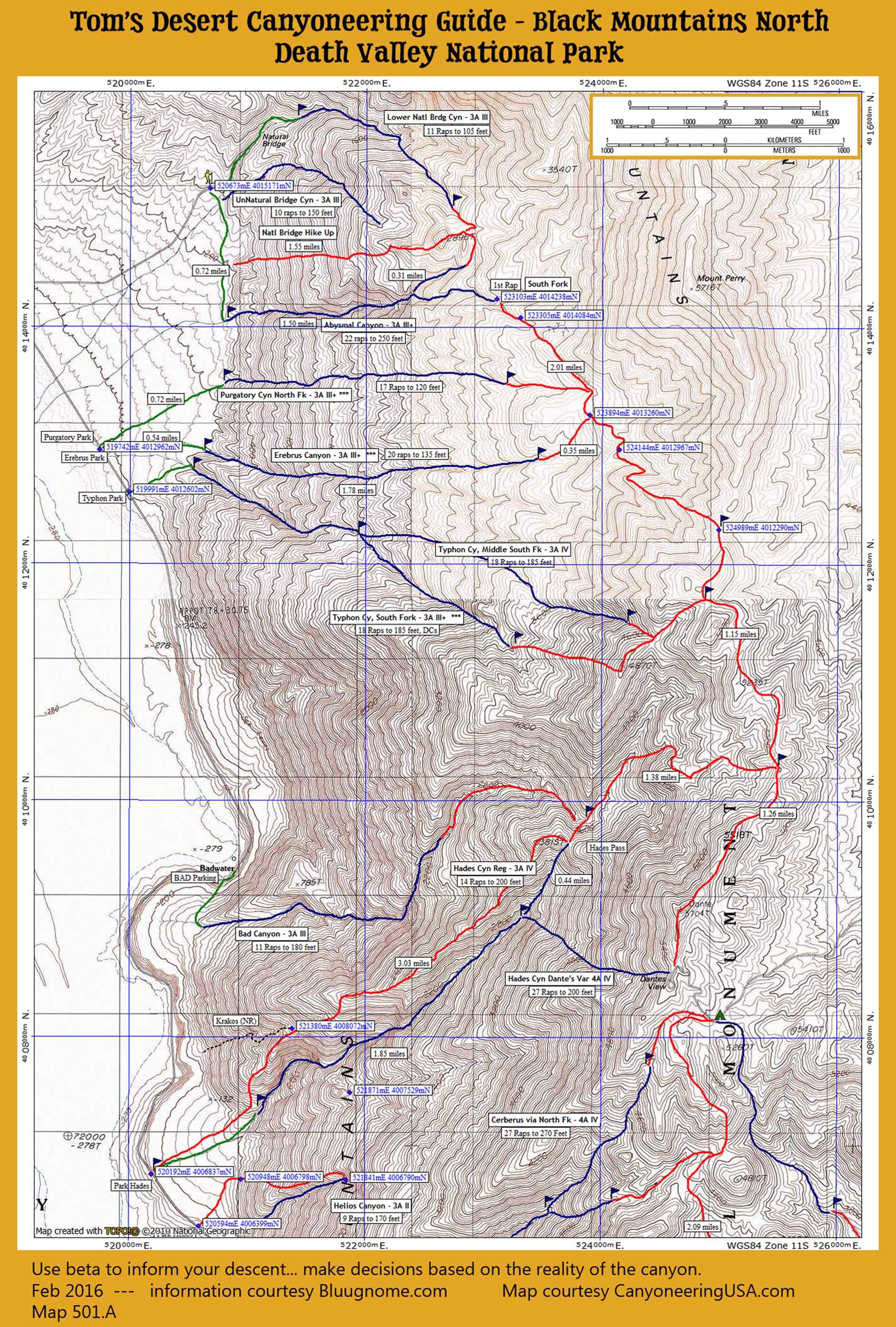
mobile version
- Black Mountains South -
Map includes Hades, Helios, Cerberus, Styx, Charon, Deimos, and Lower Coffin Canyons.

print version
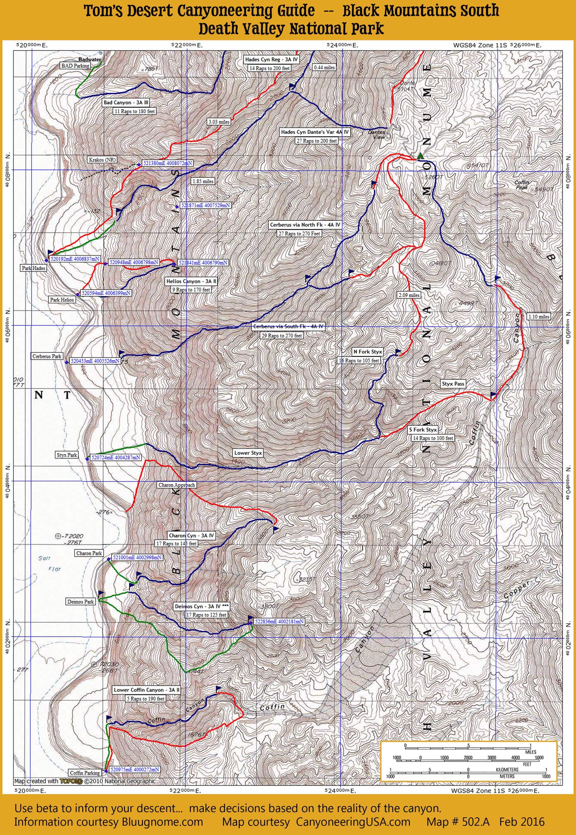
mobile version

Robbers Roost
- North Forks -
Map includes Not-Mind Bender, Mind Bender, and Ho-Hum Canyons.

print version
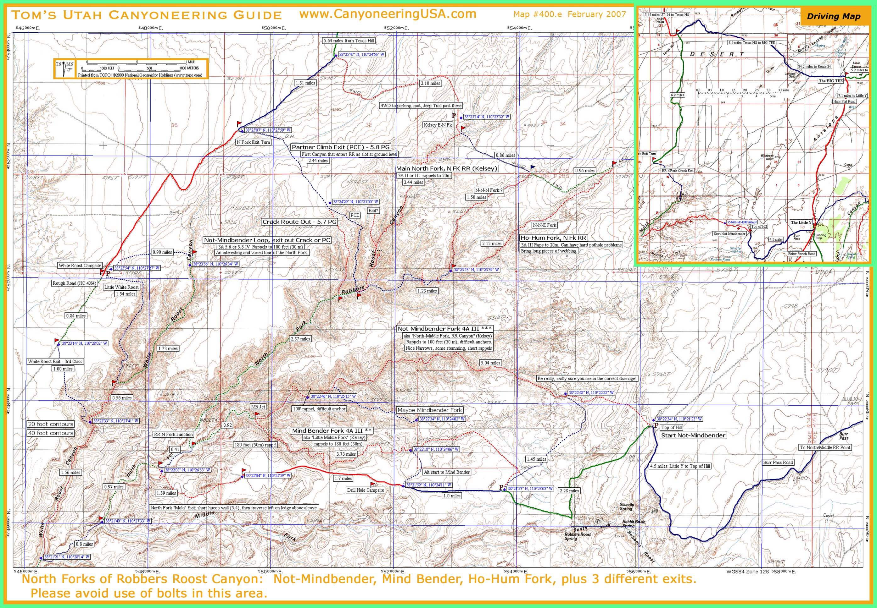
Mobile version
- TCB NORTH FORKS -
Map includes Larry and Alcatraz Canyons.
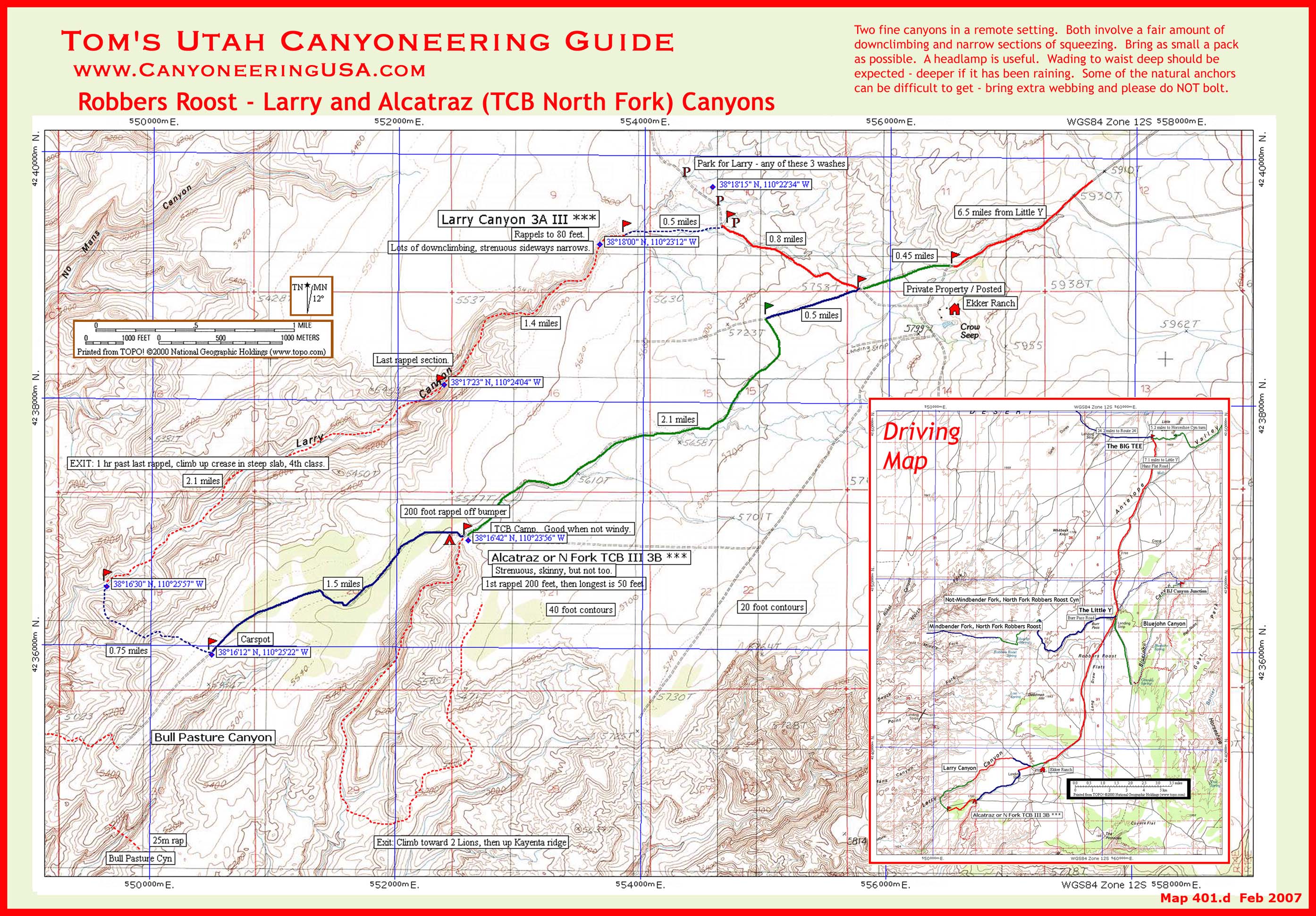
print version
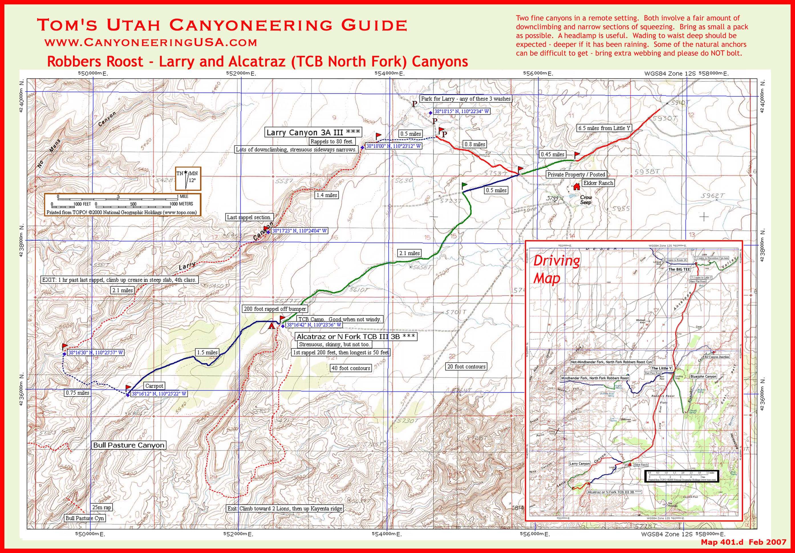
mobile version
- Bluejohn Area -
Map includes Bluejohn canyon loop with forks, Little West fork.

print version
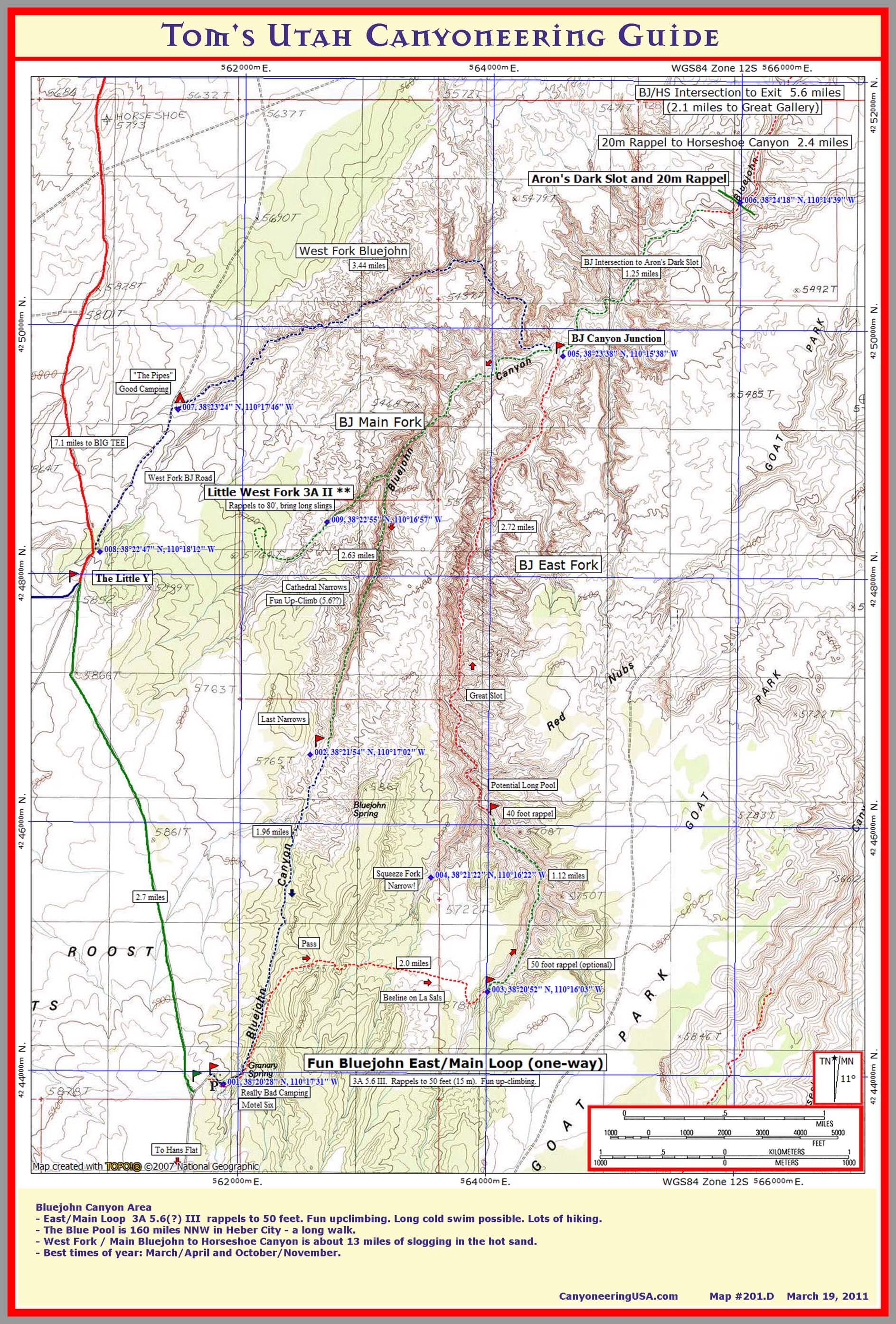
mobile version

san rafael swell
- Eardley Canyon area -
Map includes Eardley and Zero Gravity Canyons.
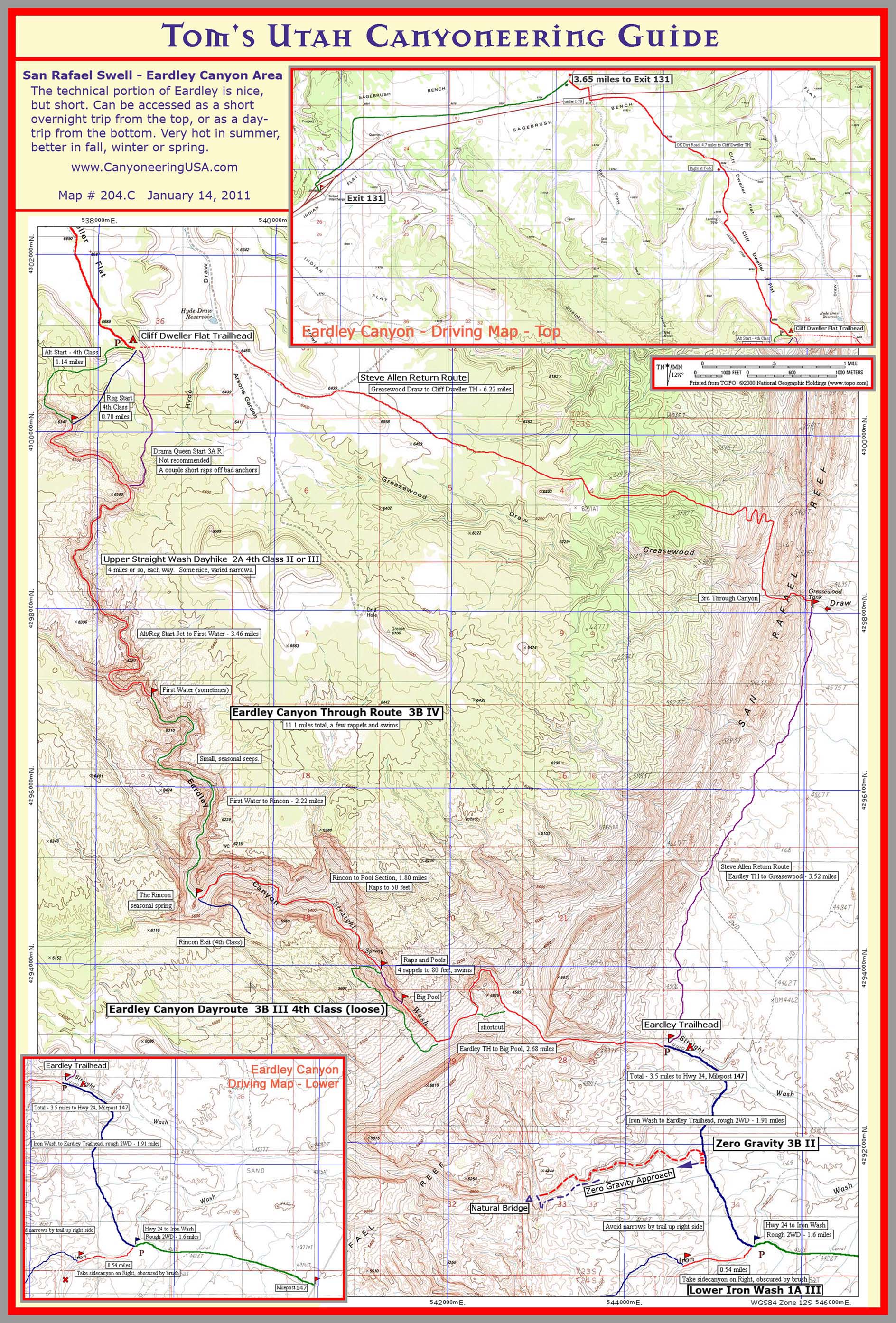
print version
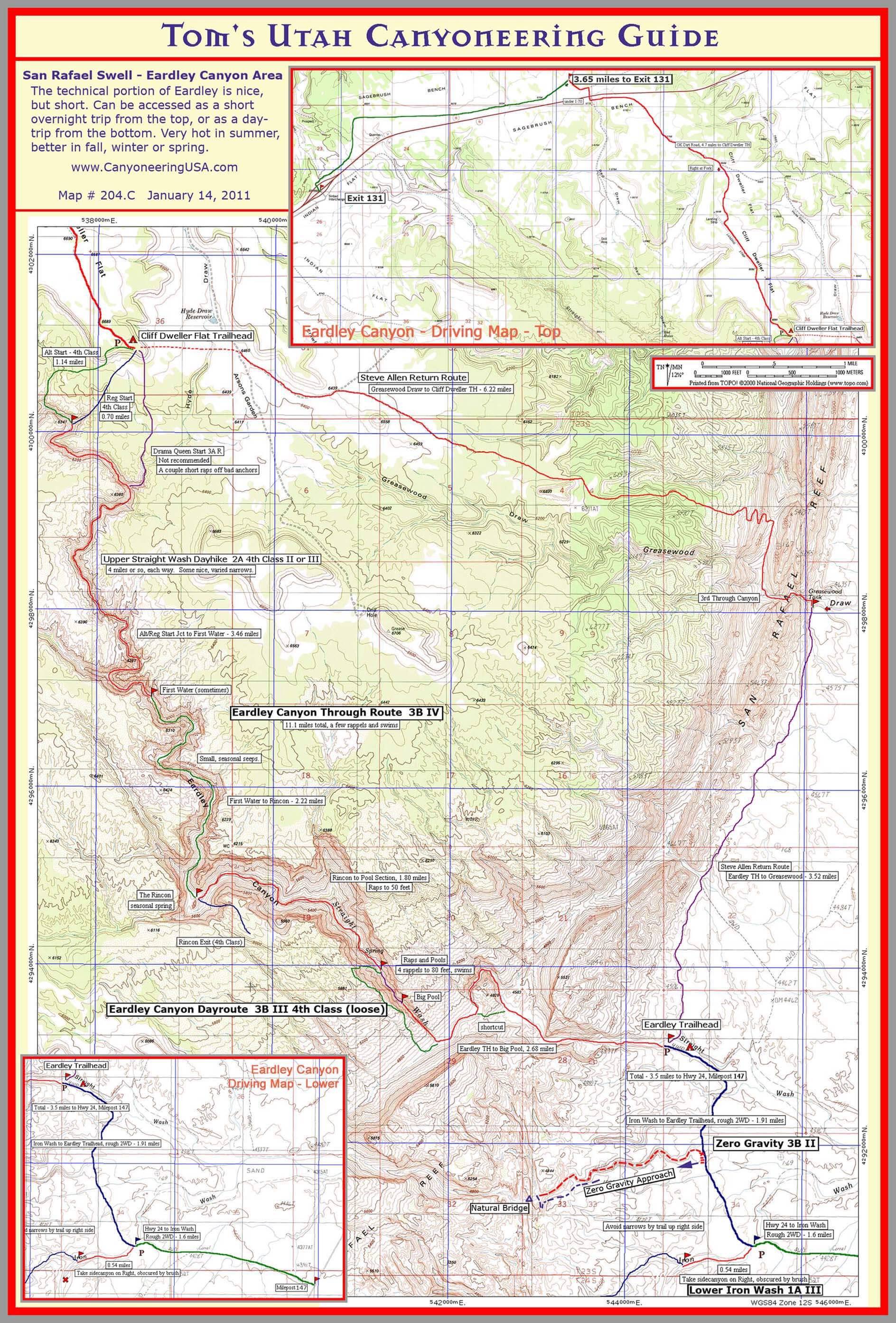
mobile version
- Southern Swell -
Map includes Music, Ramp-Cistern, Knotted Rope, Quandary, Muddy Creek, Segers Window, and Chimney Canyons.
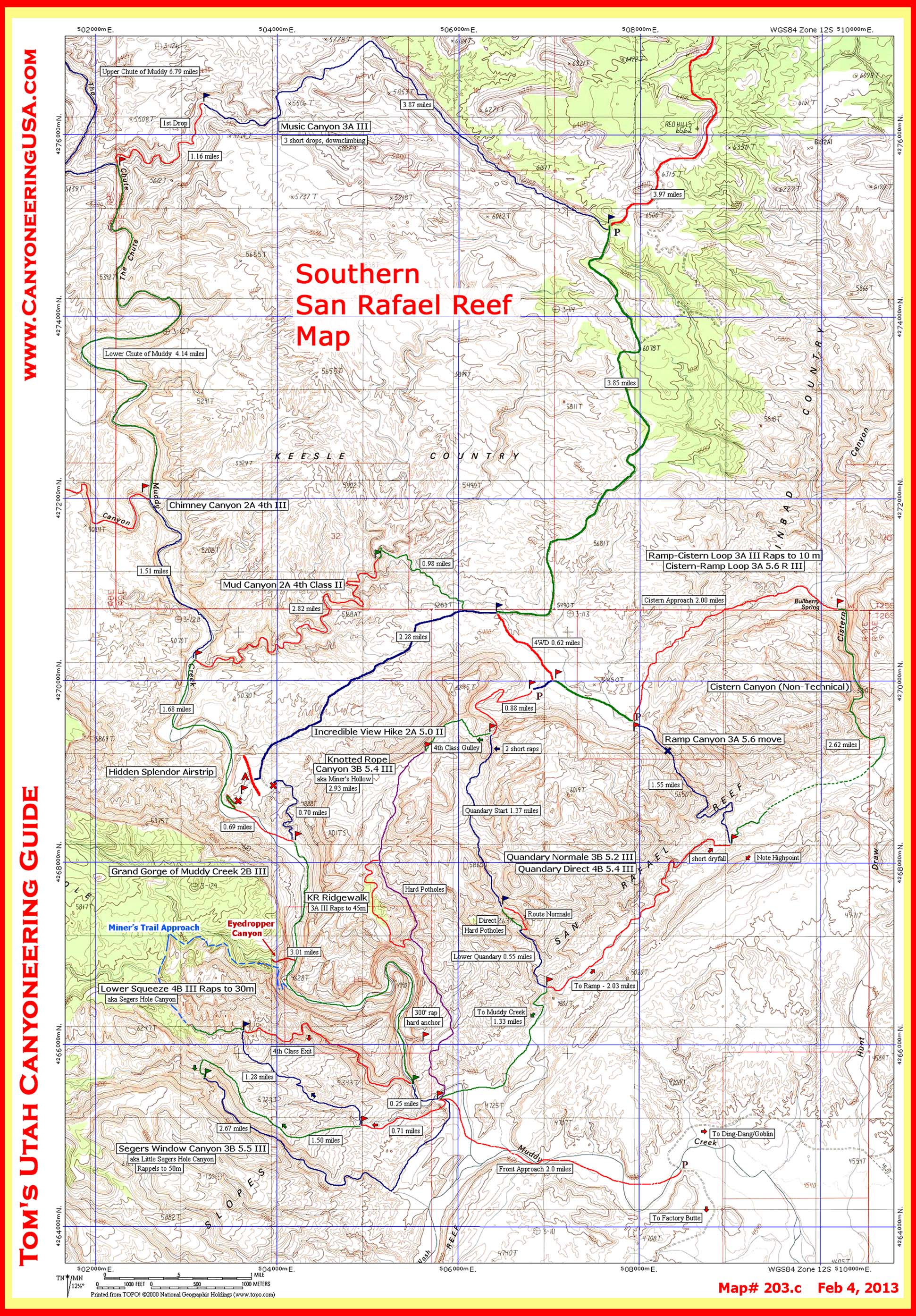
print version
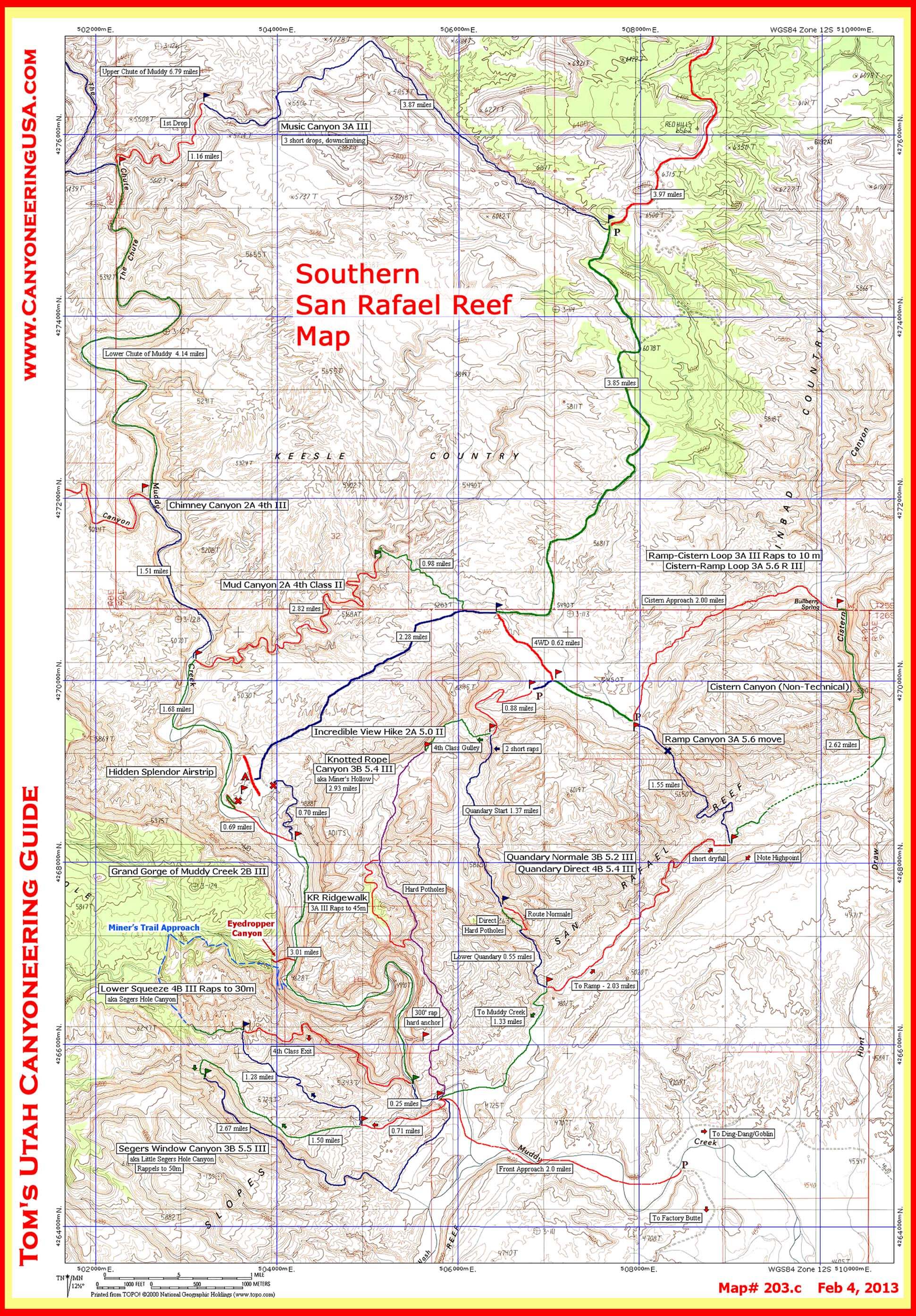
mobile version
- Eastern Swell -
Map includes Wild Horse, Crack, Chute, Little Wild Horse & Bell, and Ding & Dang Canyon.

print version
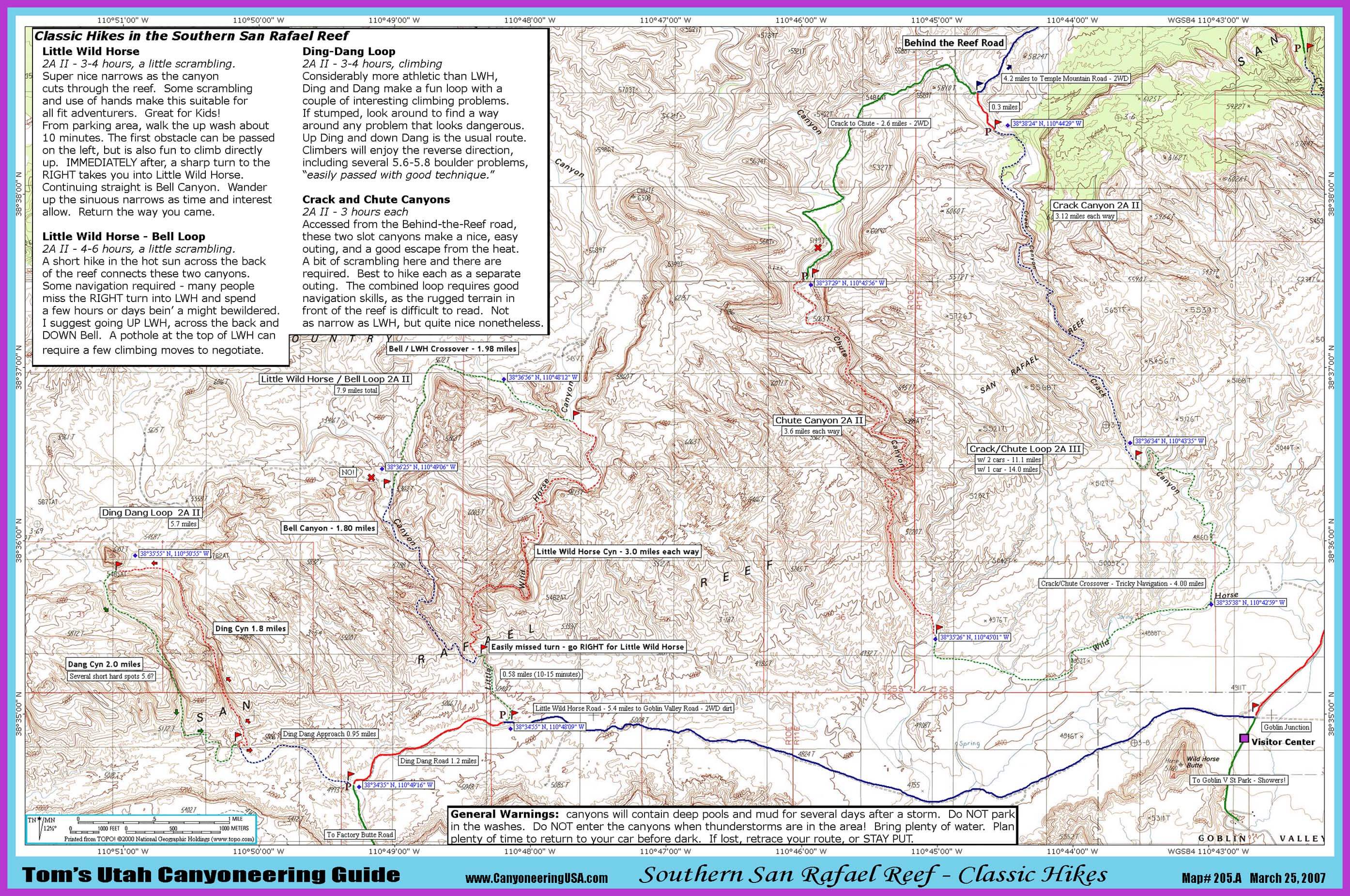
mobile version
- Forgotten & Eagle Canyon Loop -
Map includes Devils Canyon, and Forgotten & Eagle Canyon Loop.
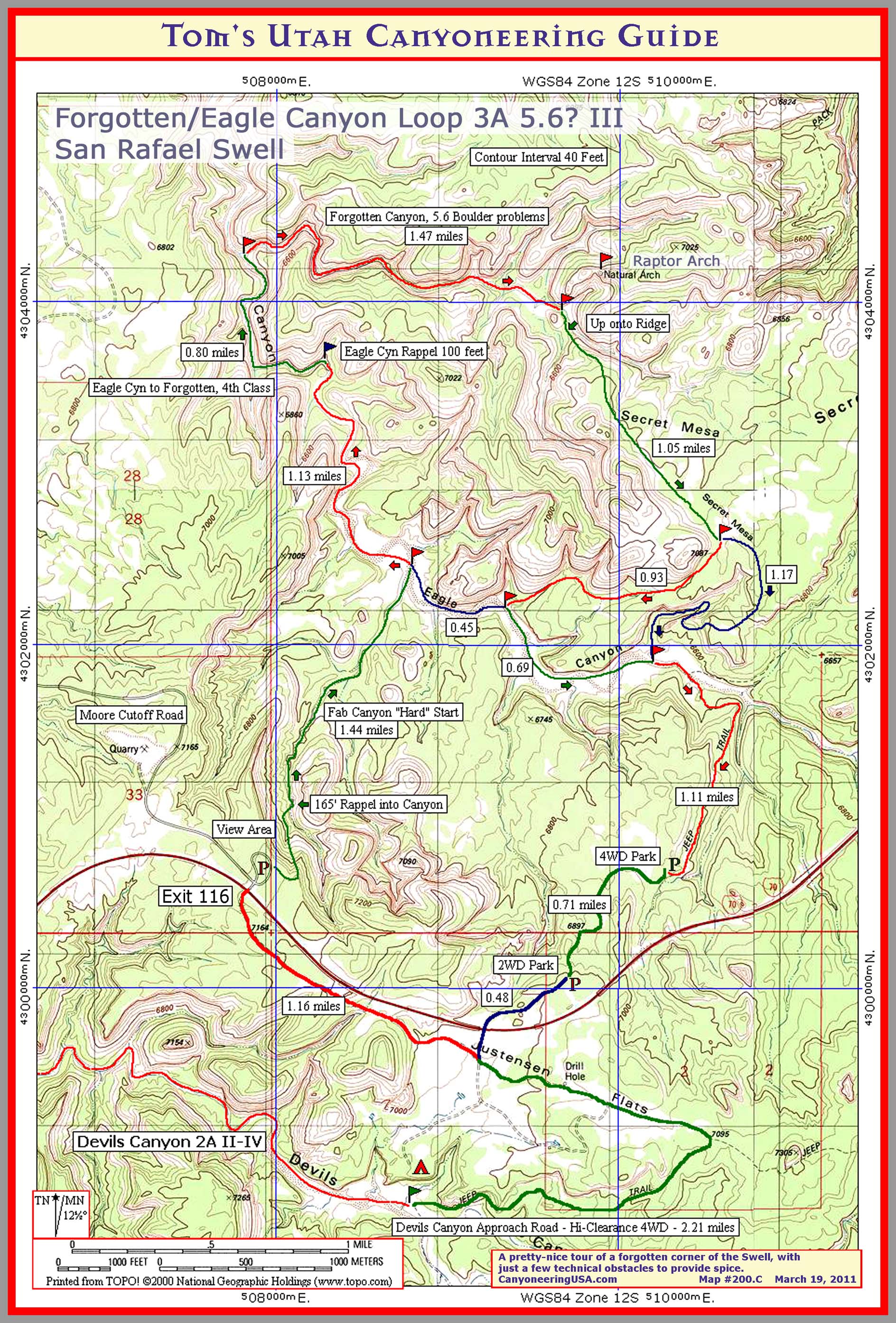
print version
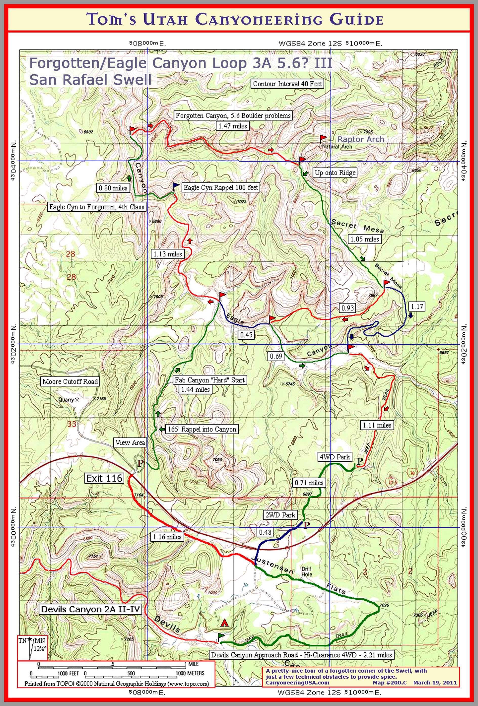
mobile version

zion
- right fork area -
Map includes Russell Gulch, Das Boot, The Subway, and the Right For Canyons.
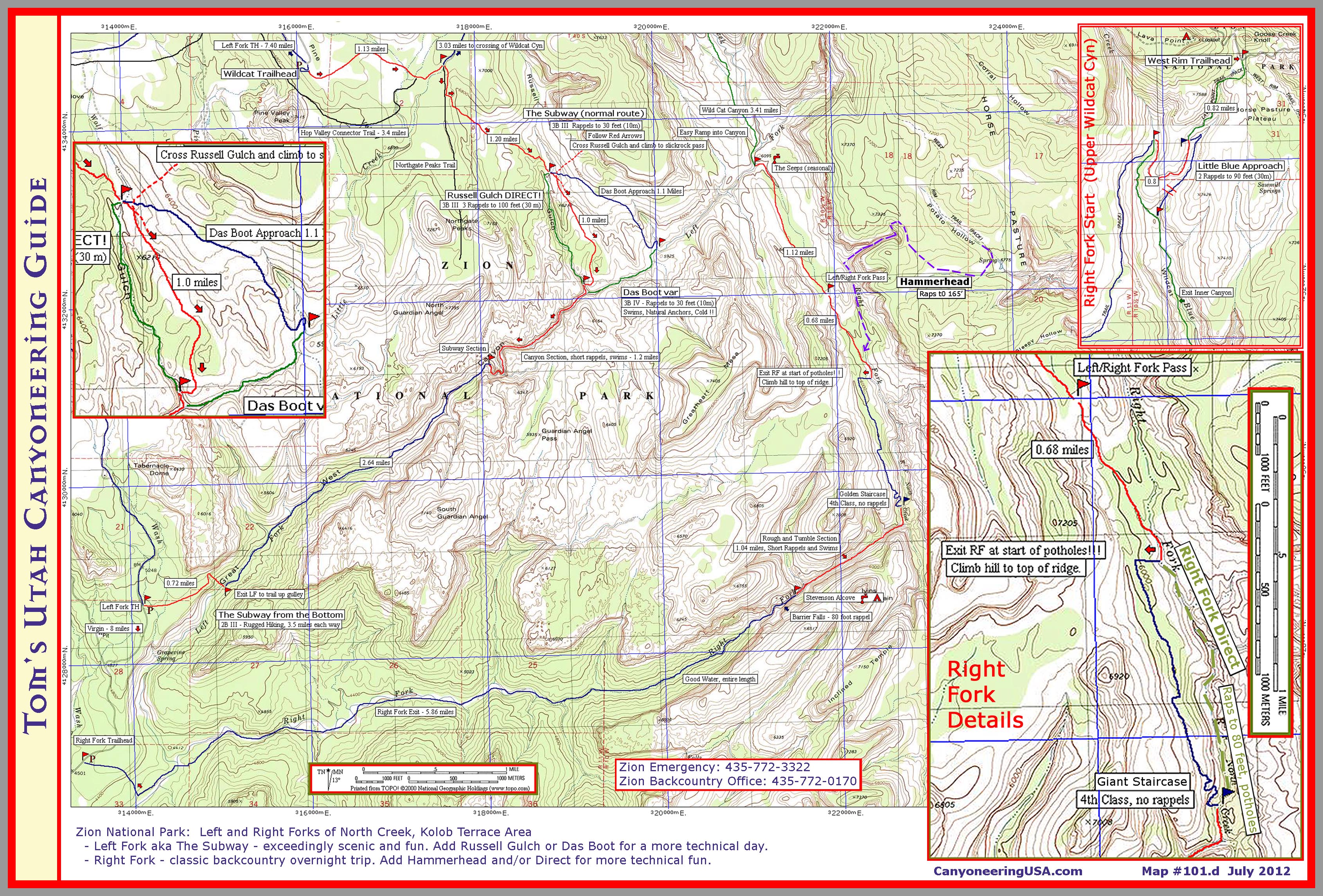
print version
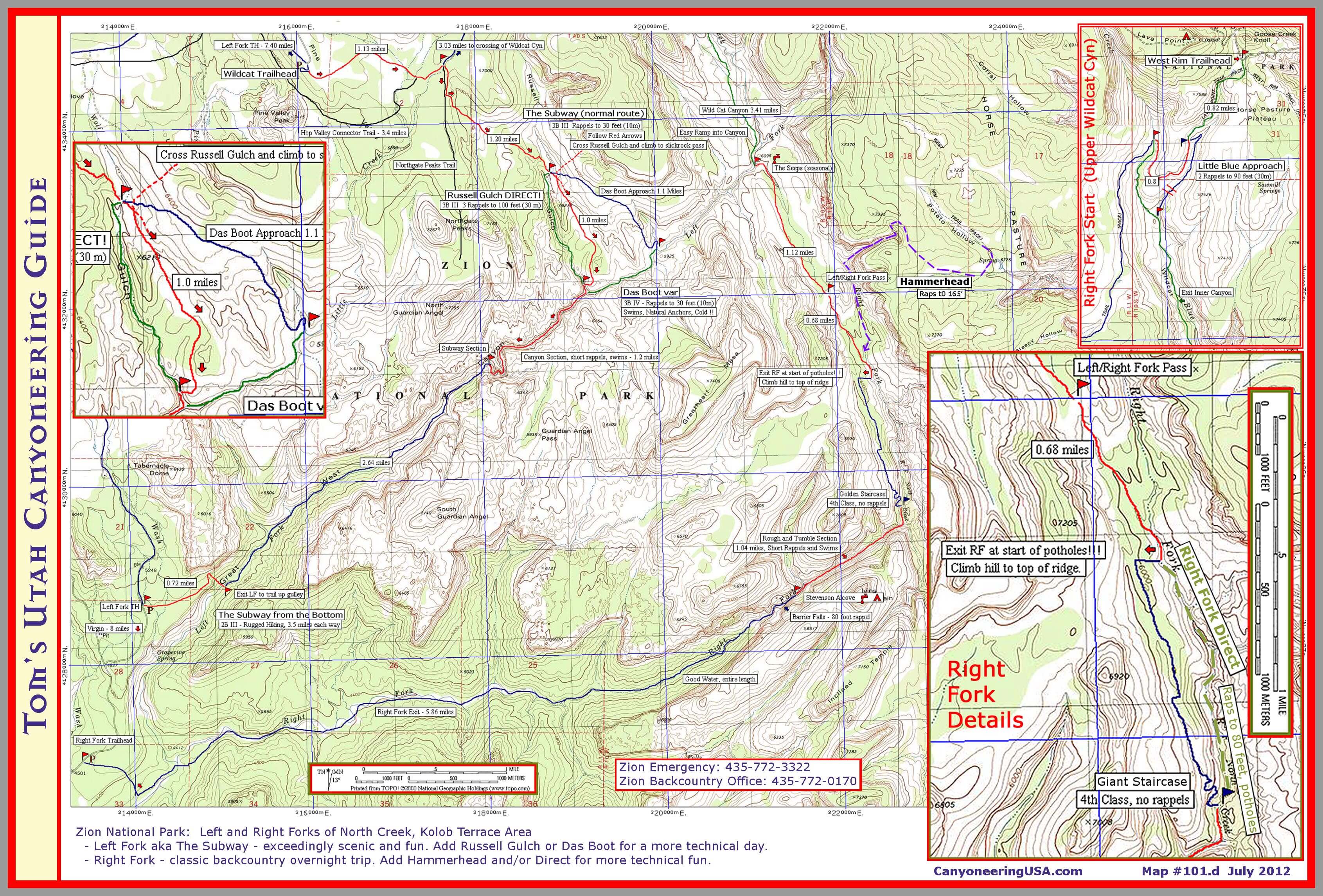
mobile version
- Narrows and orderville gulch Area -
Map includes Upper and Lower Narrows, and Orderville Gulch.

print version
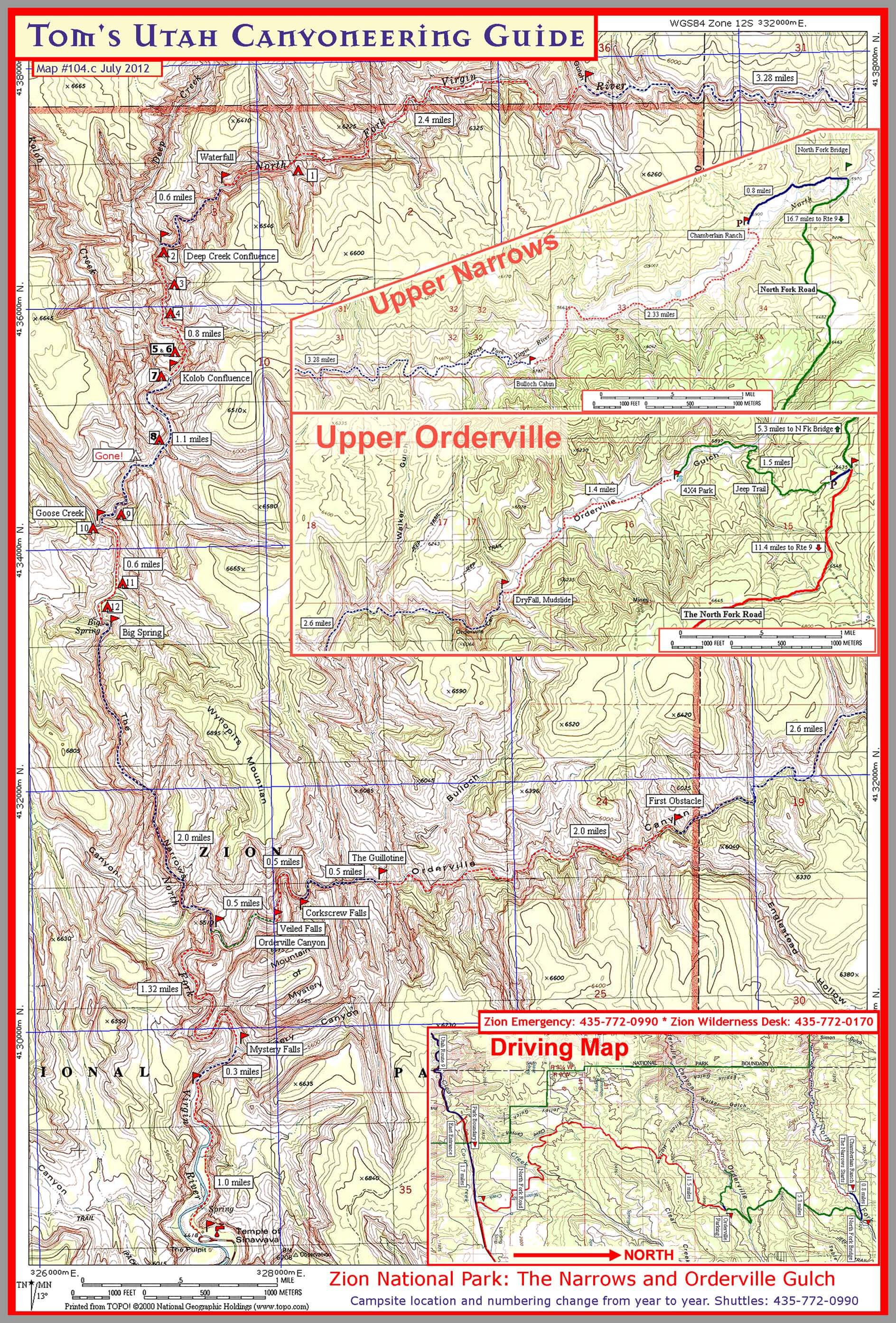
mobile version
- EAST SIDE -
Map includes Fat Mans Misery Canyon.
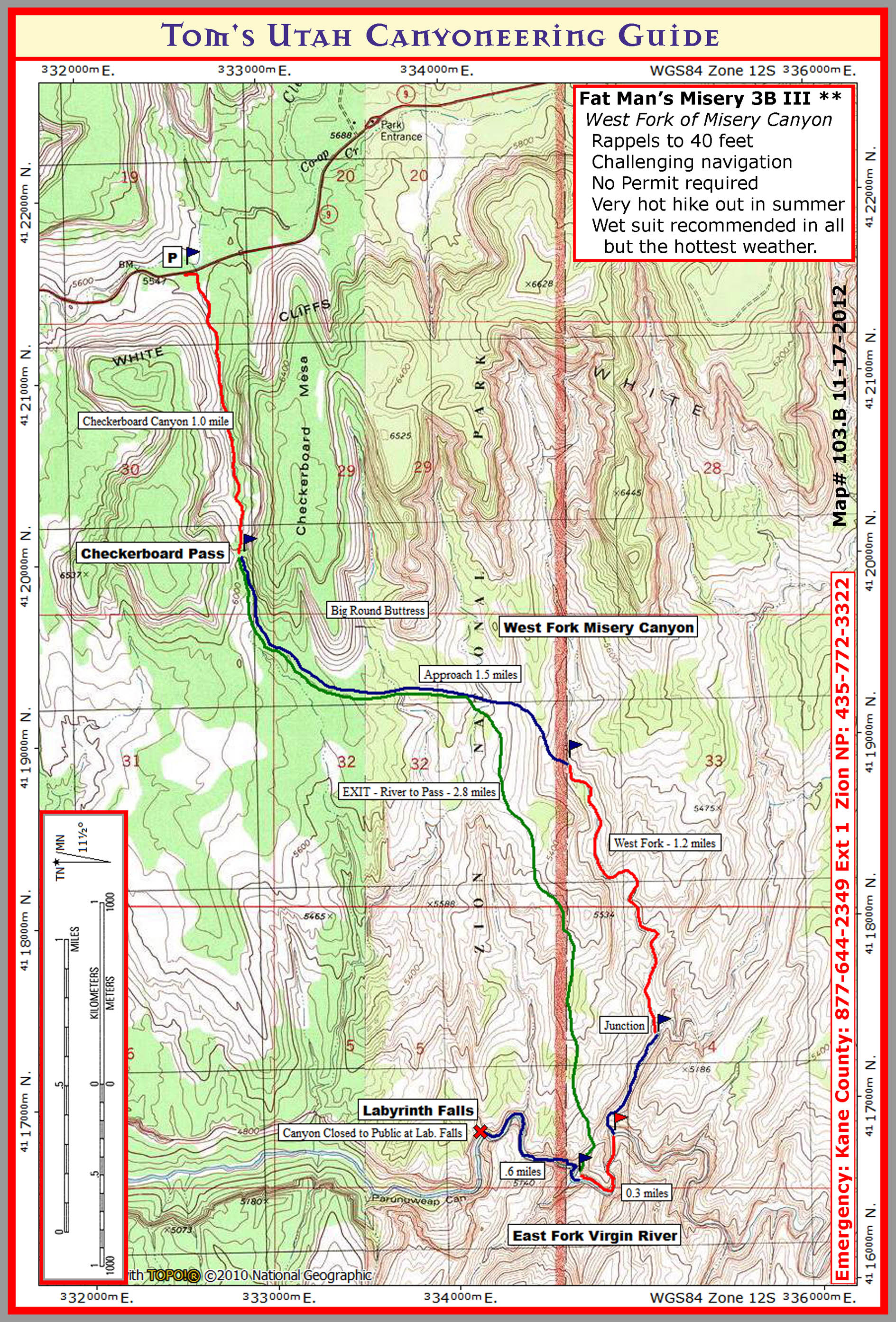
print version

mobile version
- Kolob Fingers Area -
Map includes Icebox Canyon and Kolob Canyons hikes.

print version
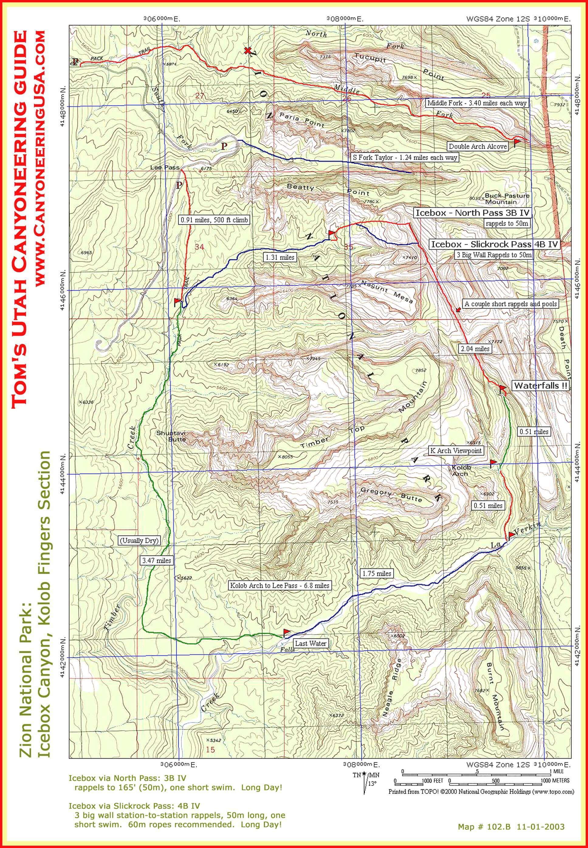
mobile version
- North Kolob Terrace Area -
Map includes Oak Creek, Kolob, Boundary, Pipe Springs Canyons, and the MIA exit.

print version
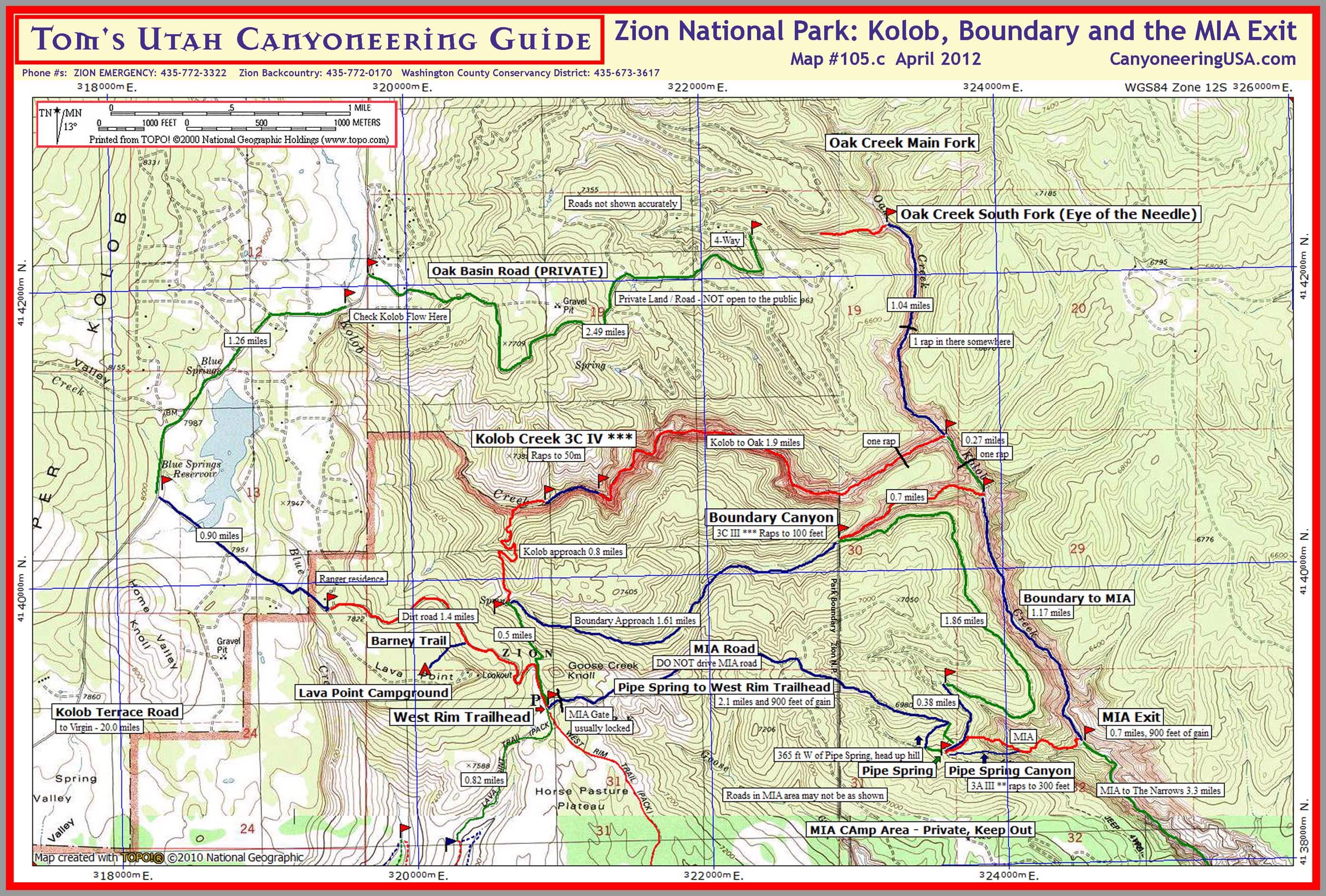
mobile version
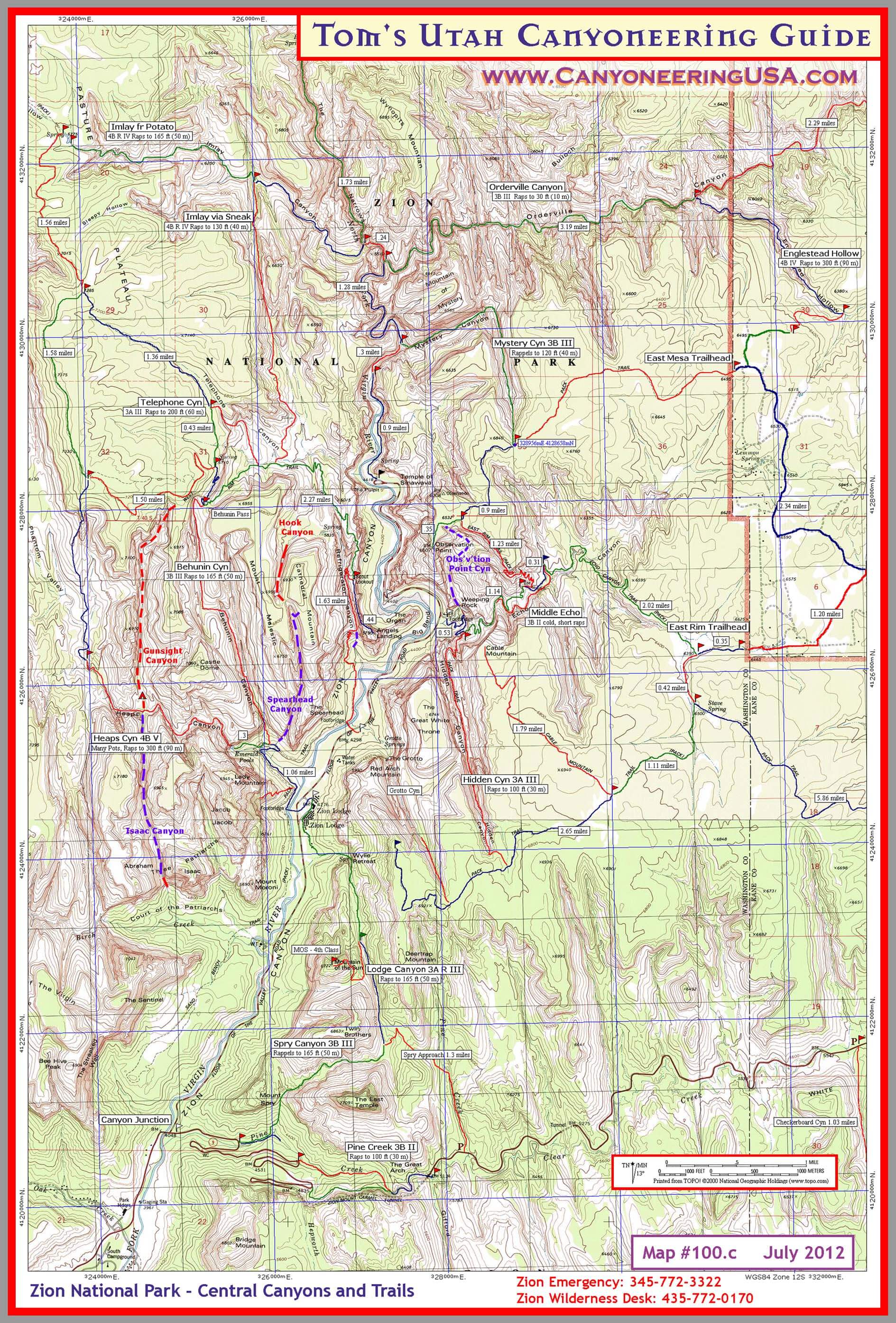
- Central Zion -
Map includes Full Imlay, Telephone, Behunin, Heaps, Hook, Spearhead, Lower Fridge, Orderville, Englestead, Mystery, Echo, Observation Point, Hidden, Lodge, Pine Creek, and Spry Canyons.
mobile version
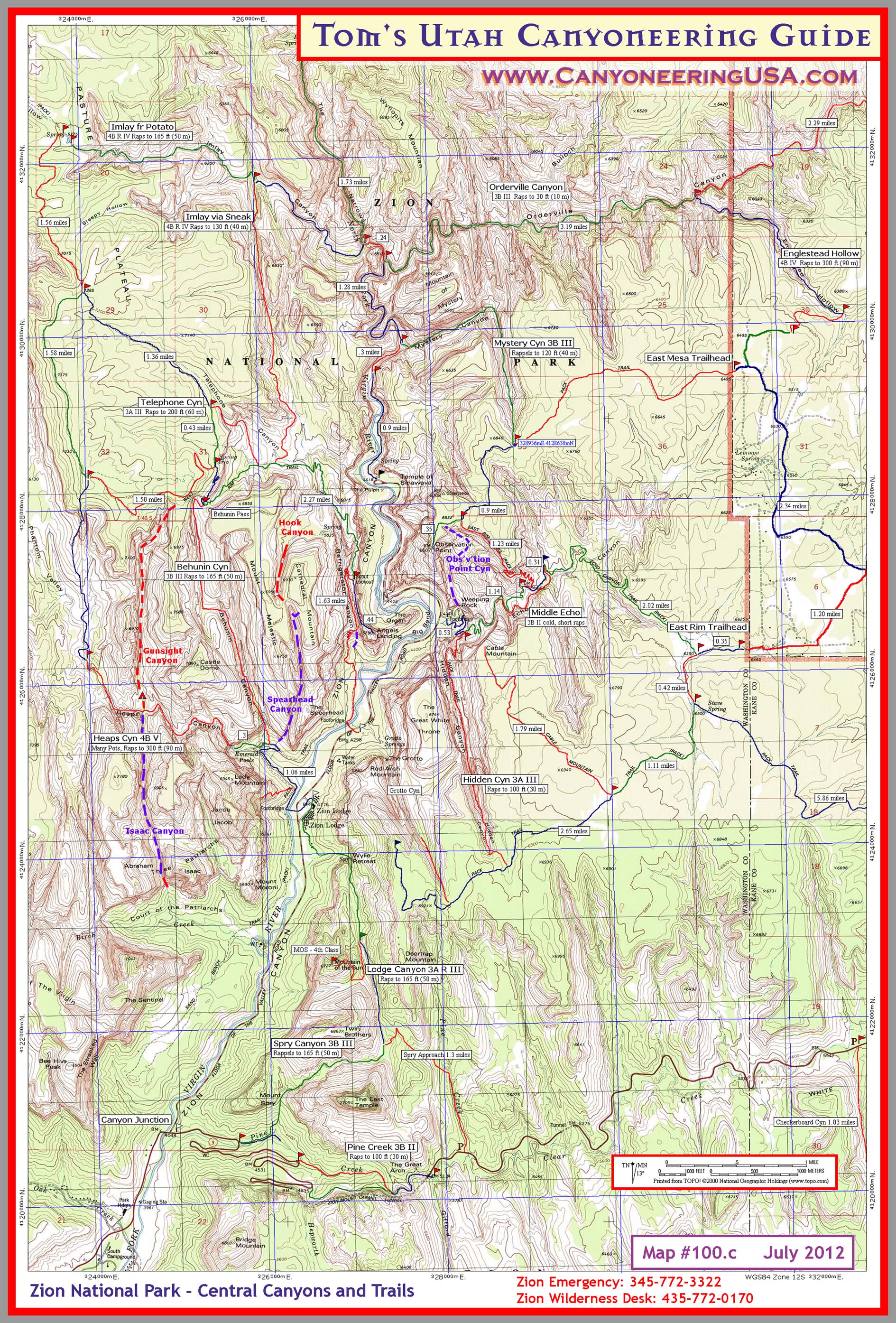
print version