A NICE LITTLE SLOT.
High on the West Rim, the technical part of Telephone makes a pretty good canyon by itself or can be combined with Behunin (Telephunin) for a longer day. The long approach hike, many rappels and a bit of downclimbing make it a good outing for experienced canyoneers in small groups. The canyon faces southeast and is well-shaded by the steep wall on the south side, so it is mostly shady in summer and can retain snow well into June. It has no water-holding capacity, so a wetsuit is never required.
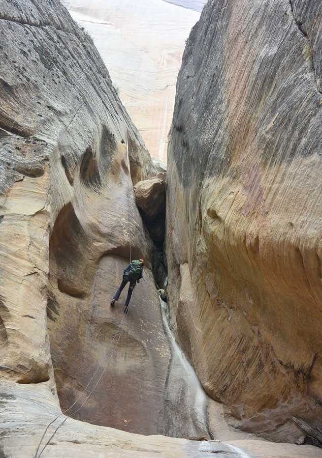
Telephone Canyon starts out as a drainage atop the West Rim then drops steeply to a bench level 1000 feet lower. From there, it wanders across the bench with some slotting then drops suddenly into the Narrows in a dramatic, 600 foot cliff. This technical route is the first bit - 1000 feet from the West Rim to the bench. Being at the top of the Navajo Sandstone, the drainage above runs with dissolved limestone which gets deposited on the rock in the canyon, making many of the downclimbs slippery. Exercise caution.
Telephone Canyon is named for the telephone line that used to run from Cabin Spring (West Rim Spring) to the Temple of Sinawava near this canyon.
GPS:
WGS84 12S: Head of Canyon: 325548 mE 4129167mN


Canyon Profile
Logistics

RATINGS
3A III ★★★☆☆

TIME REQUIRED
6 to 10 hours

PERMIT
YES

SEASON
Spring, summer, or fall

LONGEST RAPPEL
155 feet (48 m)

SKILLS REQUIRED
General rappelling and downclimbing skills.
Equipment

ESSENTIALS
Helmets, rappelling gear, webbing and rapid links.

COLD WATER PROTECTION
None. Canyon does not normally hold water.

DRINKING WATER
Bring plenty for the day.

FLASH FLOOD RISK
Moderate – There are only a few sections of sustained narrows. The collection zone above is fairly small.

ACCESS
Begins and ends at Grotto Trailhead.
Typical Time Schedule
0:00: Start at Grotto Trailhead
1:00: Top of Scout Lookout
2:30: Behunin Pass
3:30: Head of Telephone Canyon, First Rappel
7:00: Last Rappel
9:00: Back at Grotto Trailhead
SEASONAL COMMENTS
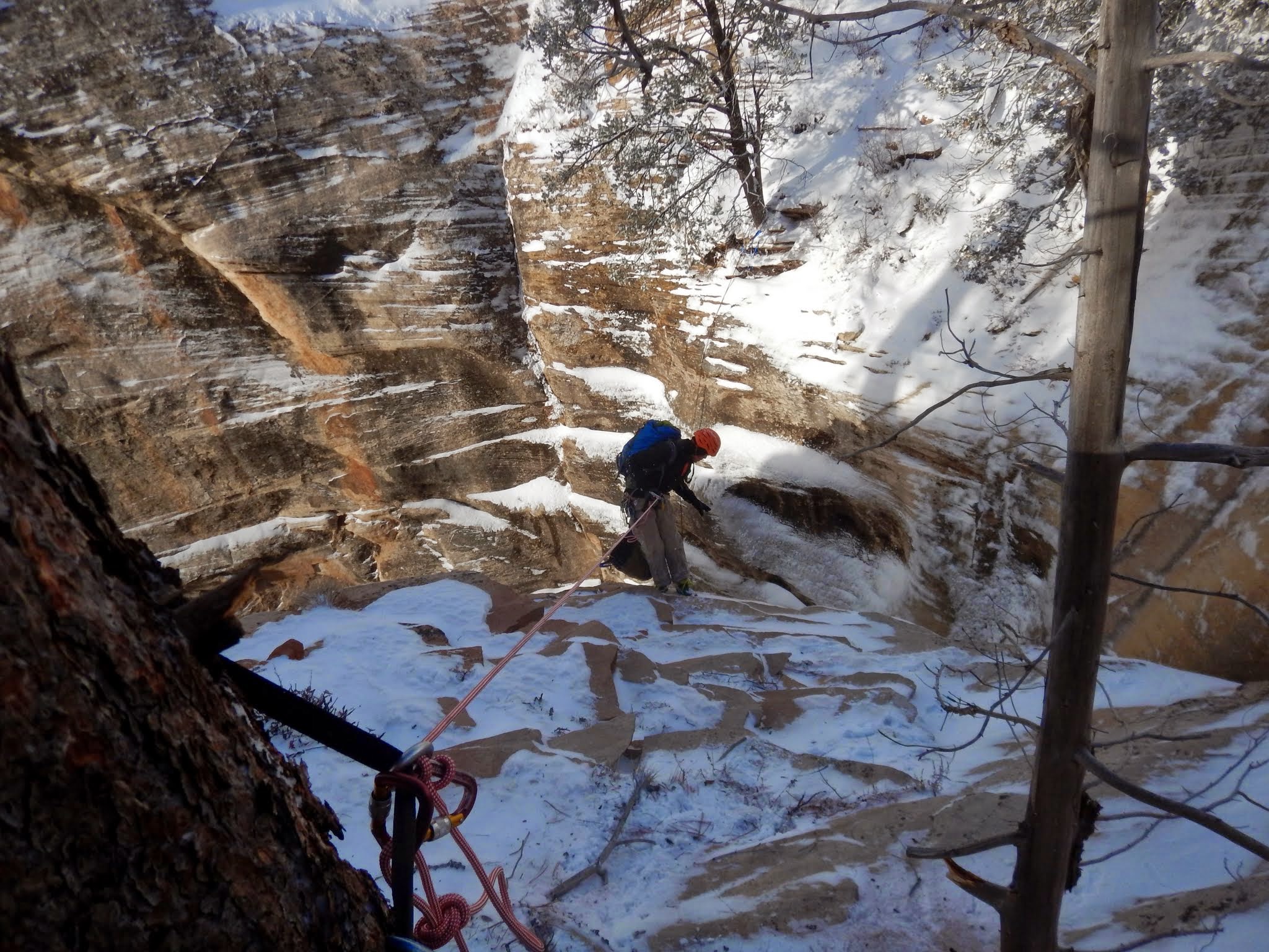
Winter and Spring : Ice and snow may hinder the hike up and descent of the canyon. The canyon holds snow a long time. Be ready for winter canyoneering conditions.
Summer : HOT! The hike up the West Rim is in full sun, get an early start to avoid the heat. Generally shaded once in the canyon.
Fall : Excellent time for this canyon.

Getting there
Start and end at the Grotto Shuttle Stop. Chug up the Angels Landing Trail to the top of Scout Lookout. Continue chugging all the way to West Rim Spring. A small spring provides filterable water. Take the "Telephone Canyon" branch of the West Rim Trail (rather than the “Rim trail”) and hike about 1/2 mile north, passing a shallow drainage. Past there, the undergrowth opens up, and the head of the canyon can be seen down and right. Hike down the hillside Follow the rim left to the canyon or the stream right to the head of the drop.
The Business
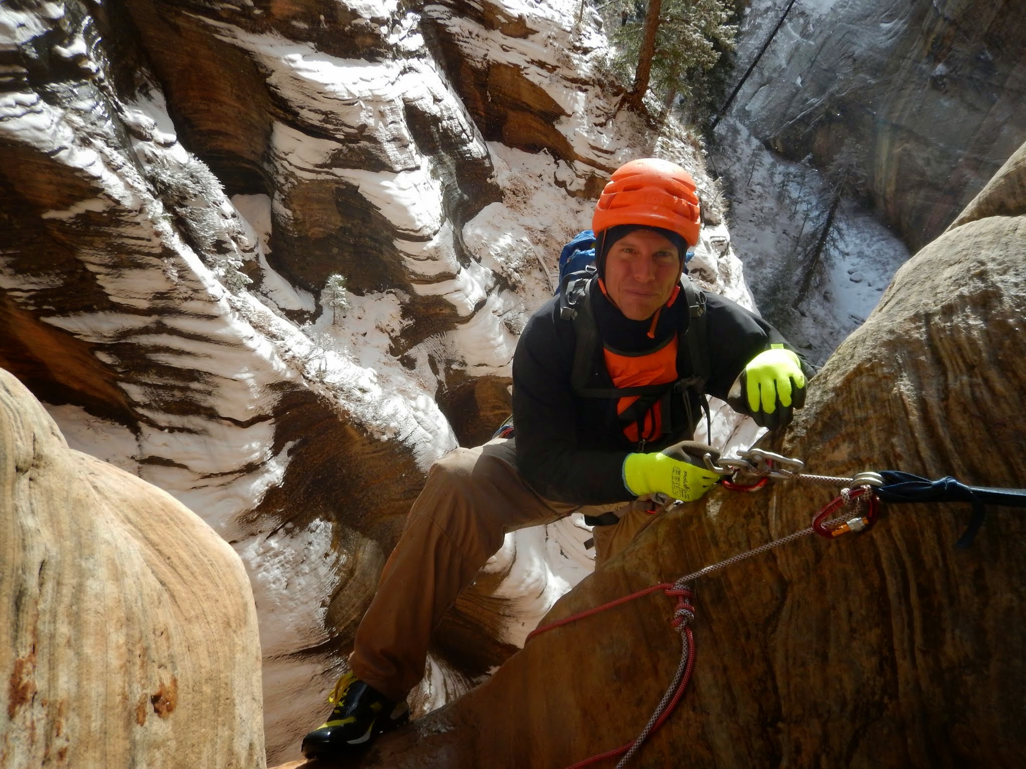
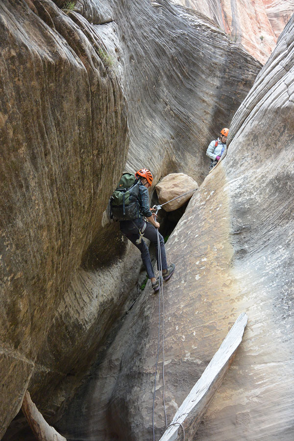
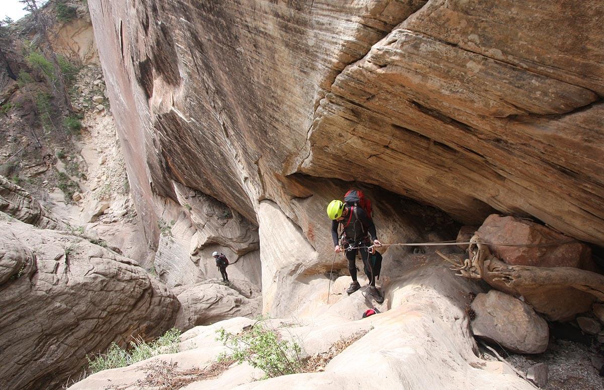
This canyon is a “dropper,” packing 13 mostly short rappels into a limited lateral distance. Be prepared to re-rig a bunch of anchors, because they seem to need it a lot in this canyon. The canyon twists and turns, and several rappels have a second drop which may be out of sight from the top. Don’t pull your rope until you have explored ahead.
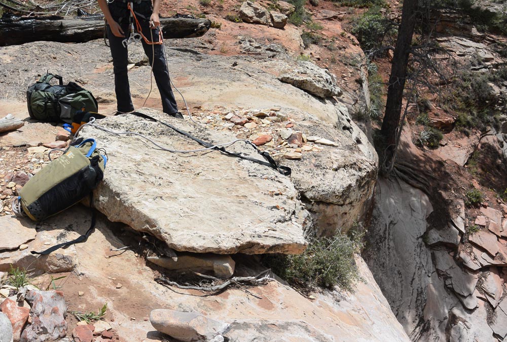
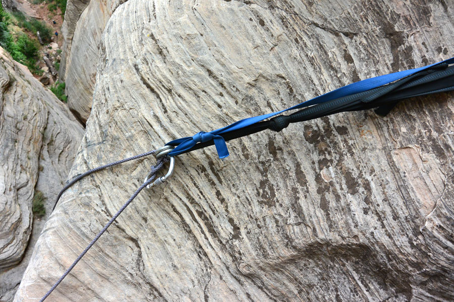
A fire in 2007 burned off the trees we used for the first anchor. There might be several different objects slung with webbing, but my new favorite anchor for the first rap is a big flat rock right where the water goes over the edge. Carefully inspect the webbing and replace if necessary. (If you anchor somewhere else, the rappel might be longer than 155 feet).
R1: 155 feet (48m) down the watercourse, avoiding a pothole at the bottom.
R2: 25 feet (7m) from a jammed stone. Might be easier to combine with R1 if you have the rope.
R3: 60 feet (18m) from a two-bolt anchor.
R4: 70 feet (22m) in two stages- 40 feet from a two-bolt anchor, then another 30 feet down a slippery chute.
DC/HL5: set a handline off a jammed stump and slither down the V-slot. Young, unbreakable men will enjoy doing this without the handline.
R6: 80 feet (25m) down a steep wall off a two-bolt anchor. This anchor is often rigged short making the pull difficult. It’s possible to pull from directly below, but it’s an easier pull fromthe steep slope beyond.
R7 – R12: numerous 20-30 foot rappels off logs, rocks and the occasional bolt anchor.
R13: 60 feet (18m) off two bolts high off the ground. The rock pile collapsed after the bolts were placed. The webbing is difficult to inspect well and replace – but do it anyway!
After a steep rappel (R13) into an area of recent rockfall, follow a game trail right across a steep wooded slope to exit onto slickrock to the side of the canyon. Traverse slickrock to regain the West Rim Trail.

The Exit
Turn left and hike down the West Rim Trail back to the Grotto, or; turn right and hike up to Behunin Pass and descend Behunin back to the main canyon.
Trip Reports
Author's Experience
Brian Cabe and I did the probable first descent of Upper Telephone on September 30th, 2000, installing bolts for several of the drops. Since, I have descended Telephone once every couple of year.
Zion Summer Camp, September 2004 - Tom returns to Telephone Canyon. The first picture of the Backcountry desk window is priceless.
Telephone Canyon, 5/28/06 - Tom and Hank take a look at the BIG DROP of Lower Telephone Canyon.
Telephone Canyon, 5/21/08 - Tom, Ram, Nat and Matt get rained out of their project, so they settle for Telephone Canyon. Tom has included some incredible photographs of local flowers in bloom for his ever-unfinished Zion wildflower catalog.
Maps
Click for higher resolution