BACKCOUNTRY ADVENTURE.
Spearhead is a nice, rarely visited canyon in a difficult to get to location. The entry into the canyon is big and scary, with potentially very difficult anchors. The middle part of the canyon is easily descended using natural anchors. The final, bolted chimney section is a rarely-used climbing descent route.
Spearhead is the canyon running south from the pass between Cathedral Mountain and Mount Majestic. It descends behind The Spearhead into the Emerald Pools cirque.

Canyon Profile
Logistics

RATINGS
4B V ★★★★☆

TIME REQUIRED
5-8 Hours

PERMIT
YES

SEASON
Summer or fall

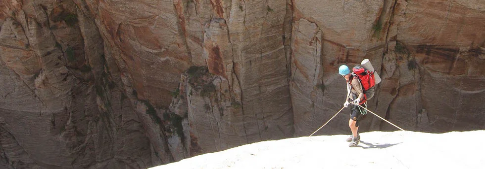
LONGEST RAPPEL
300 feet (91 m)

SKILLS REQUIRED
Difficult navigation and access, logistics and anchors. The entire journey takes about a day and a half. Probably best to hit the start of Behunin Ridge at dawn, leaving enough time to summit, then descend the canyon and get to water near the end of the middle of the canyon before dark.
Equipment

ESSENTIALS
Helmets, rappelling gear, webbing and rapid links. A bolt kit is probably a wise thing to bring along.

COLD WATER PROTECTION
None required

DRINKING WATER
Sparse. Bring Plenty.

FLASH FLOOD RISK
Moderate– There are only a few sections of sustained narrows.

ACCESS
Begins at Grotto Trailhead, ends on Emerald Pools trail to Lodge or Grotto Trailhead.
Getting there
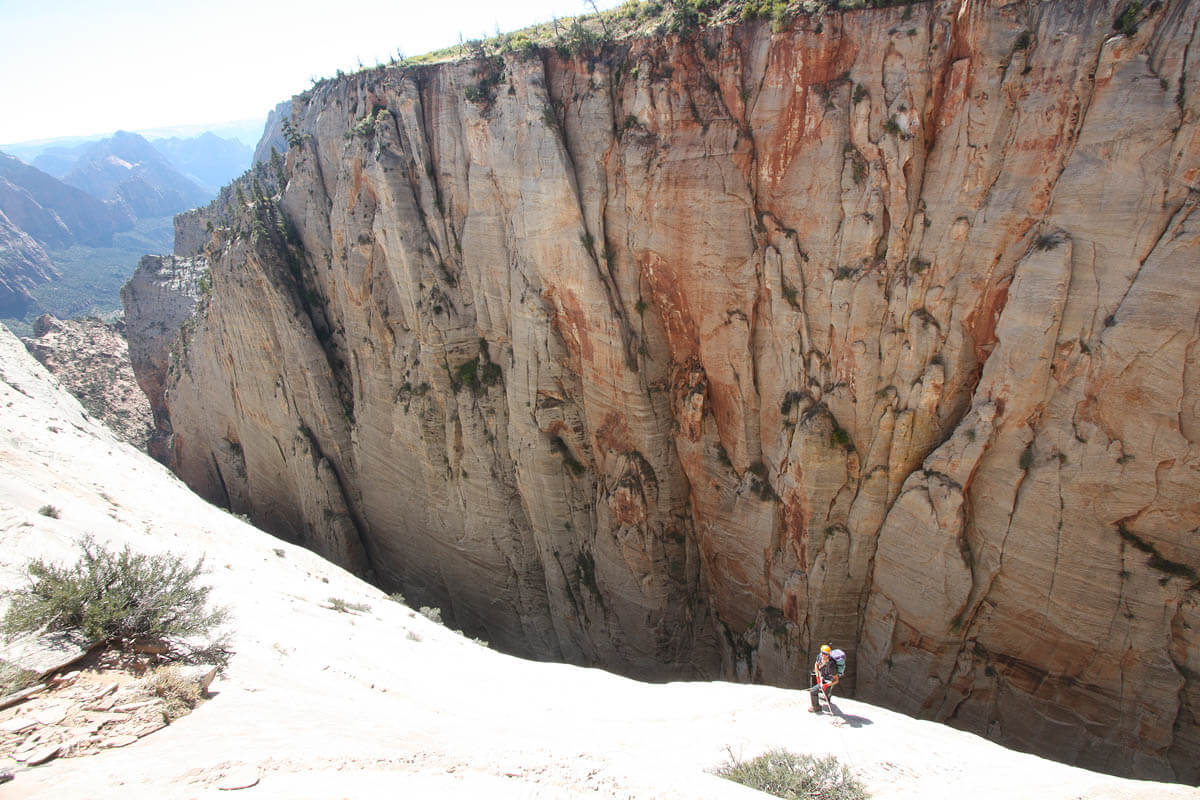
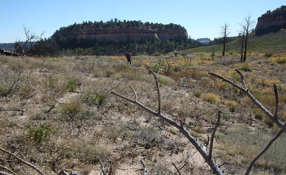
Start by hiking up the West Rim trail and attain the summit plateau of the Majestic/Cathedral massif. The best route is probably Behunin Ridge – the ridge that climbs toward the northern summit of Majestic Mountain from the top of the first rappel in Behunin. Climb steeply from the flat slickrock, then cut left and avoid the sub-peak and attain a loose, steep, brushy gully heading toward the top. The last pitch follows the crest of the ridge, and weaves through trees on steep 4th-class rock to the plateau rim. The ridge is south-facing and steep, and unpleasant in all but the coolest weather.
Cross the Manzanita to the col between Majestic and Cathedral. From the Majestic side, spy out the best descent route down the wall across the way. About 500 feet south of the apex of the canyon, note two large snags, the second next to a 30-foot red cliff. Just beyond the second snag, note a "Christmas Tree" on a small ledge about 40 feet down from the rim.
The Business
Hike around to the rim above the single tree.
R1: 40 feet (12 m) from a tree to the single pine tree on ledge.
R2: 290 feet (88 m) to a brushy ledge.
Note: the pine tree is not particularly sturdy, and is perhaps not suitable as an anchor. I suggest that placing bolts on the white ledge 30 feet below the pine might be appropriate.
Follow the ledge right (upcanyon) and down some to a tree perched on the edge of a drop.
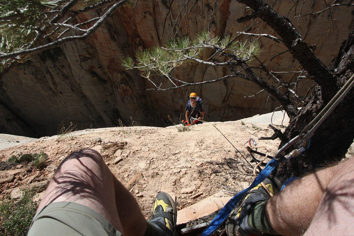
R3: 165 feet (50 m): Rap 40 feet (13 m) down a steep wall, then through brush another 125 feet (40 m) to a stout tree.
R4: 290 feet (88 m): Rap another 30 feet (10 m) to the top of a steep wall, then down to the canyon bottom.
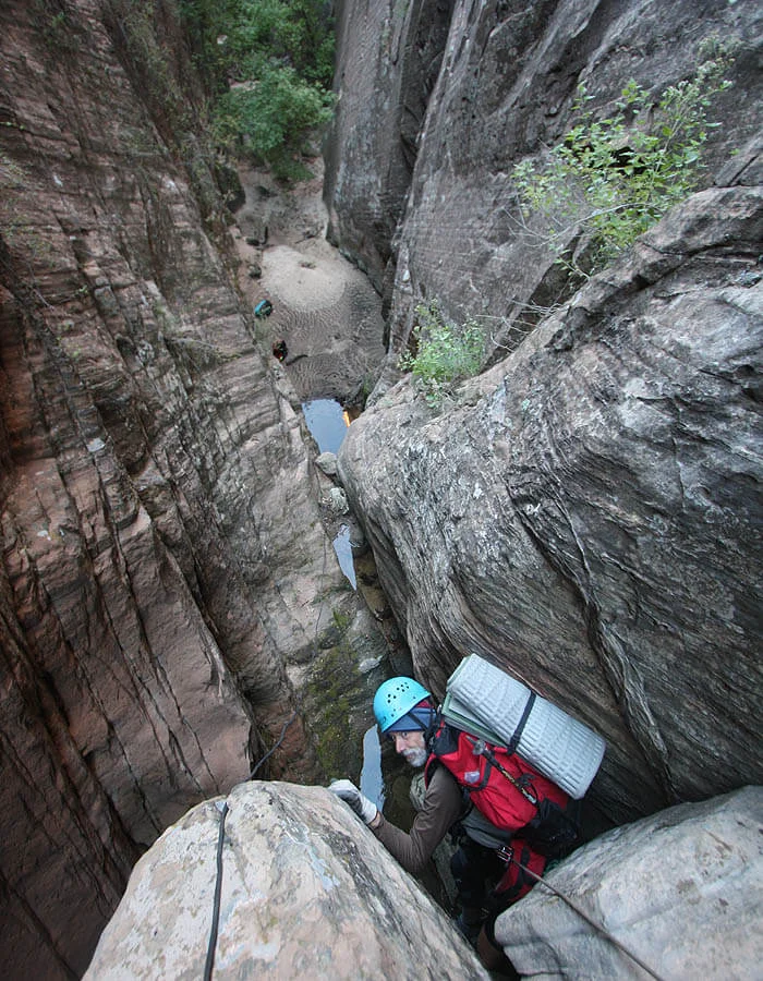
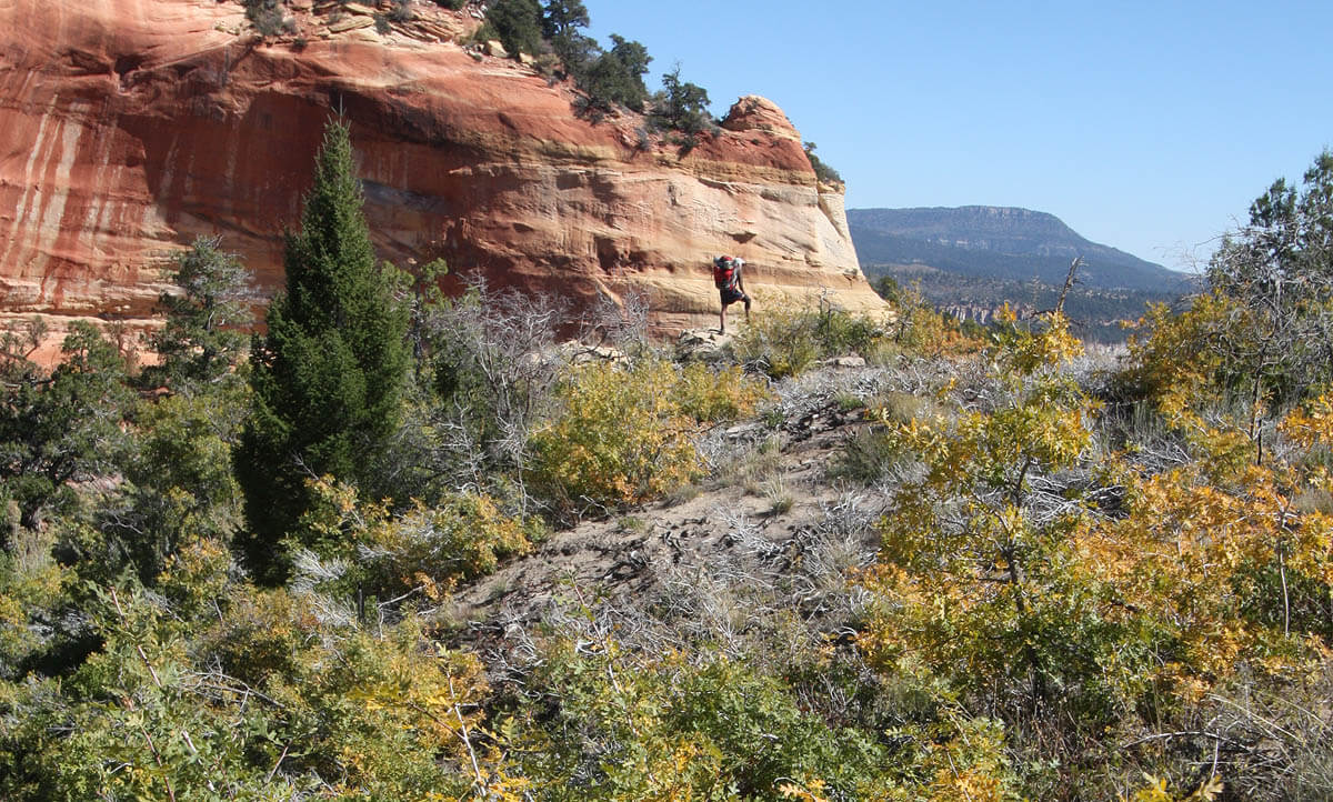
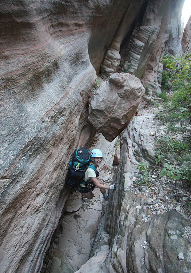
The main canyon quickly heads south, providing a beautiful though easy walk in a deep canyon. A couple of short rappels are intermixed with a few pools that may require swimming, and are likely to provide water for a bivy in even dry conditions. This part of the canyon only drops a couple hundred feet before arriving at the final chimney. Carefully rappel the final chimney from natural anchors and bolts to the main canyon floor. Cut left and descend game trails through the woods to the Emerald Pools Trail.

The Exit
Once on the Emerald Pools Trail, you can return to either the Zion Lodge shuttle stop or the Grotto Trailhead. Both descents take about one hour.
Trip Reports
Maps
Click for higher resolution