Big drops.
Behunin is one of the more straightforward and more popular of Zion's backcountry canyons. Those with good rappelling skills will find it pleasant and easy; for those without, this is not a good choice. Many rappels provide opportunities to get the rope stuck, and the backcountry nature of Behunin means you are on your own. This is not a good canyon for groups larger than six and DEFINITELY not a place to teach beginners how to rappel.
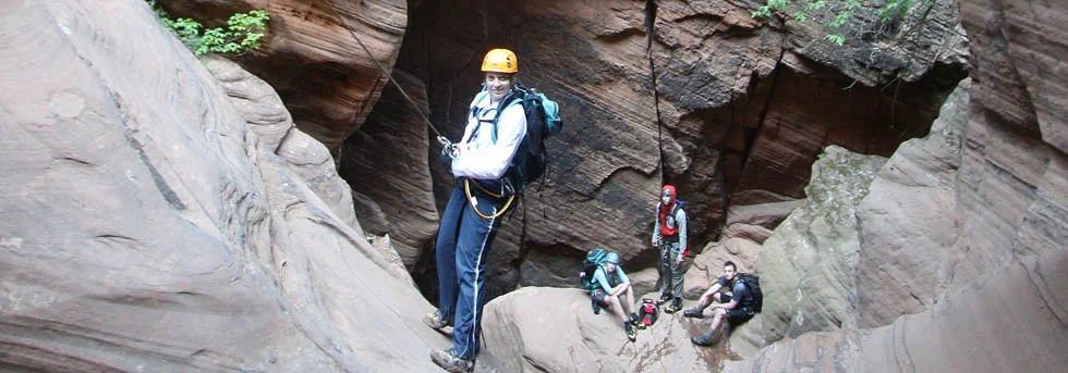
In 1863, Utah pioneer Isaac Behunin built a small cabin near the current location of Zion Lodge, across from the Emerald Pools cirque. He grew melons and tobacco during the summer and wintered in Springdale. A narrow canyon that drops into that cirque was named for him, and it is a fine canyoneering adventure. Two hours of hiking up the West Rim trail takes the intrepid canyoneer to the head of the canyon. Eight rappels and a bunch of fun hiking lead to a final precipitous drop of 165 feet (50 meters) into the Emerald Pool cirque. Behunin is a great backcountry canyon with mostly fixed anchors and perhaps one short swim.
Behunin has become popular in winter and spring, because people think it is dry. Sometimes it is, but, in winter and spring, melting snow vastly complicates the descent. At least one canyoneer spent a few hours stuck on a rope under a waterfall contemplating his fate. Luck was in his favor, as the Zion SAR team responded in time to save him.
The popularity of Behunin is also its curse - it showcases the impacts canyoneers can have in the fragile desert environment. As you descend, note several places of eroded social trails cutting around drops and pools. Where possible, avoid further erosion by travelling in the watercourse, rappelling and downclimbing, rather than scrambling around. Many of these eroded areas are returning to a natural state now that canyoneers have stopped using them.

Canyon Profile
Logistics

RATINGS
3BIII ★★★☆☆

TIME REQUIRED
5-9 Hours

PERMIT
REQUIRED. Group size limit of 6.

SEASON
Early summer or fall

LONGEST RAPPEL
165 feet (50 m)

ACCESS
Hike starts at Grotto Trailhead, ends at Zion Lodge. Use of Park shuttle required March-October.

Emergency
Zion Wilderness Desk: 435-772-0170
Zion EMERGENCY: 435-772-3322

GPS WAYPOINT
Head of Canyon:
WGS84 UTM 12S Waypoints
325364.73mE
4128053.12mN
Equipment

ESSENTIALS
Helmets, rappelling gear, webbing and rapid links.

COLD WATER PROTECTION
Wetsuits advisable in cold weather.

DRINKING WATER
Bring plenty, water is generally stagnant in this canyon.
Difficulties

FLASH FLOOD RISK
Low/moderate: The collection basin is small, and there are few sections of continuous narrows without escapes.

SKILLS REQUIRED
Experience rappelling is important, as many of the rappels are long. The ability to get up early and on the trail is valuable for this one.

ANCHORS
All anchors are fixed, from bolts and trees.
SEASONAL CONSIDERATIONS
Fall: The best season, nice temperatures and great fall colors.
Winter: The high altitude tends to make winter use impossible after the first snow.
Spring: Snow and ice might block the last part of the trail to Behunin Pass. Melting snow in the upper basin can create flowing and freezing water in the canyon. Can be wet to flowing and wet in the spring.
Summer: HOT! The canyon faces south and has almost zero shade. Make sure to get up early and bring plenty of water for the day. Not recommended on really hot days.
Approximate times
On trail, hiking to Behunin Pass: 2 hours
Off trail, to first rappel: 1 hour
First rappel to last rappel: 3 to 5 hours
Last rap to Bust Stop: 1/2 hour

The Approach
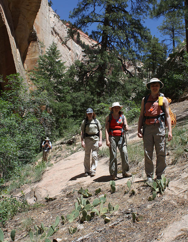
From the Grotto shuttle stop, head up the West Rim/Angels Landing Trail to the top of the Scout Lookout ridge. Turn left (north) toward the West Rim. The trail follows the crest of the ridge with spectacular views and then cuts left and down to cross a branch of Telephone Canyon. Follow the trail around the north end of Mount Majestic. The trail crosses slickrock and works its way into a steep-walled north-facing canyon then up to a pass, Behunin Pass. The West Rim Trail continues to the right, switchbacking up the steep sandstone on cut steps. The canyon over the west side of the pass is Behunin.
The approach is 3.8 miles (6.0 km) with 2000 feet (600m) of altitude gain. Allow two to three hours.
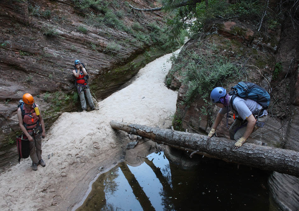
The Business
Drop over the pass and follow trails down and right about 120' (40m). Next cut right and carefully traverse across the top of steep slabs and then down to the base of a striped wall. Follow the bottom of the drainage, occasionally scrambling left to avoid the worst of the brush. After about 45 minutes, the canyon turns left and starts to descend. A scenic section of slickrock leads to pools and the first drop.
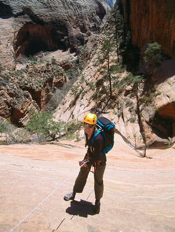
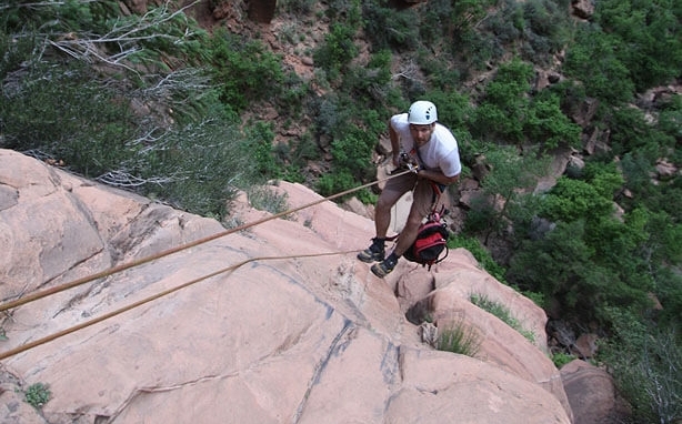
R1: from the lip of the drop, follow a narrow ledge left 60 feet (20 m) to a two-bolt anchor. Rappel 100 feet (30 m) down a low-angle slab to a flat area.
(Var-1a: (useful in winter) from the lip, look up and left to find a large ponderosa pine with slings around it. Climb up and traverse over (4th class, exposed) to the pine, possibly belaying off an intermediate tree. Rappel 165 feet (50m) off the large tree to a flat area).
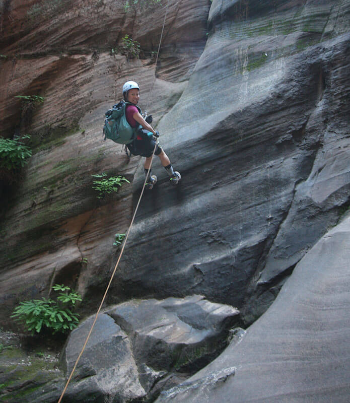
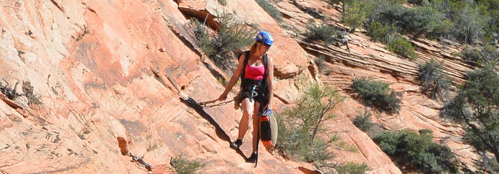
R2: from a large ponderosa pine, rappel slabs and a few short, steep walls 150 feet (45m) to a small tree and ledge at a rollover. Where the water runs can be slippery, so stay on-rope all the way to the tree.
R3: from a small tree, rappel down a slab then steeper down a banded sandstone wall to a bowl/ledge, 150 feet (45m). When wet, this rap can be difficult to retrieve.
R4: rappel 100 feet (30m) from a bolted anchor to the canyon floor.
Hike downcanyon ¼ mile (400m).
R5: from a bolted anchor right of the watercourse about 50 feet (15m), rappel 90 feet (30m) to the edge of a pool.
Hike downcanyon ¼ mile (400 m). The watercourse comes to a complex small drop.
R6: A large rotten log would provide an anchor for a rappel into a pool, if it was not quite so rotten. Instead, pass the drop and climb a small trail into the woods. After 40 feet, a trail leads left and down to a tree with slings. Rappel 50 feet back into the canyon at the edge of the pool.
Hike downcanyon. A small drop is downclimbed directly - much easier than it looks. When wet, many will choose to follow a trail up right and then down to a single bolt for a short rappel or handline. Continue downcanyon through some nice narrows.
R7: the canyon turns left in a complex series of short drops and pools. Rappel 90 feet (30m) from a bolted anchor following the watercourse. The first part rappels to the edge of a pool. The second part rappels into a knee-to-chest-deep pool - take a few giant-steps right (rappeller's right) to avoid the deeper part of the pool, and to place the rope over a gentler edge. A 120 foot guided rappel can be used to avoid the deep wade (or swim, in winter and spring). (Do NOT take the trail up and left to a dirty and thoroughly annoying 2-stage rappel).
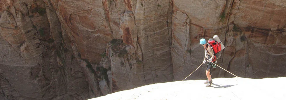
Avoid a pool by traversing a narrow ledge on the right. Continue downcanyon. The end of the canyon appears ahead. Scramble through large blocks to avoid pools, climbing to the top of a large boulder that blocks the end of the canyon.
R8: Rappel 150 feet (45m) from the top of the boulder using bolts on the right hand wall down a steep wall, over some steps and down to a huge ledge above a slot on the left. (The final person should pull the rope from the ledge above the slot and downclimb into the slot). This is a common place to get ropes stuck – be careful.
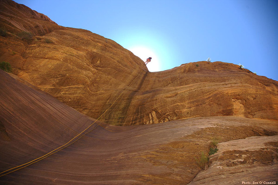
R9: Climb down into the slot then under a chockstone to the front. Clip your safety tether into the bolt garden under the chockstone and rig your rope off a two-bolt anchor around the corner a few feet on the outside face. Rappel 165 feet (50m) mostly free to a wet nook in the talus below.
If you have trouble pulling the rope, walk away from the cliff as far as possible, down to "The Beach".
The Exit
Pack up the gear and shoulder the packs. From the shallow pool or sand flat below the large rock, boulder-hop directly down the streambed to the Middle Emerald Pool and the trail. Turn left to hike to either the Grotto or the Lodge.
The fastest way to Zion Lodge is to take the trail left. After a few minutes, a trail junction is found among giant boulders. Turn RIGHT and follow the trail steeply DOWN to the lower Emerald Pool and behind the waterfall. Follow to Zion Lodge.
Trip Reports

Maps
Click for higher resolution
Alternative Descriptions
Other Stories
Zion Black Book, December 1974: Bob Sears, Jr., Tom Brereton, Paul Kuhn, and Robert N. Sears traversed the entire length of Behunin Canyon.
Zion Black Book, June 1978: A. J. Bonanno and Tina Gornck hike with Mark Meinert.
Simul-rap difficulties: October 7, 2006: A Roshomon by Hank Moon - Canyon Tales.
Behunin Panorama: Ryan Gardner's panorama of the end of Behunin.